I’m probably asking the bleeding obvious but clarification would be appreciated. The height showing on my Mavic Mini controller is the height between the drone and controller, not the height of the drone from the ground? So, if I take off at 75 metres above sea level and fly over a hill that is100 metres above sea level I can legally fly up to an indicated 145 metres on the controller?
This 
And if you want the (boring?) details behind it, check this 

3 Likes
The height shown in the Fly app is relative to your take off point so for example if you take off on the edge of a canyon for instance and fly straight up to 10 meters you are 10 meters above your take off point. If you now fly forward in a straight line over the edge of the canyon your app will still read 10 meters even though now your drone is over the edge of the canyon and is way above 10 meters from the ground. Hope this answers your question 
1 Like
I understood it to be the height relative to your current location.
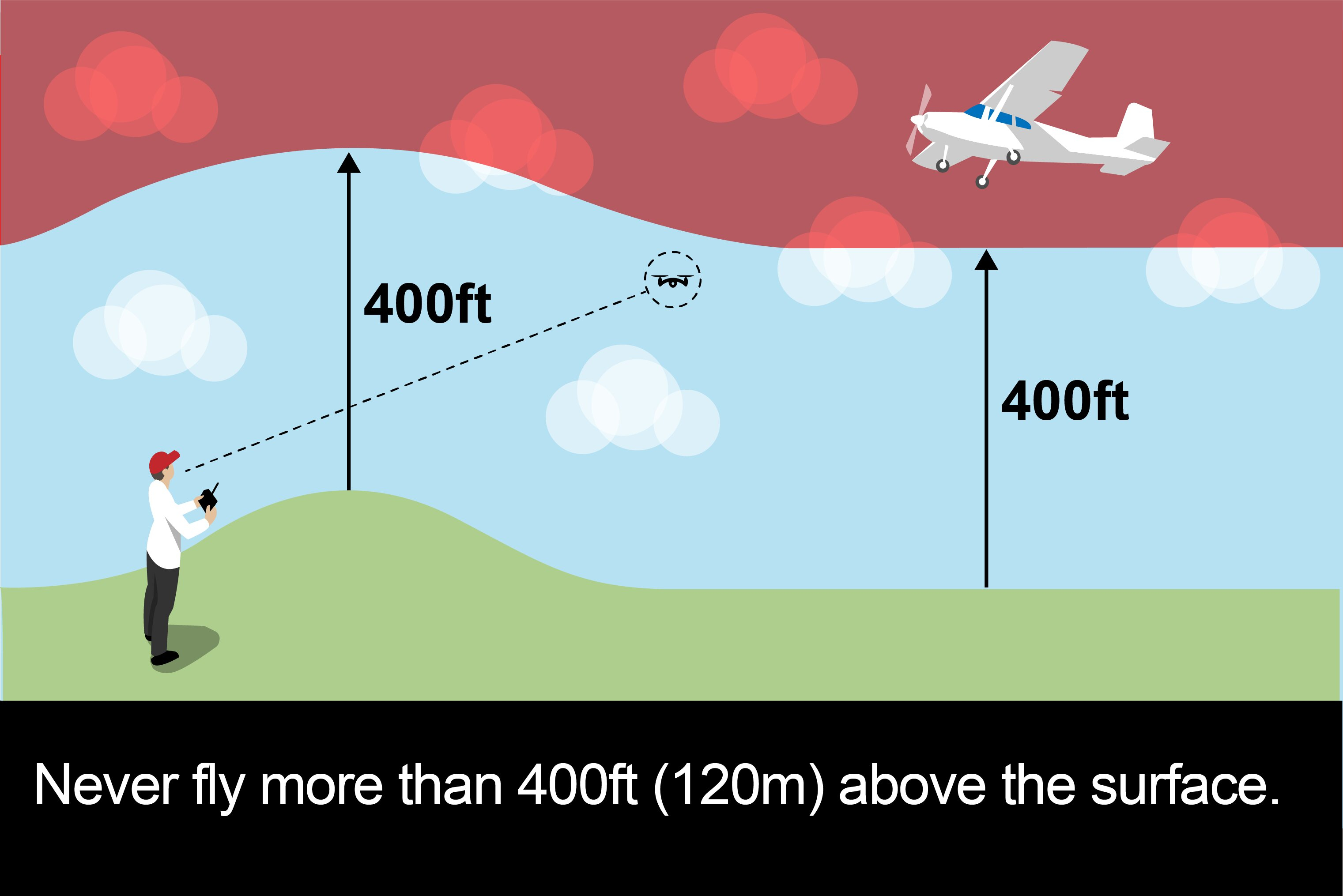
AMSL is the hight relative to sea level regardless of where you are
AGL is the height relative to your take off point.
If you have a flight map the two will be shown sometimes together generally where there is an airport and there is a big difference
Then you understood incorrectly. That image is from the Drone Code.
AGL = height Above Ground Level … which varies.
Thats why l said relative l did not say it was fixed to your take off point.
But your take-off point is fixed … once you have taken off.
The height relative to your take-off point is just that.
If you are at the top of a 100ft tower and fly out horizontally - you remain at 0ft above your take-off point … but you will be 100ft AGL.
If you fly out further and the ground falls away 100ft, you will be 200ft AGL … but you will still be at 0ft ATO (Above Take Off).
1 Like
Is there any drone on the market that shows the distance between the drone and the ground using satellites - like it shows the altitude on the sat nav on my motorcycle. I live 73 metres above sea level so if I fly over my nearest hill which is 117 metres above sea level I sometimes take it up to an indicated 164 metres. It maybe legal but it feels naughty!
I’m assuming your motorcycle stays pretty close to the ground? 
For the drone to be able to do that one of two things would be needed …
- it would need to carry a huge database of the world’s surface height data, or
- have a seriously good internet connection to access that data in real time (and the processing power/speed, too!).
OK! I take your point. Bit more involved than I thought but the way technology is advancing maybe one day…
1 Like