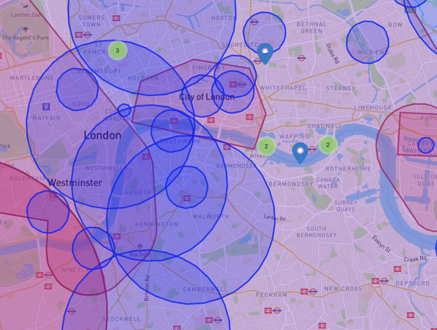
Anyone who flies or has flown in central London this year will be aware of the seven Temporary Danger Areas centred on seven Metropolitan Police stations to allow them to trial beyond visual line of site flights. They are calling these Drone as a First Responder, or DFR trials, and at each location there are restrictions from the surface to 600ft four nautical miles wide.

EGD186B - Islington
EDG186C - Charing Cross
EDG186D - Kennington
EDG186E - Kensington
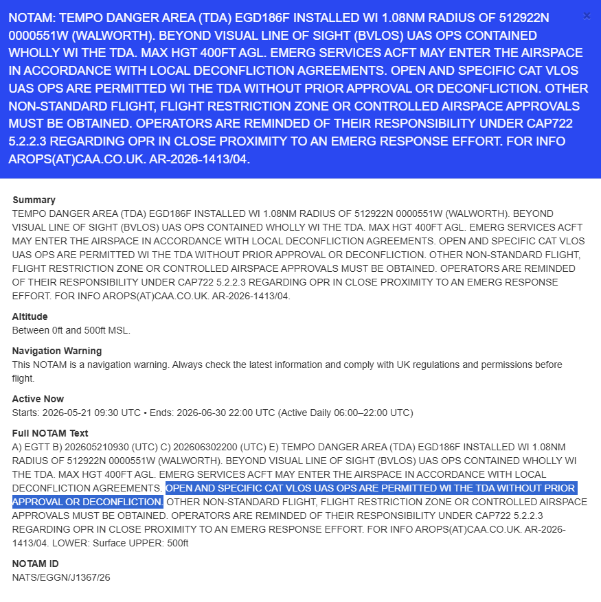
EDG186F - Walworth
EDG186G - Stratford
EDG186H - Brixton
I hope this thread can serve as a central place to discuss and inform others about what is happening here. But I will also go into why I personally think it is a problem.
WHAT IS GOING ON?
There is surprisingly little information for such a major change to the airspace restriction landscape of London. These are areas which have for the whole of this year been impossible to fly in without seeking permission first. This is a long time for a “Temporary” Danger Area. Gary Mortimer of sUAS news complained of this “utter lack of transparency” when similar trials were held in one location for a week in October last year.
HOW TO GET PERMISSION
It seems some people have had success contacting arops@caa.co.uk for permission to fly within these areas after providing information about their prospective flight. So these restrictions need not stop you flying for work or fun. That is good news.
MY OPINION
But this is ridiculous and unfair. When you read the NOTAM it appears these are “only” in place for one month which is bad enough. But they have been renewed month after month after month and I’m getting a bit fed up with it.
Gary Mortimer put it well in the above article when just talking about what was at the time a one week restriction:
For those of us involved in aviation, the implications are clear and frustrating: the police have effectively commanded a week-long cessation of all other flight operations within that specific section of the sky. This is a complete lockdown, giving the NPCC unfettered access while completely sidelining all other airspace users.
WHO IS TO BLAME?
I have seen an explanation repeated online (though I haven’t personally seen any evidence of it - please mention if you have) that the Police running the tests don’t want the restrictions in place but that the Civil Aviation Authority has activated them anyway for safety. If that is so, what is the CAA doing to tell the NPCC that their conduct is out of order? Because it effectively sterilises Class G airspace for a trial that likely only uses a fraction of the time the ban is in place.
And who are the “Police” in this context. Is it the Metropolitan Police UAS Unit, the National Police Chiefs’ Council, or National Police Air Service (NPAS). Does anyone know?
WHO CAN HELP?
I don’t know, and I would love your suggestions. Is it ARPAS-UK that has the most influence within the airspace world? If so, what are they doing about it?
POTENTIAL SOLUTIONS
It is easier to ask for change if it comes with a solution. I understand why the police would want to trial BVLOS “drone-in-a-box” systems to fight crime. But do they need to trial seven (mostly overlapping zones) all the time, all at once? Could they:
- largely test their drones within already restricted airspace like EGR157, EGR158, EGR159, or EGRU143?
- deactivate the zones when no craft are airborne?
- activate it some days/weeks and not others (especially as this is just a trial)?
WIDER IMPLICATIONS
I think the Police here are contradicting the CAA’s principle of Flexible Use of Airspace (FUA). And if the drone community takes this sort of thing lying down then more and more airspace is going to become “ask-permission-to-fly”.
I also dislike how there appears to have been no consultation, accountability or transparency for such broad restrictions on such a large amount of airspace for so long. The airspace is essentially “blocked” for convenience rather than active tactical use. It would be a shame to let this become the norm.