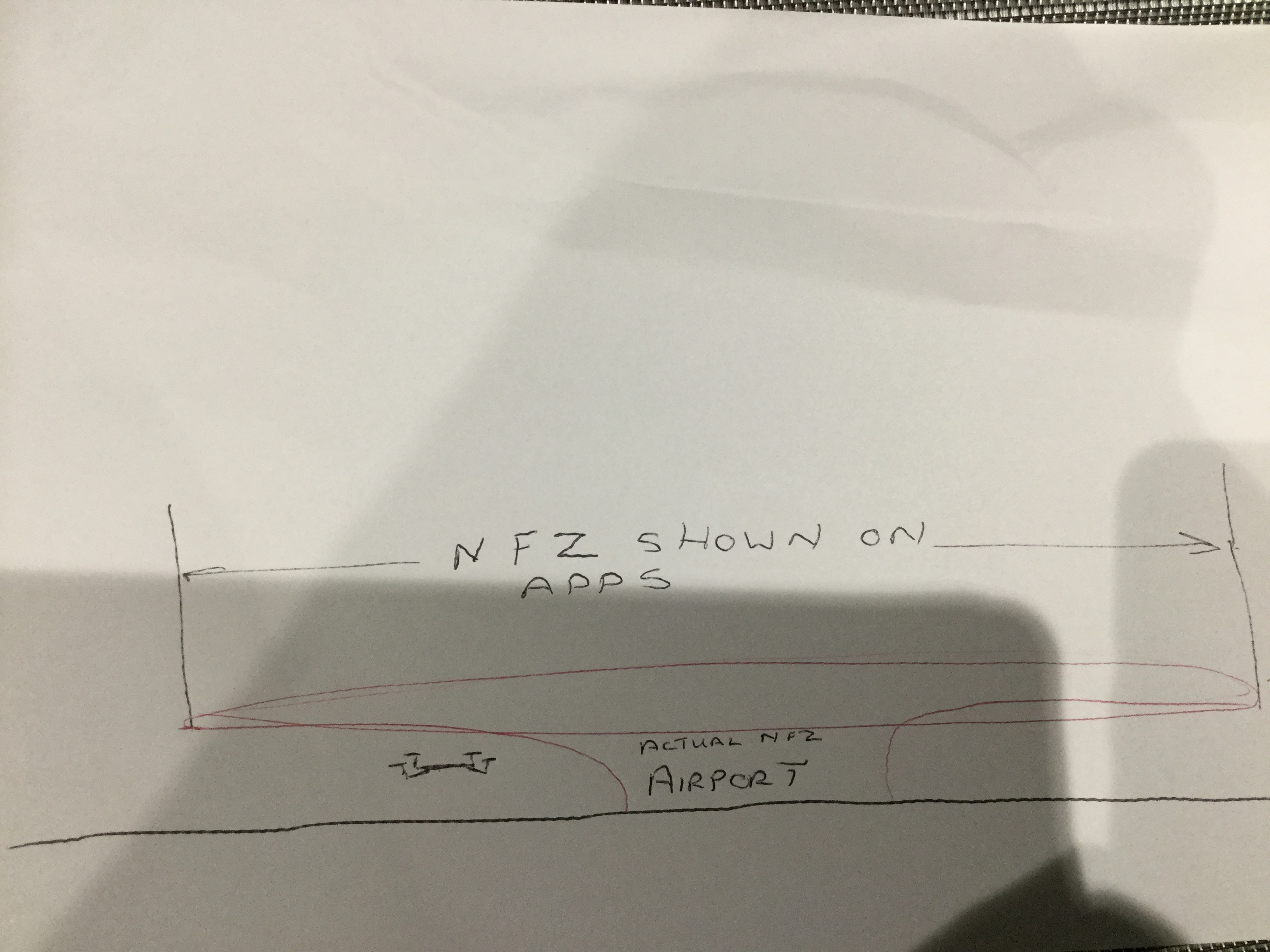
I’m not sure if anyone is aware that when they see a NFZ on an app (shown as a red circle). The NFZ is actually shaped like a funnel. A bit hard to explain, but if you imagine a huge red mushroom shape plonked with the spout 1km wide in the middle of the airport and the actual funnel shape extending skywards, growing in circumference the higher you go and further from the airport. This has implications on our airspace. So if you do see an app advising that you are in a NFZ due to airport proximity, don’t immediately assume that you can’t fly. You can legally and safely fly up to 1km near the airport providing you stay under the legal height or lower if possible.
I’ve included a drawing to try and explain what I mean.
I’ve seen a lot of temporary NFZs issued, for air displays, defence training etc but when I’ve checked the details, a lot of them are not meant for drones at the legal height we operate at.
Brian… can’t see any drawing. Interested to see it.
Ok … I live down souf and I work up norf in the Knutsford / Cheshire area. There’s Manchester airport to the east and liverpoowel to the west.
There’s the dark reds around the airport and there’s a lighter shade of red inbetween .
Can I fly there ? The aircraft appear extremely low around there.
Legally you can fly up to 1km near an airport but must stay under 400ft in height. As I say, the app might show a red circumference of several miles around an airport, this is for all types of craft , balloons, paramotors, gliders etc which might fly into the airspace reserved for planes.
You will find that if you are very close to an airport, it will say NFZ on the controller and you won’t even be able to start your propellers spinning.
I’ve tried it myself and it does work. I couldn’t start the propellers, however if I walked a short distance away (1km) no problem, even tho technically the app says I was still in the NFZ.
Thanks Brian … I’ll take my drone with me next time I go up north to work and give it a go.
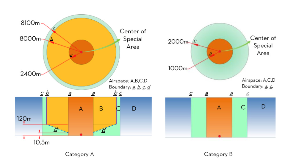
There was a time, when NFZs were being introduced by DJI, that this diagram was included in the manual.
.
Exactly how this relates to what we have today is difficult to determine - since no amount of Googling locates current equivalent diagrams.
(And I can’t find out what defined Category A and Category B!  )
)
But in the “Category A” case, there was an incline to the base of the outer area - but I don’t think at any time one could penetrate the red section - and certainly one can never start the motors to take off in that area. (I know - I live in the red bit pertaining to Southampton.)
In those days, the Phantom manual also had these notes …

.
Strange, really, that the Mavic Pro manual had no similar diagrams, limiting their information on it to less than one paragrapgh …
