I have just added this to the map of places to fly your drone at Drone Scene:
Land owner permission not required.
Parking: 52.061402, -2.347214
TOAL: 52.058501, -2.351338
About a 25 minute walk from the carpark (which cost £4.80) to the summit. Probably 15 minutes without ice and snow. Absolutely stunning views for about 20 miles or more, a full 360 panoramic.
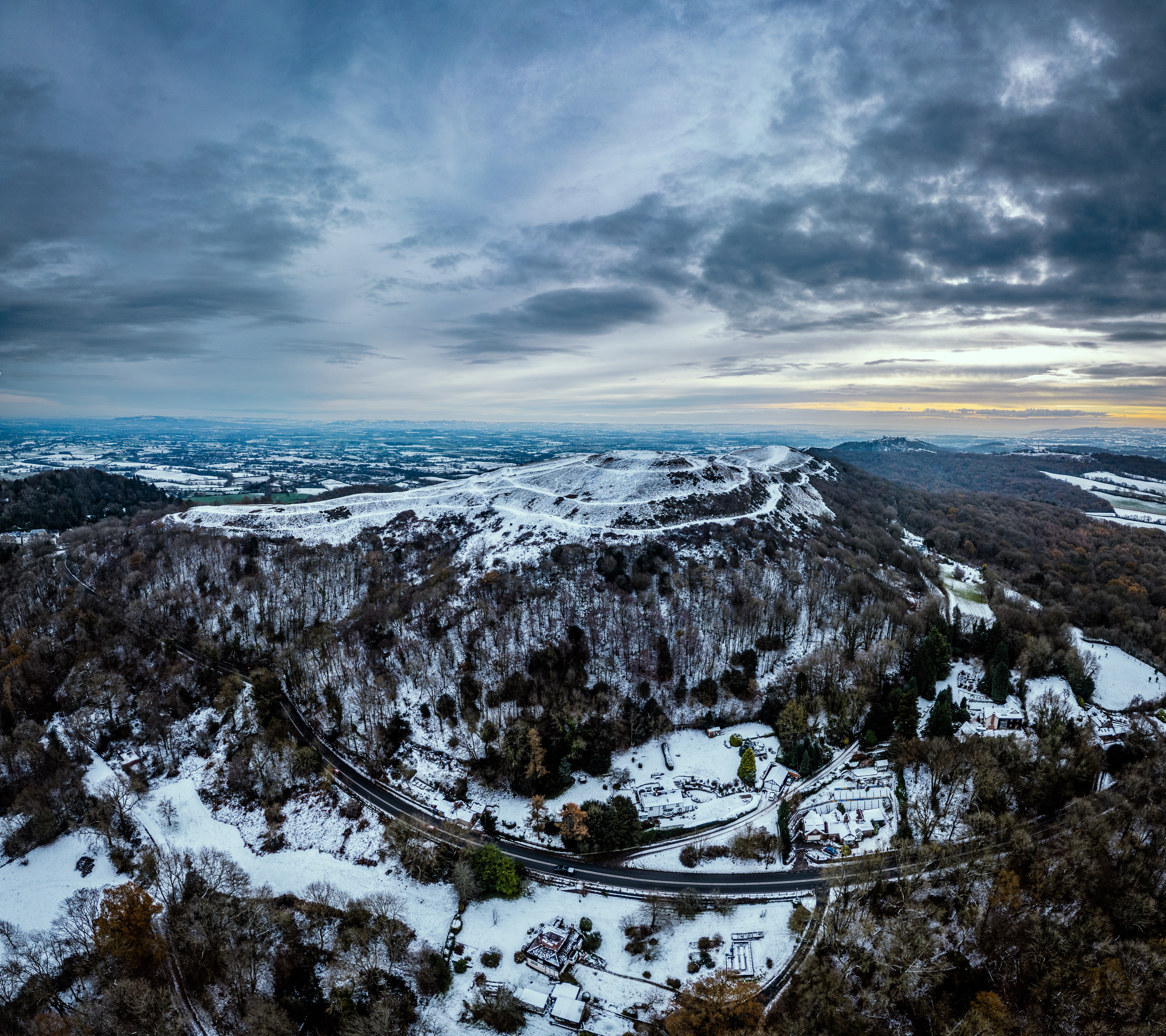
The most recognisable of all the Malvern Hills, British Camp is thought to have been the location of a hillfort dating from maybe 3,500 years ago in the Bronze Age. At a height of 338m above sea level, it offers a magnificent view of land all around and especially the primary pass through the hills at that time; Wynds Point.
The first hillfort was built on the British Camp summit. Then, at around 400 BC, there was a rapid expansion of population in Britain and the hillfort was extended to include the northern spur of British Camp and also Millennium Hill.
The originator declared that this location was not inside a Flight Restriction Zone at the time of being flown on 17/12/2022. It remains the responsibility of any pilot to check for any changes before flying at the same location.