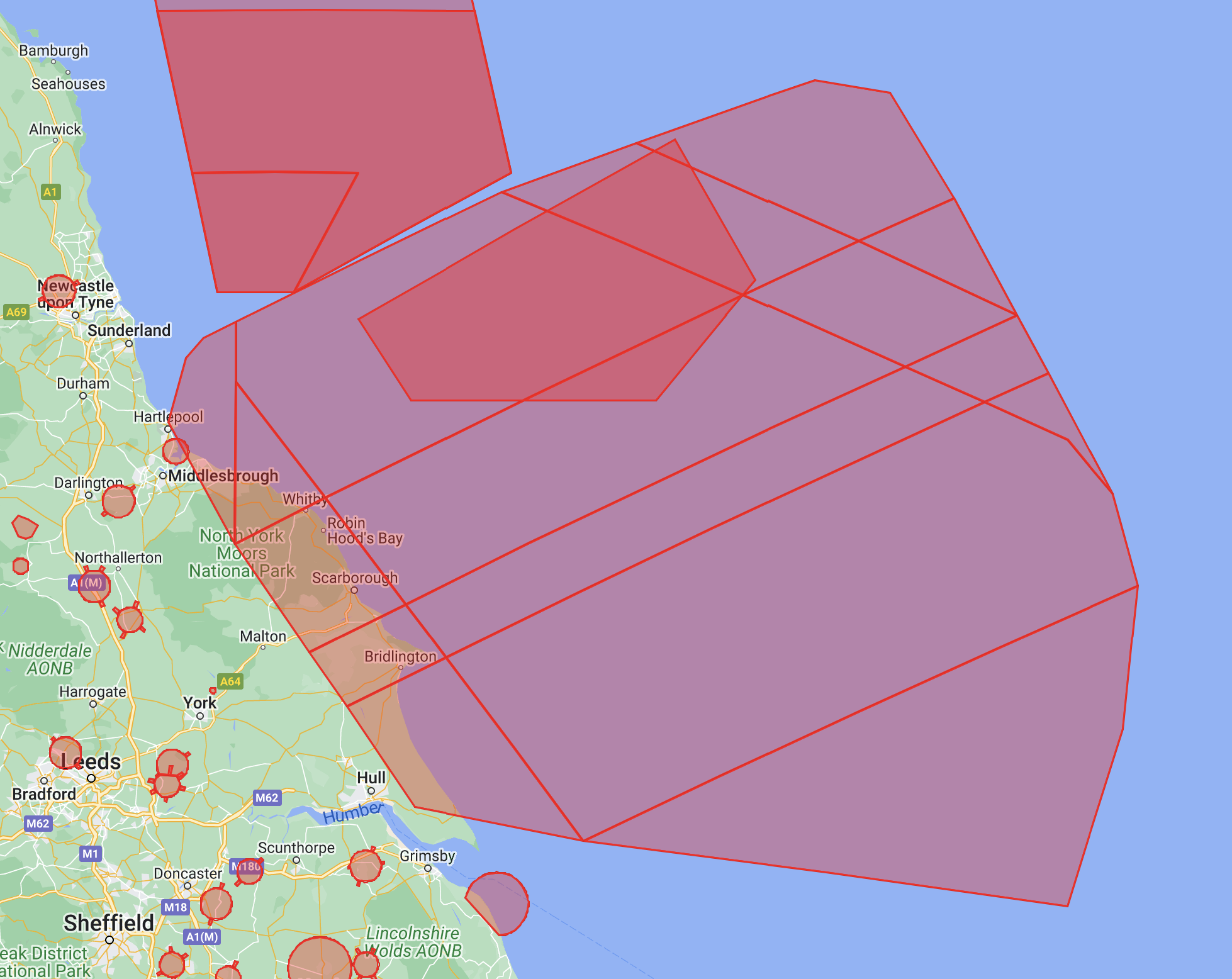
I’m looking at the NATS UK site and I see an enormous area blocked off from the Yorkshire Coast out past Dogger. Seemingly for military training purposes. Is this permanent feature, or will it go away when the war mania is over, or earlier?
I’m wanting to go and do the Dane’s Dyke, but this bit of map cancellation eliminates the whole thing as a flying possibility.
Ah okay. So “Lower Limit FL150” means they will operate down to 150 metres, so we can operate up to 120 metres and be comfortably clear of the Harrier or whatever it is?
Some of the zones are saying Lower Limit SFC, which I take to mean “Surface”.
Just fly up to the legal limit as normal… Most of the activity it references to is certainly not going to happen over residential areas marked on the map such as Ordnance, Munitions and Explosives (OME) / Electrical/Optical Hazards. That’s going to be way out to sea activity.
Having a PPL, FLs are rather important, and FL x 100 = ft is something that was well drummed into me by the RAF.
Despite having flown a selection of planes since, even 50+ years later, I can still recall all the checklists for the University Air Squadron Dehavilland T10 Chipmunk with Cartridge Starter … Approach, Internals, Externals, Cockpit, Pre-Engine Start, Post Engine Start, Taxying, Power Test, Pre take-off, Post take-off, Pre aerobatics, Pre-Approach, Downwind, Approach to Land, Post Landing, Engine Shutdown.
eg … Downwind checks (the shortest of those checklists) My = Mixture Friend = Fuel Fred = Flaps Has = Harness Hairy = Hood Balls = Brakes
… etc. - and some I wouldn’t repeat here, particulalry in the “politically correct 21st C”! (It was the RAF in 69/72)
I was hoping to to walk and fly along it when we went last year but it’s only the bit on the south end that you can access and its heavily wooded. I tried from the coast path at the northern end with the Mini 3 but it was so windy I just took off, up about five metres, took a picture and landed again. Hope you get some good footage.