Although I’ve had my M2Z for over 20 months, Ive done very little with its waypoints feature - Until Now that is.
They’ve just started building a large housing project around 1/2 mile away, so i thought it would be interesting to fly say once a week on the exact same route and maybe work out how to make some kind of ‘rapid build’ video in a years time.
So Ive watched a few videos on creating waypoints but still have a few unanswered questions.
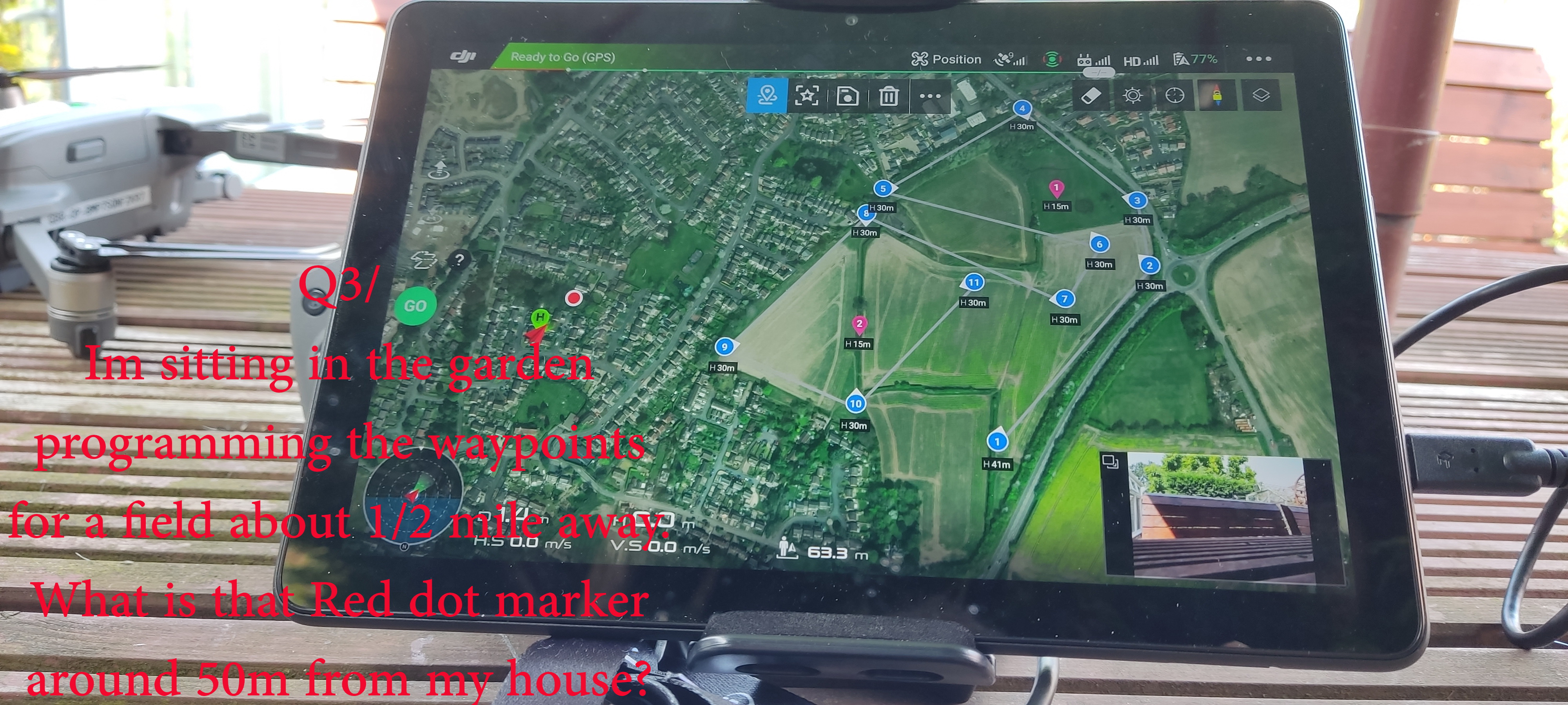
I programmed a possible route whilst in my garden earlier today - What is that red dot around 50m from my house
When I got to the launch point at the top of the field, there was still a line joined to my garden?
If I’ve set all the waypoints to say 40m, what happens if circumstances change & I have to take off from the bottom of the field which is around 10m lower than the top of the field - will all waypoints now be 10m lower than they were on previous flights?
At the moment Im changing the waypoint heights and gimbal angle on an individual basis, is it possible to do a universal change?

Thanks