I have just added this to the map of places to fly your drone at Drone Scene:

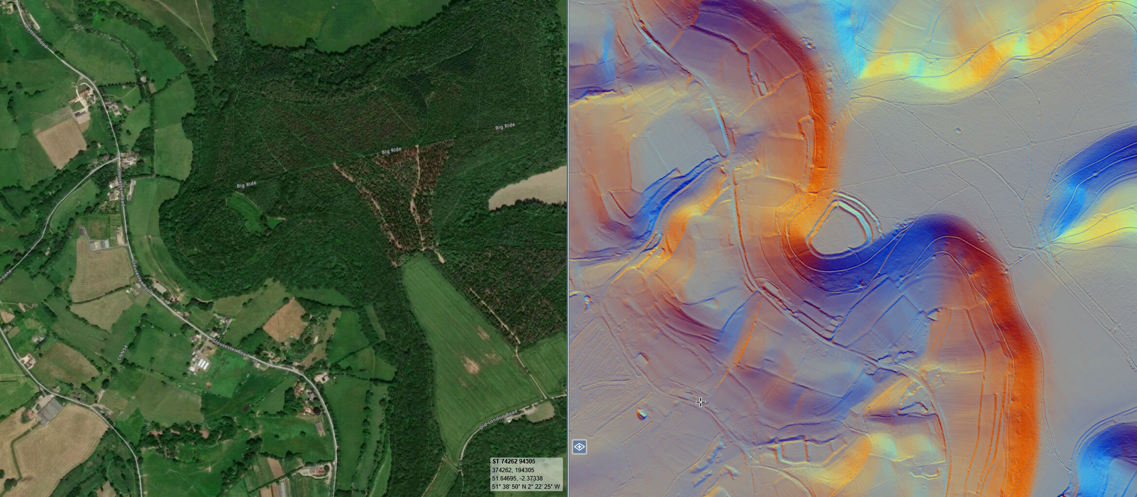
An Iron Age hill-fort scheduled under the Ancient Monuments and Archeological Areas Act was constructed on the steep SW-facing scarp of the Cotswold hills, overlooking the Vale of Berkeley to the Welsh Hills and the River Severn
It consists of two banks and a ditch with an entrance at each end and an enclosed area of about 8 acres. The walk around the camp is about 750m long. There are reputed to be some 'pit dwellings' in the area (supposedly upwards of 600) have been found.
The hill fort is heavily wooded and it takes a bit of effort on the ground to be able to clearly see the raised earthworks but their outline can be seen from the air.
The woodland that encloses the fort is worth a visit in its own right, but the view – from altitude – down to the valley below stretching off into the distance is equally worth the visit.
Parking was in a layby 20 minute’s walk out from the hill fort, while TOAL point was in a small clearing close to the edge of the perimeter bank
The originator declared that this location was not inside a Flight Restriction Zone at the time of being flown on 30/06/2025. It remains the responsibility of any pilot to check for any changes before flying at the same location. Landowner permission may be required before taking off.