I have just added this to the map of places to fly your drone at Drone Scene:
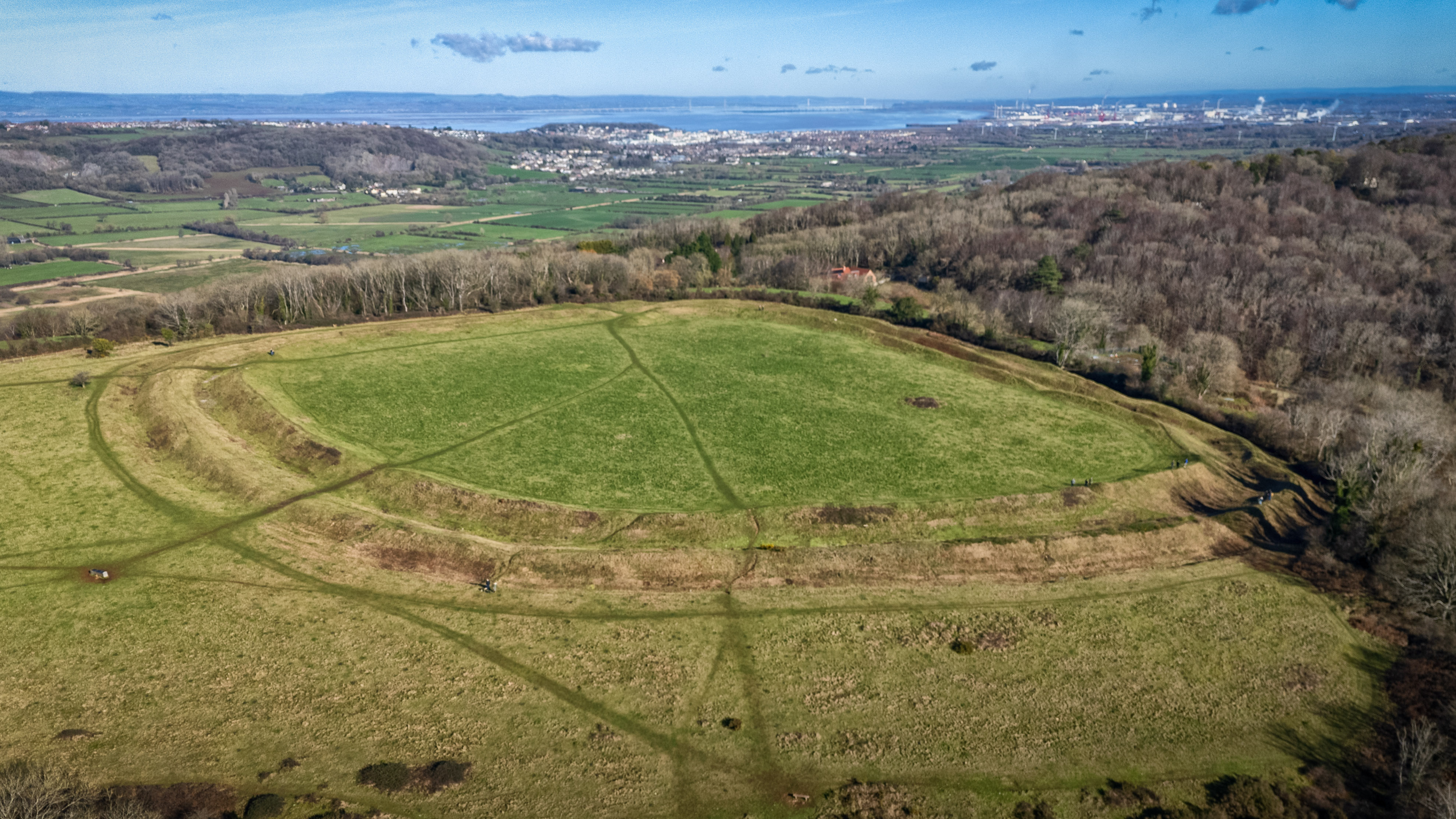
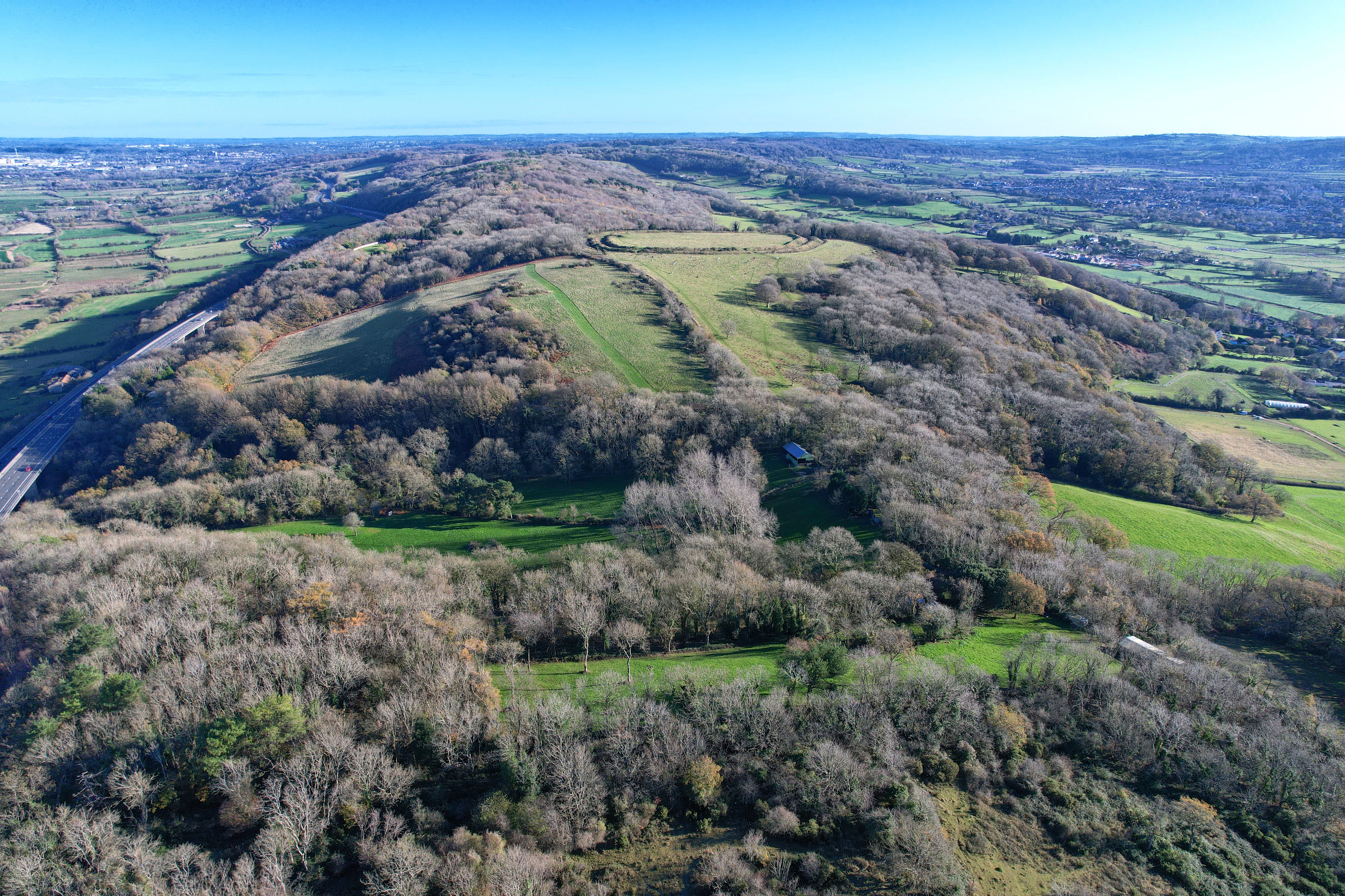
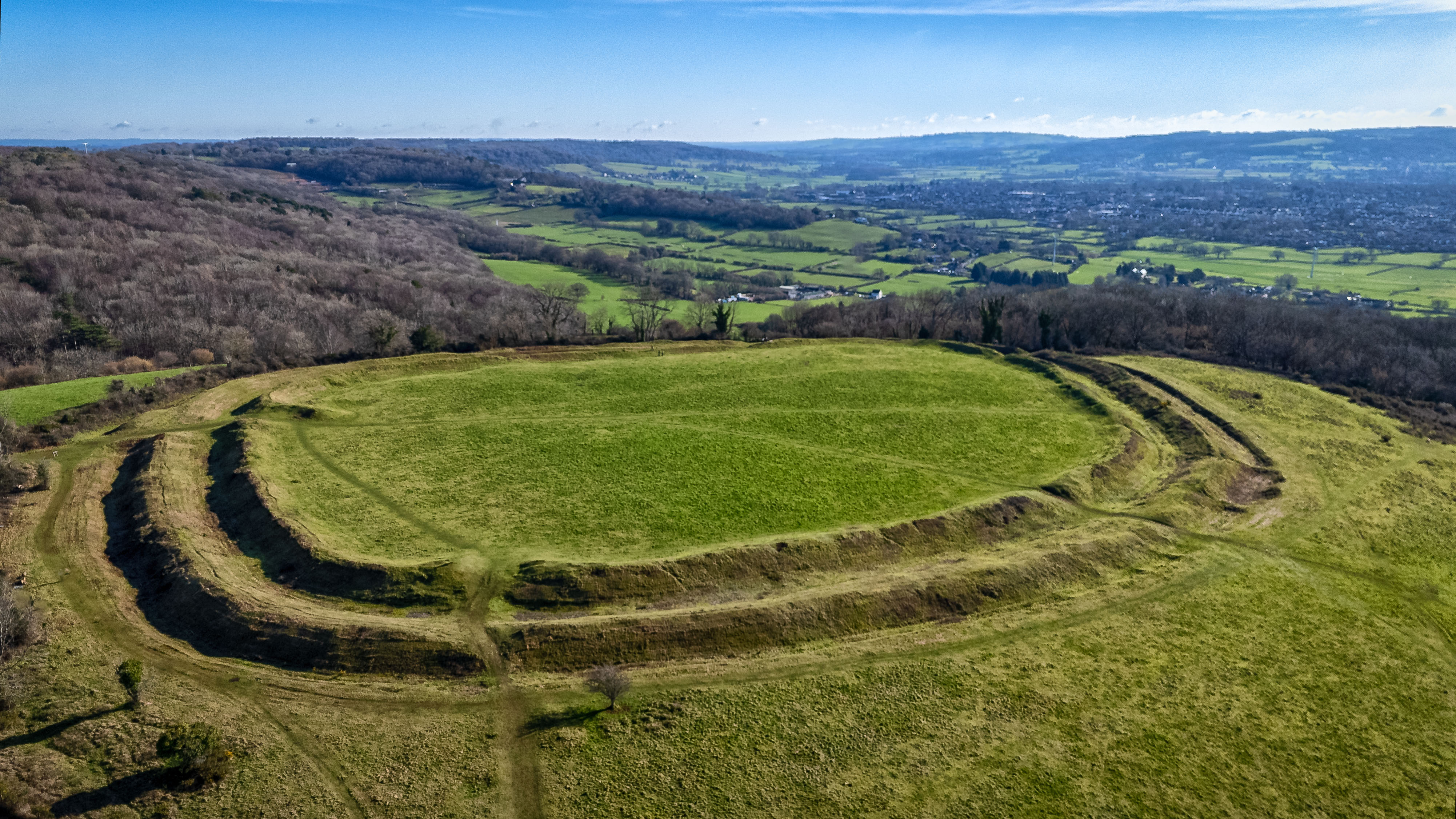
Perched atop a limestone ridge near Tickenham, Cadbury Camp is a striking Iron Age hill fort that has watched over North Somerset for over 2,000 years. Constructed and occupied between the 6th century BC and the mid-1st century AD, it served as a vital community hub and defensive stronghold for the Dobunni tribe.
As you can see in the photograph, the site stands out for its impressive multiple rings of earth banks and ditches. The image clearly highlights the double circuit of ramparts and ditches that follow the natural contours of the hill. These earthworks weren't just for show; they provided a significant tactical advantage, offering 360-degree views across the Yeo Valley and toward the Bristol Channel.
The site is of historical significance, with excavations uncovering Roman coins and pottery, suggesting the site remained significant even after the Roman conquest. Much further along its timeline, during World War II the camp’s strategic elevation was utilised when it housed a searchlight battery to protect Bristol from aerial raids.
Today, it is managed by the National Trust, preserved as a haven for limestone grassland wildflowers and rare butterflies.
The originator declared that this location was not inside a Flight Restriction Zone at the time of being flown on 14/02/2026. It remains the responsibility of any pilot to check for any changes before flying at the same location. Landowner permission may be required before taking off.