I have just added this to the map of places to fly your drone at Drone Scene:
Perched atop a commanding ridge in western Cardiff, the Caerau Hillfort and the ruins of St Mary’s Church represent over 5,000 years of continuous human history.
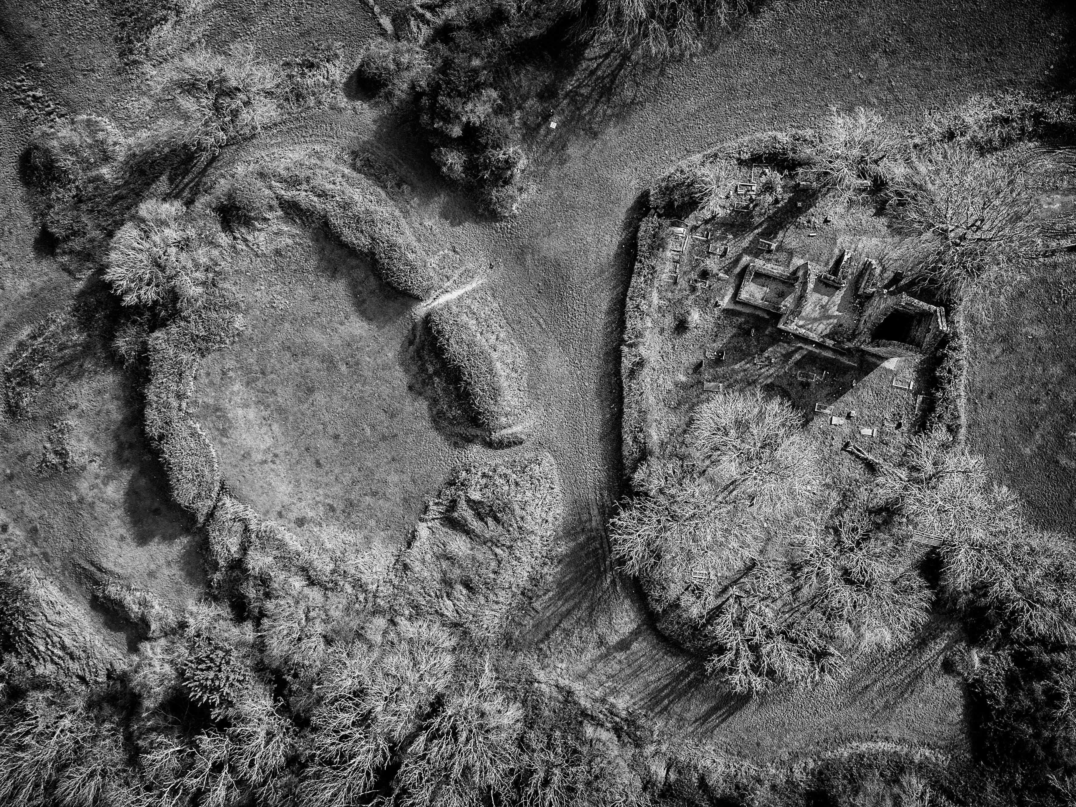
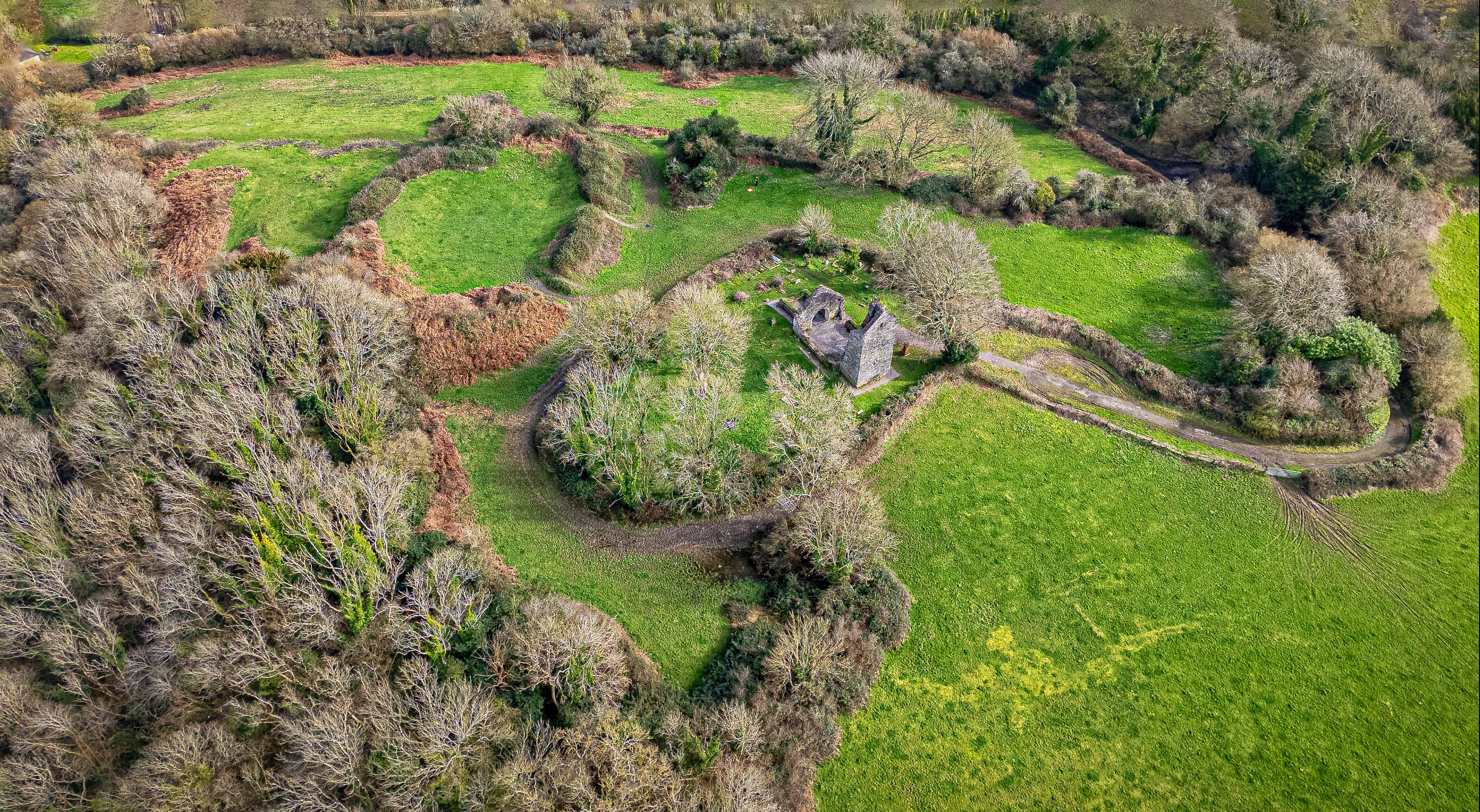
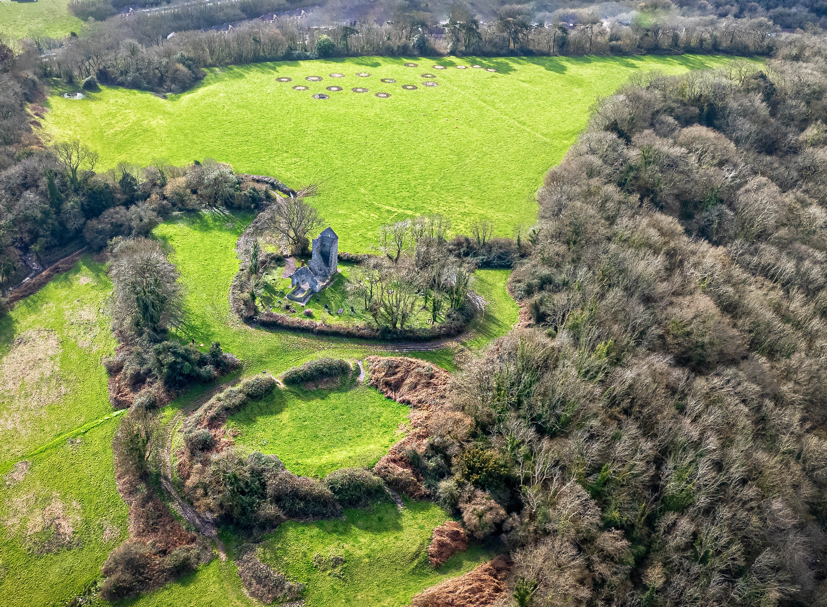
The hillfort is one of the largest and most significant Iron Age sites in South Wales, originally a stronghold of the Silures tribe. The overall site covers an area over 5 hectares – larger than 4 full size football pitches. Its multiple ramparts and ditches, clearly legible in the aerial photographs, enclose a strategic plateau overlooking the Ely Valley. The sweeping curves of earthworks visible from above reveal successive phases of construction, reflecting the site’s long occupation and defensive importance within pre-Roman tribal territories
At the hillfort’s heart lie the roofless ruins of St Mary’s Church, founded in the 13th century and abandoned after the medieval period. Though it was restored in the 1960s, it fell victim to severe vandalism and was deconsecrated in the 1970s.The images show the church isolated within its oval churchyard, itself set inside the prehistoric enclosure—an explicit layering of sacred and defensive landscapes. Together, the photographs emphasise how medieval Christian worship appropriated an ancient stronghold, illustrating over two millennia of adaptation and reuse within Cardiff’s historic landscape.
The originator declared that this location was not inside a Flight Restriction Zone at the time of being flown on 02/03/2026. It remains the responsibility of any pilot to check for any changes before flying at the same location. Landowner permission may be required before taking off.