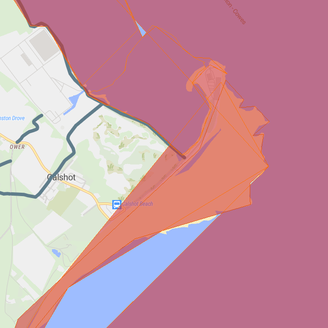
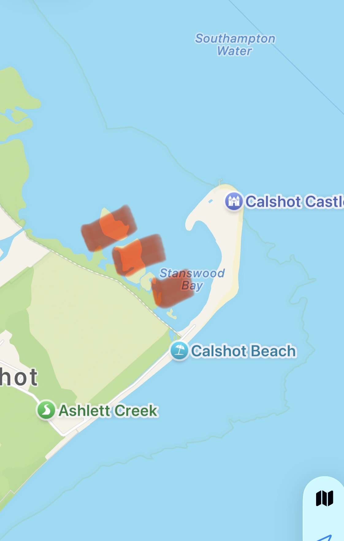
Area is covered by Crown foreshore for TOAL. Nice spit with a small castle. Nearby marsh land and Fawley delelict power station. Lots of water sports and boats coming and going.
The originator declared that this location was not inside a Flight Restriction Zone at the time of being flown on 02/04/2021. It remains the responsibility of any pilot to check for any changes before flying at the same location.
There are no parking or take off and landing markers on the map at this location. Could anyone that has flown here or knows the area add some useful markers to the map, please?
So there’s a nice purple (thanks yer majesty) bit there that we can go up and down from, but what about the “solent and southampton water SPA” and the “north solent SSSI” ? It looks to me that they completely cover the crown estates purple land, so the whole thing is a no-fly.
Or am I misreading something, somewhere? I hope so. Please tell me I’m wrong.
I fly at that location at least 5 times a week. Ignore the SSSI warning, it doesn’t affect drone flying at all. But be careful, it’s a huge nesting area for a plethora of marine species and especially at low tide, Oystercatchers get angry with drones.
But as I’ve previously mentioned, the staff at the Activities Centre are starting to enforce their no TOAL policy just past the automatic barriers at the Spit.
The area I’ve marked in red should be avoided, especially at low tide. An area of increased bird activity.