I have just added this to the map of places to fly your drone at Drone Scene:
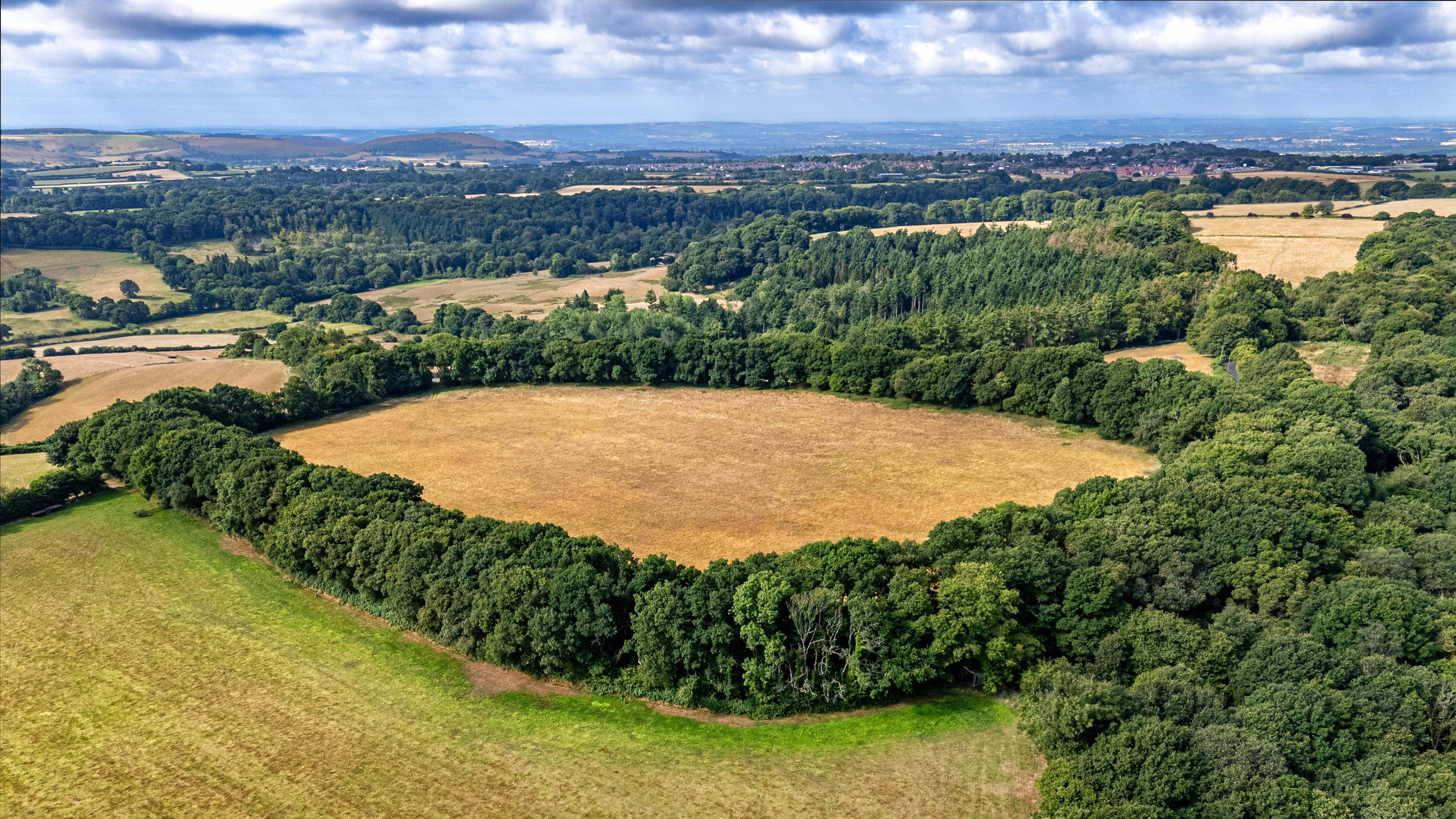
Castle Rings is a univallate (i.e. single wall) hill fort close to Donhead St Mary in Wiltshire. The site is a Scheduled Ancient Monument and has been dated to the Iron Age.
The rampart of the fort stands 2.8 metres (9.2 ft) high with a 0.4-metre (1.3 ft) deep ditch. The ditch is set between double earth banks. The ditch averages 16 metres (52 ft) wide and varies in depth to a maximum of 4.4 metres (14 ft). The inner rampart has an average width of 8 metres (26 ft) and stands 1.9 metres (6.2 ft) above the internal surface level of the fort.[5]
The fort measures 320 by 200 metres (1,050 by 660 ft) (NS by EW), enclosing an area of 5.2 hectares (12.8 acres).
The roughly oval rampart of the fort is overgrown with trees and bushes. The interior of Castle Rings is flat and used for pasture. There is no visible evidence of Iron Age occupation, from the ground or the air.
In the mid-1980s a metal detectorist unearthed a hoard of coins of the Durotriges tribe within the hill fort and was subsequently fined for looting a Scheduled Ancient Monument. 88 coins were found in all.
The finds were handed over to the police and in 1987 were declared treasure trove by an inquest, which found that the metal detectorist had excavated a 30-centimetre (1 ft) deep hole into the upper section of the outer bank and therefore the find fell within the bounds of the scheduled monument. The finder was prosecuted under the Ancient Monuments and Archaeological Areas Act 1979 and fined £100 (equivalent to £355 in modern currency)
The originator declared that this location was not inside a Flight Restriction Zone at the time of being flown on 16/07/2025. It remains the responsibility of any pilot to check for any changes before flying at the same location. Landowner permission may be required before taking off.