I have just added this to the map of places to fly your drone at Drone Scene:
Land owner permission not required.
Parking & TOAL: 51.710237, -1.970934
This site is owned/managed by English Heritage, so TOAL was from outside the boundary.
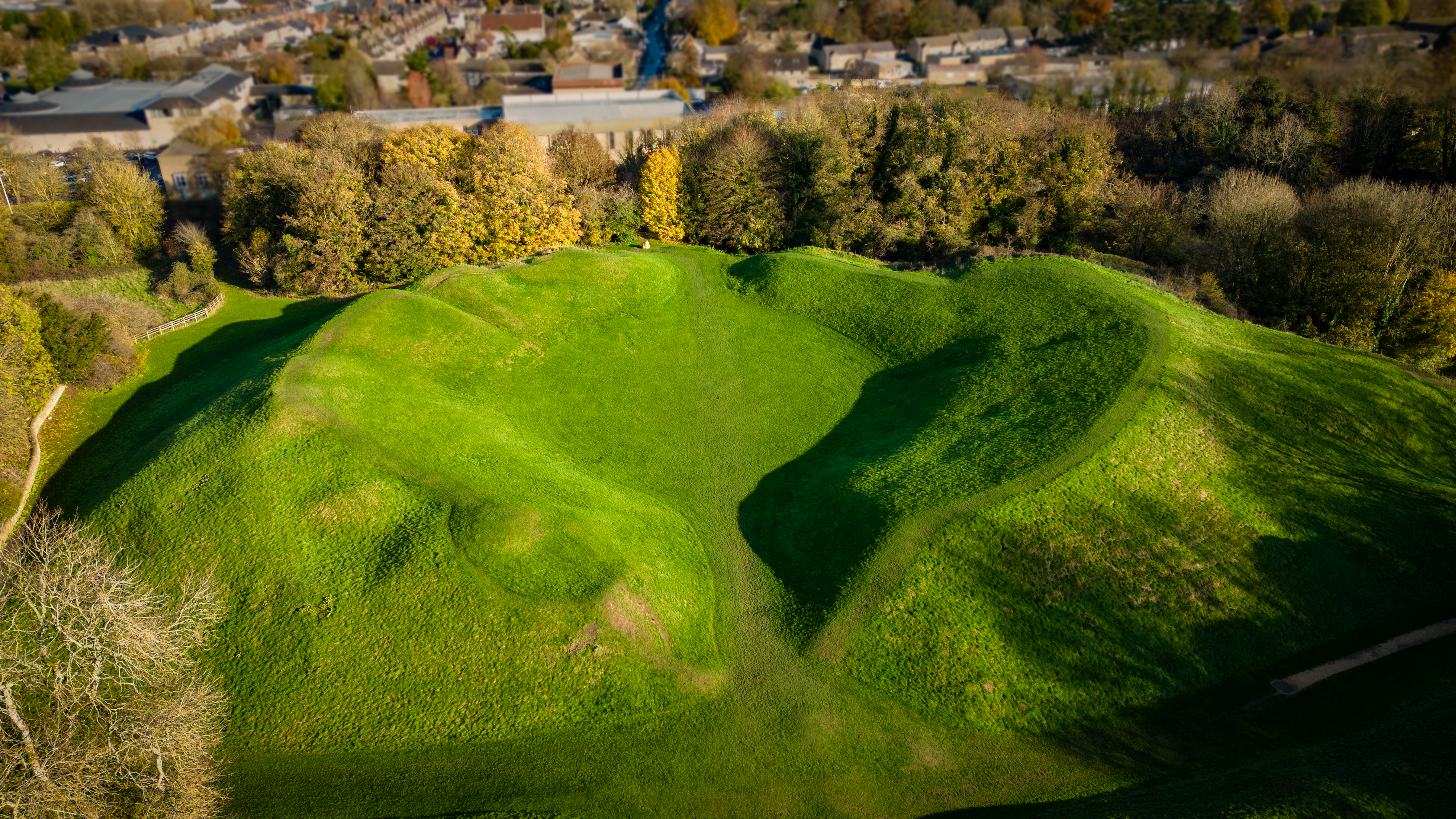
The Cirencester amphitheatre is one of the largest known examples surviving from the Roman occupation of Britain.
It was built just outside the walls of the town (then known as Corinium) early in the 2nd century AD.
Cirencester was second only to London in size at this period, with a population of over 10,000, and was at its finest just as Roman rule was collapsing throughout the Western Empire.
In AD 408 the last contingents of the regular Roman army left Britain. Without their pay to support the local economy and maintain order, and with no central administration to maintain communications, town life rapidly declined.
Private patrons prepared to pay for the public games could not be found. No longer used for the pursuit of pleasure, the amphitheatre became a fortress in an attempt by the town leaders to safeguard their community.
Its entrances were narrowed and a ditch dug along the southern sides, and remains of timber buildings dating from the 5th century have also been found. These efforts appear to have been in vain. In AD 577 a stronghold believed to be Cirencester is reported as falling to the advancing Saxons.
The amphitheatre then remained abandoned for several centuries.
In the Middle Ages the Abbot of Cirencester enclosed it for use as a rabbit warren. Its local name, the Bull Ring, suggests that it may once have been used for bull-baiting: a return to its original purpose.
The originator declared that this location was not inside a Flight Restriction Zone at the time of being flown on 20/11/2022. It remains the responsibility of any pilot to check for any changes before flying at the same location.
