I have just added this to the map of places to fly your drone at Drone Scene:
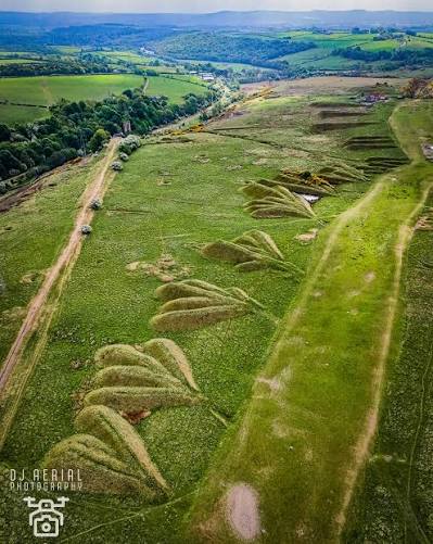
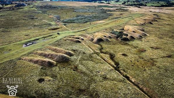
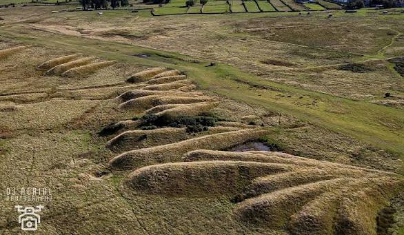
The Cockfield spoil heaps, located on Cockfield Fell in County Durham, are prominent industrial relics from centuries of coal and whinstone mining. These large mounds and ridges of waste stone and shale, often referred to as extraction heaps, now form a distinctive, weathered landscape that acts as a significant, preserved remnant of the region's mining heritage.
Location: Situated on Cockfield Fell, near the village of Cockfield in County Durham, UK.
Origin: They are the result of decades—and in some areas, centuries—of coal mining and industrial activity.
Appearance: From above, the heaps appear as sweeping, linear mounds and deep scars in the landscape, often described as having an "otherworldly" or artistic quality.
Significance: Cockfield Fell is recognized as one of the best-preserved industrial landscapes in England, with the spoil heaps serving as a powerful, visible reminder of the area's coal mining history.
Reclamation: The mounds have largely weathered, with nature slowly reclaiming the area, blending the industrial debris into the natural fell.
The site is popular for walking and photography, offering a direct view into the intense industrial activity that once dominated the area.

The originator declared that this location was not inside a Flight Restriction Zone at the time of being flown on 01/01/2026. It remains the responsibility of any pilot to check for any changes before flying at the same location. Landowner permission may be required before taking off.