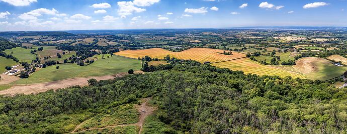
I have just added this to the map of places to fly your drone at Drone Scene:
Drakestone Point is part of Stinchcombe Hill, a ridge overlooking the Severn Vale and the Cotswold escarpment.
It's a popular spot for walkers, with the Cotswold Way passing through, and there are various paths leading up from Dursley and from a car park near the golf course (that's where I parked and then walked in)
The point itself is a triangular area of grassland, with an oak tree and a memorial bench at the tip, offering stunning views.
There's some evidence of earthworks at the site, possibly indicating an Iron Age beacon or a signaling post. It has also been suggested, though not definitively proven, that it might have been a castle site in the past.
The main draw of Drakestone Point is the extensive views it offers over the Severn Vale, towards the Forest of Dean and the Welsh hills. Its summit reaches a height of 220m, add on 120 metres of drone altitude and the view from above of the valley below is the main attraction of this recommended location.
Parking was by the golf club house, TOAL from the public footpath approaching the viewpoint (The Cotswold Way)
The originator declared that this location was not inside a Flight Restriction Zone at the time of being flown on 30/06/2025. It remains the responsibility of any pilot to check for any changes before flying at the same location. Landowner permission may be required before taking off.
