I have just added this to the map of places to fly your drone at Drone Scene:
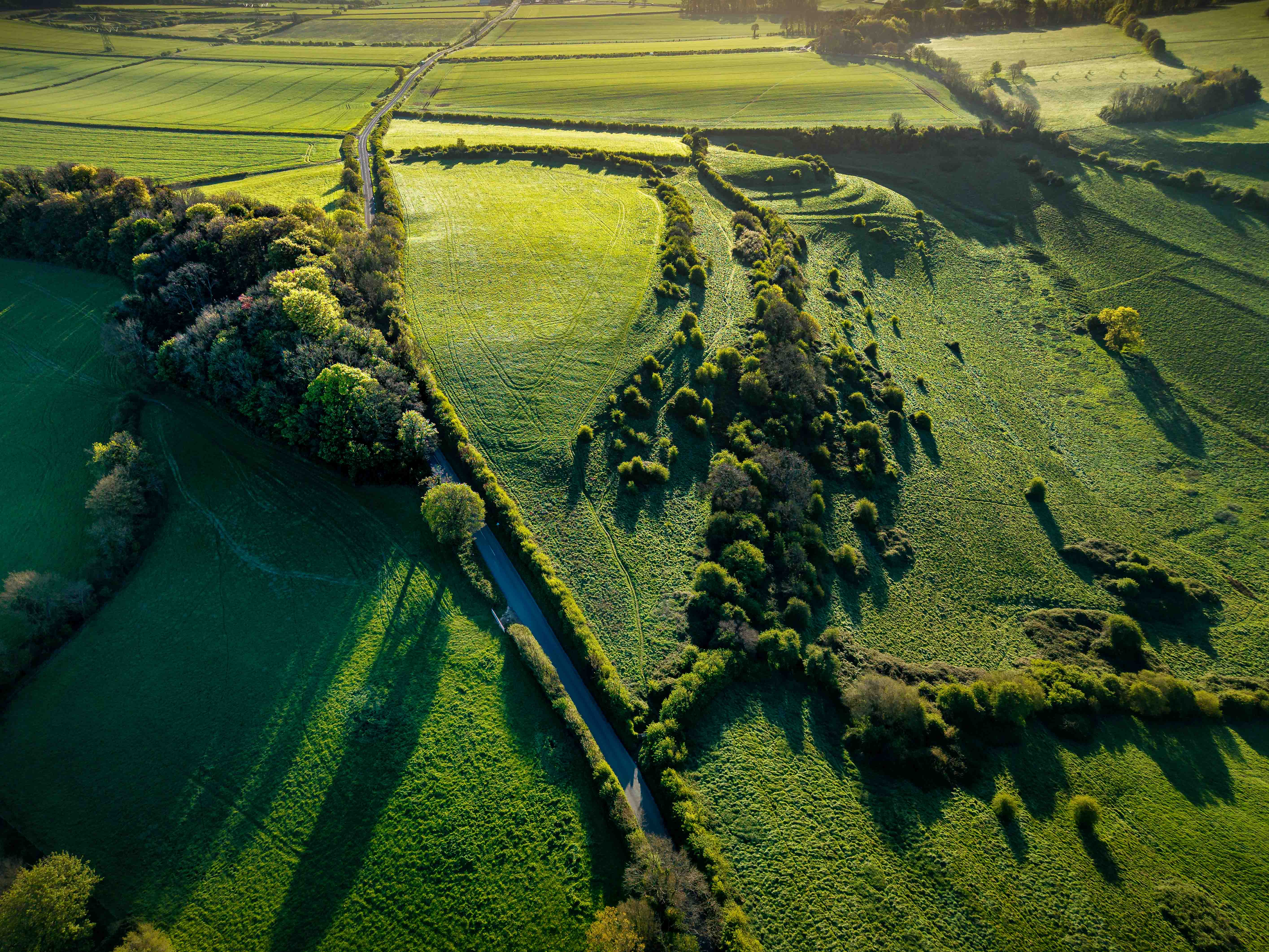
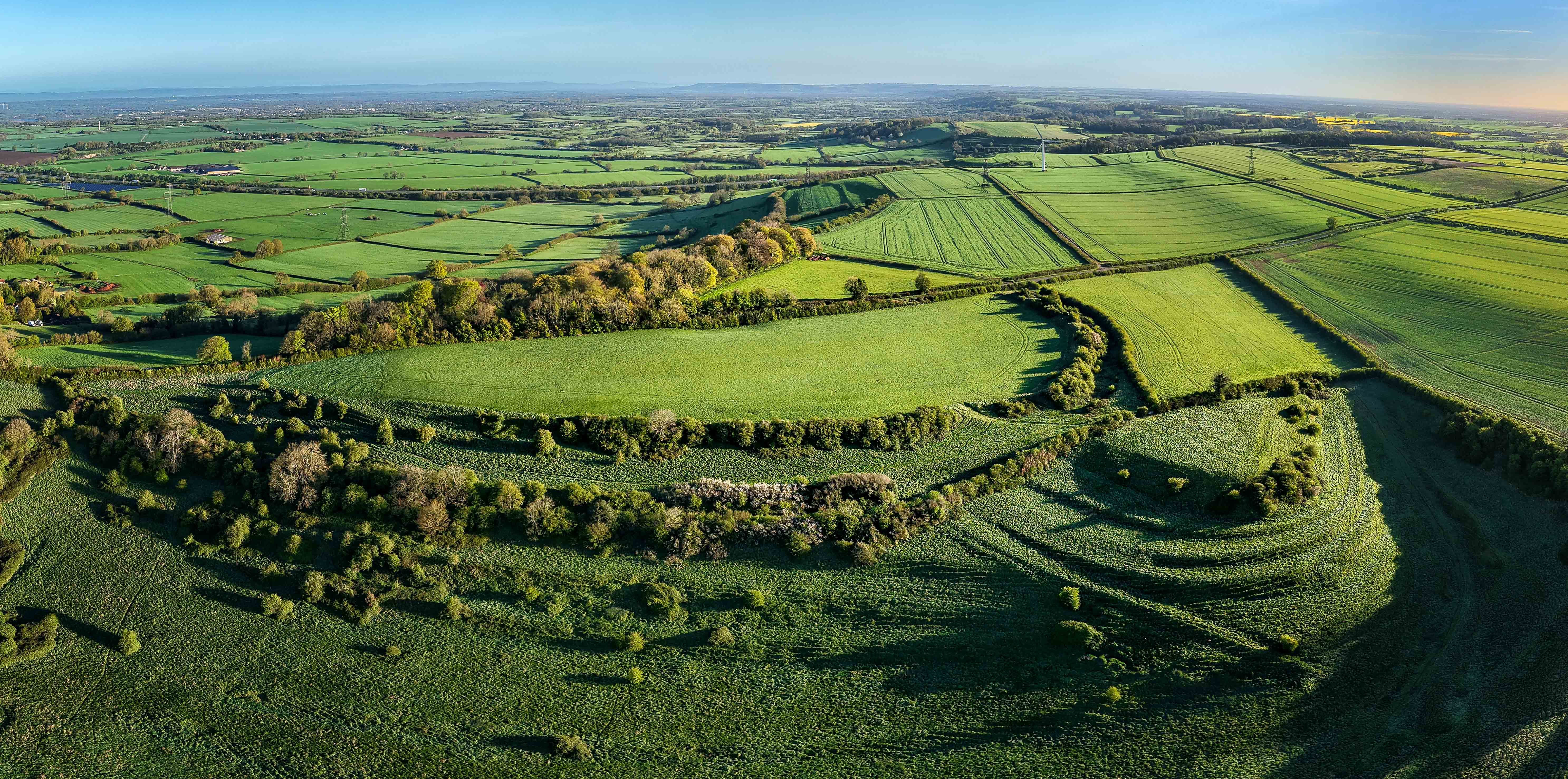
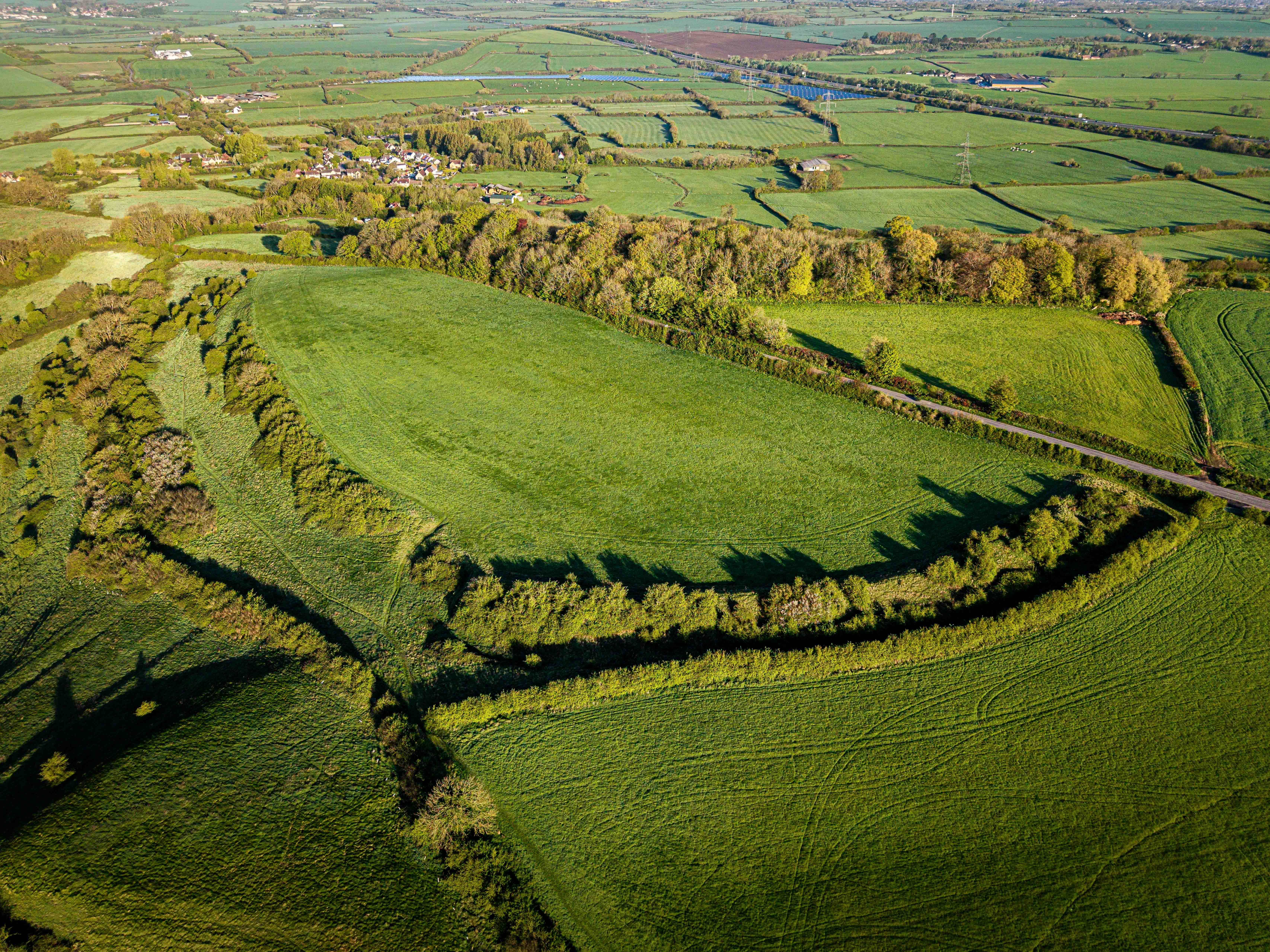
These aerial perspectives offer a striking masterclass in Iron Age engineering and the strategic use of topography. Hinton Hill Fort (also known as Dyrham Camp) occupies a commanding 240-meter limestone spur of the Cotswold Edge in Gloucestershire. Its primary defensive feature—a massive, single ditch and bank—is most visible where the low morning sun casts deep shadows that emphasise the surviving earthworks.
While the ramparts we see today likely date to the Iron Age (circa 500 BC), the site is most famously associated with the Battle of Deorham in AD 577. This pivotal Saxon victory saw Ceawlin of Wessex defeat three British kings, effectively severing the link between the Celts of the South West and those in Wales. The fort likely served as a strategic lookout and a final rallying point during this Anglo-Saxon expansion.
You can clearly see the broad, semi-circular plateau protected by the steep natural scarp to the west and man-made ramparts to the east. The "scalloped" appearance of the greenery highlights how the land was sculpted to create a formidable barrier.
The images show how the ancient site is now integrated into the English pastoral landscape. The Cotswold Way passes through these ramparts, while modern roads and field boundaries now dissect the periphery of what was once a secure tribal capital.

The originator declared that this location was not inside a Flight Restriction Zone at the time of being flown on 19/04/2026. It remains the responsibility of any pilot to check for any changes before flying at the same location. Landowner permission may be required before taking off.