I have just added this to the map of places to fly your drone at Drone Scene:
Land owner permission requirements unknown.
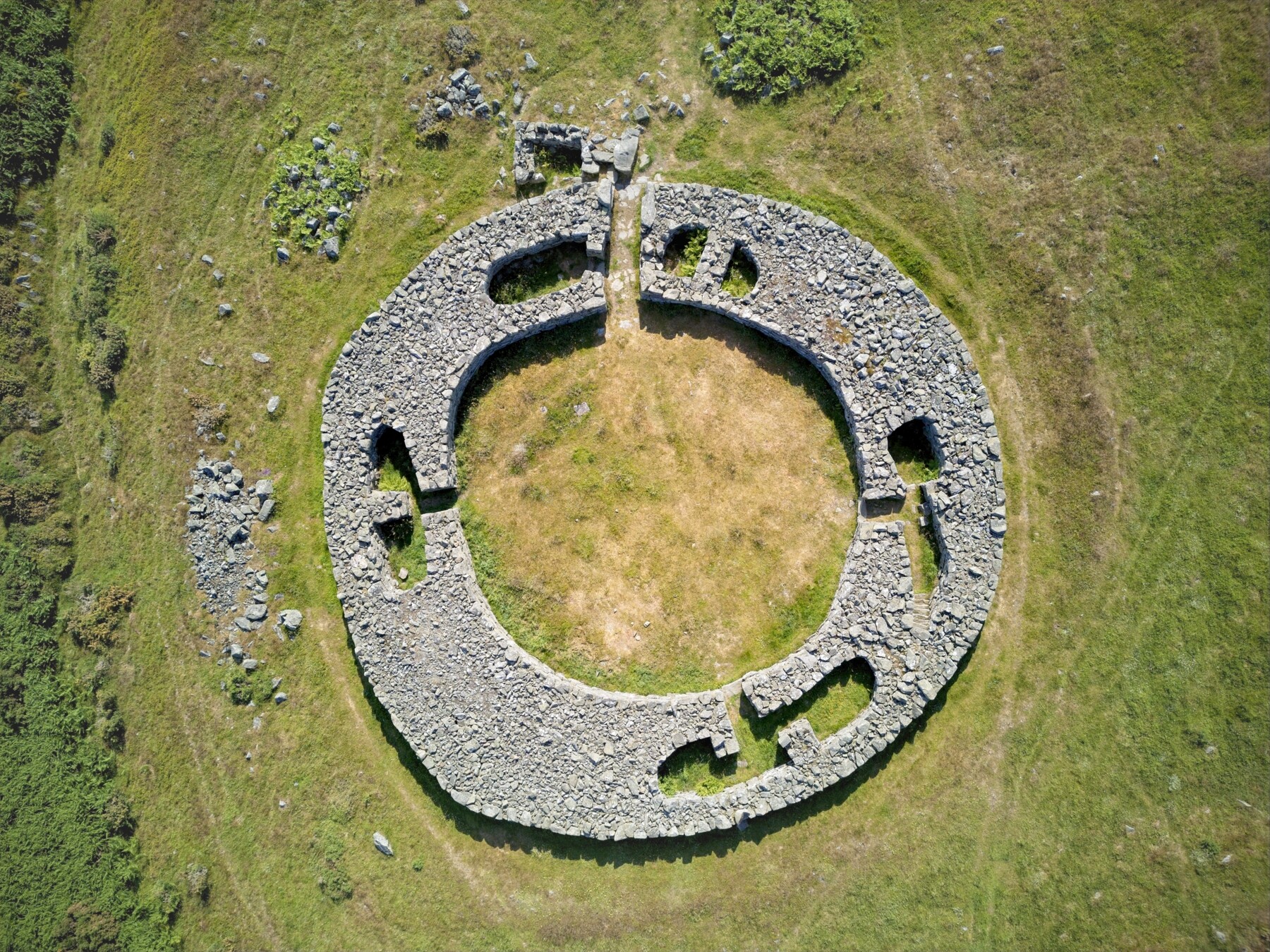
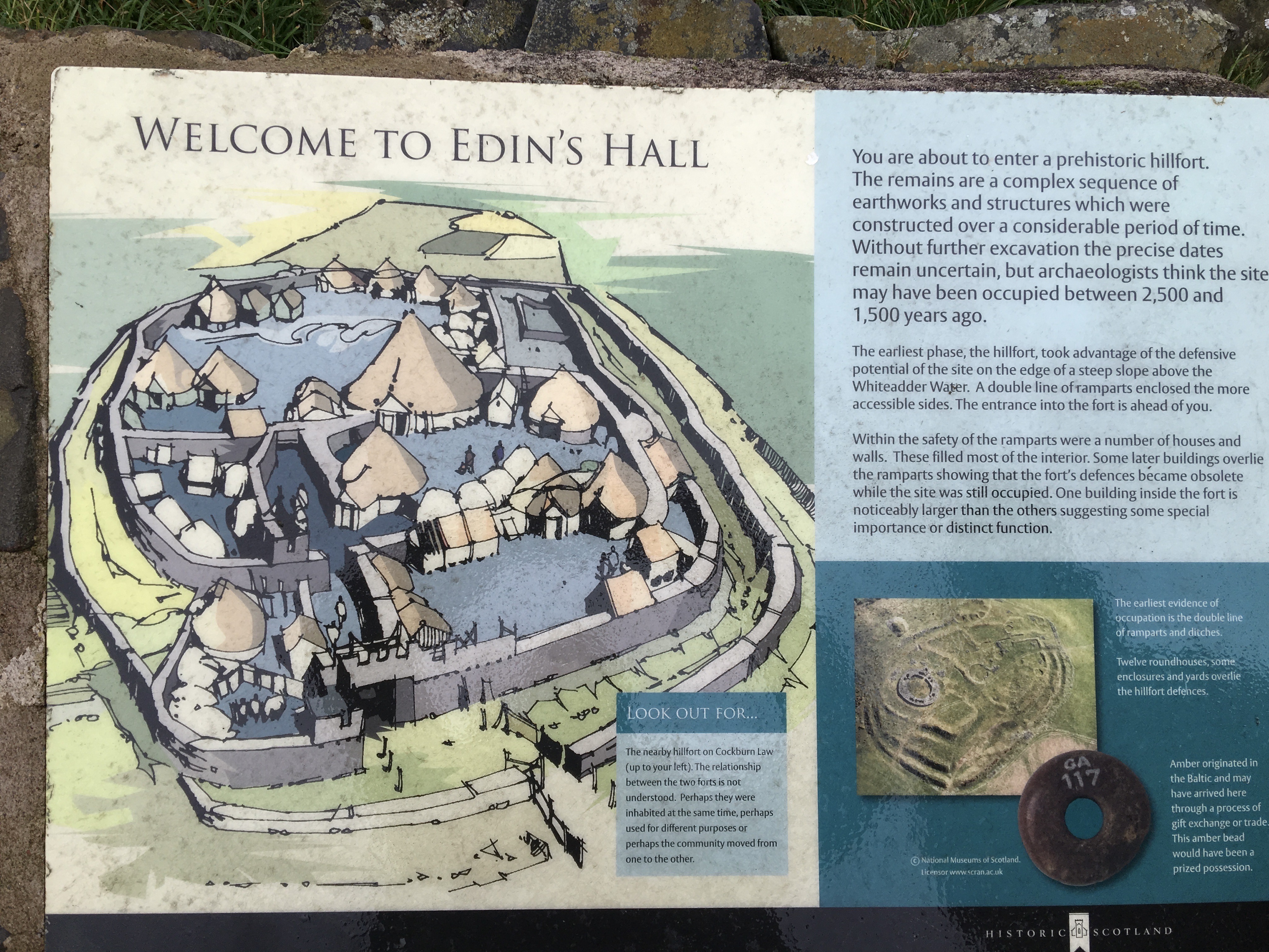
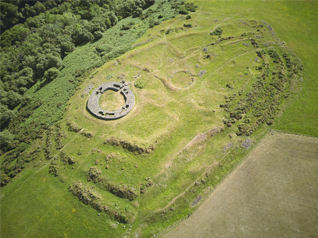
This Scheduled Monument is a rare example of a lowland broch (fortification), and is not the easiest place to access. Getting there involves a trek of about 2.3km, with the trail climbing about 80m over the last half of the walk (quite steeply as you get close to the broch, it’s on a hill after all…). Wear good boots!
There is limited free parking (for about 6 cars) at W3W: reef.sonic.bonus
Take the track from the car park, and where the track forks, take the track down to the left. If you take the track to the right you will have to paddle across a ford, while the track to the left leads you to the wonderfully wobbly Elba suspension bridge to cross the river. From there the route is clearly signed.
This a Historic Environment Scotland site so TOAL from outside the site.
PastMap (Pastmap | Pastmap) may be useful, just turn on the Scheduled Monuments layer).
There are overhead power lines about 600m from the site, other than that, the Lammermuirs are to the North, and the Cheviots to the South, enjoy…
The originator declared that this location was not inside a Flight Restriction Zone at the time of being flown on 22/06/2023. It remains the responsibility of any pilot to check for any changes before flying at the same location.