Been thinking about having a go at this for a while now but had assumed it would be incredibly complicated. Turns out, not so much.
The trees and bushes are a bit ‘soft’, presumably because of the wind on the day (they’re showing up as the lower numbers in the confidence map). But all in all, I’m pretty pleased with the results.
Need a new laptop if this is to become a regular thing though - my 2019 MacBook Pro took more than 24 hours to do the final render.
Had the Mavic 3 Classic with me on this one, but it was just a couple of hand-flown hyperlapse flights around the building and then feed the (452!) jpegs in to the software (Metashape) so will be trying it with the Mini 4 next time
Could you please share with us the process & steps you’ve used to shoot the footage/images, then processing through to outputting this presentation video please?
I’ve got a Mav 3 Pro, and have been thinking to go on this journey as you’ve done.
It was surprisingly easy once I’d done some research and watched a couple of videos on YouTube.
To get the pictures, I put the drone in Hyperlapse mode and flew two full circles of the house, once at about 15m height and about the same distance away and the second at about 30m and a little further away. I went for a shot every second and the maximum duration, top speed was 2.5ms (I think). The camera was pretty-much set to auto for focus, exposure, etc.
Once I had the pictures, I downloaded a 30-day trial of Metashape and literally followed their walkthrough.
Took a LONG time to render and the laptop got very hot - I paused it a few times and let it cool down to avoid damaging it, but it picked right up where it left off, no bother.
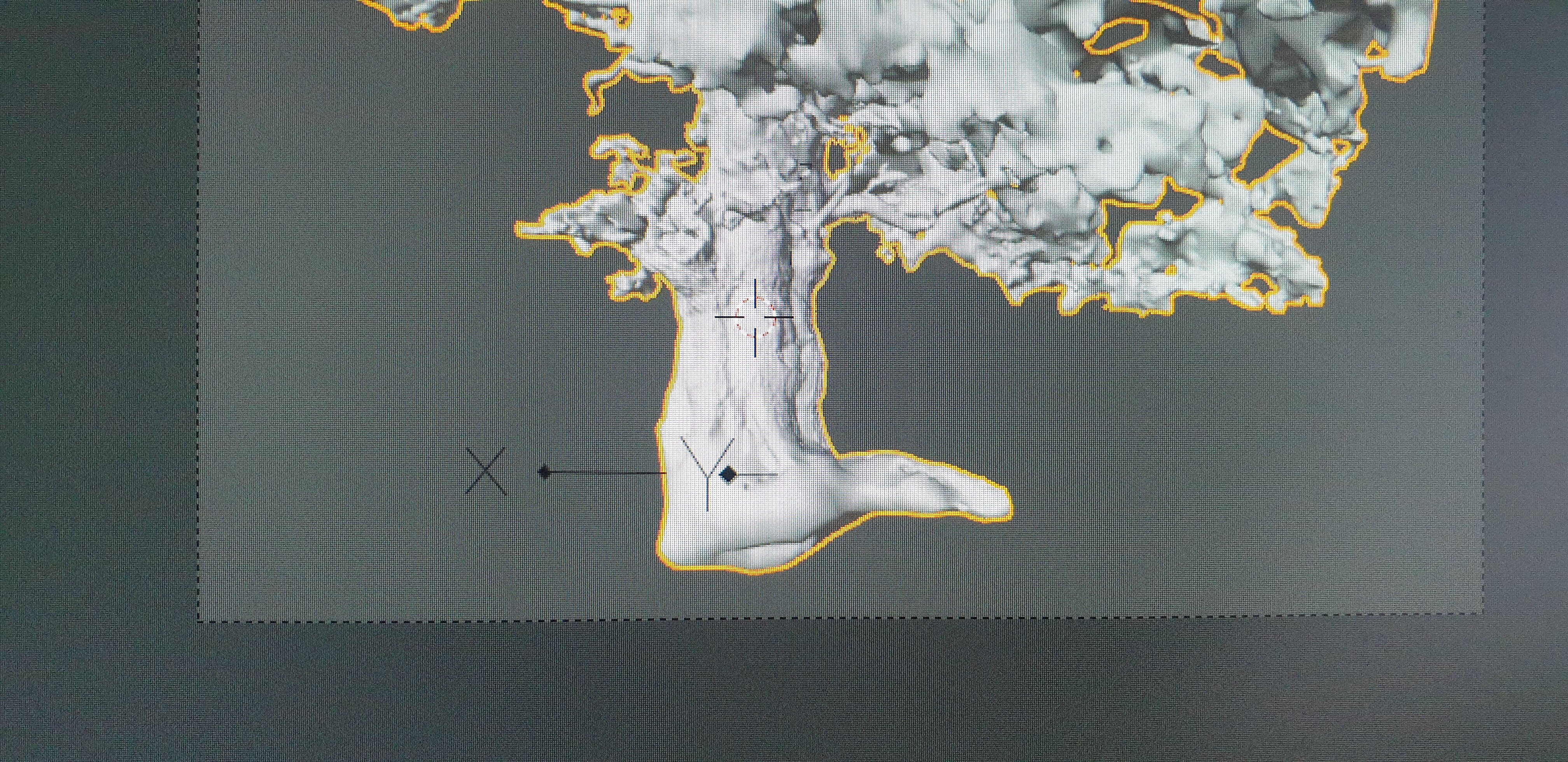
Once I had the model, I played about with the alignment a little. Easiest way I found was to turn on the grid and line up the object to it first, then line up the region.
After that, I turned on a basic animation effect to spin it 360º on the horizontal and took a screen capture of each of the different layer types (Tile Points, Confidence, Wireframe, Solid, Shaded, Textured) and I edited them together in to the final video I posted above.
In Ayrshire, but it’s my folks’ house up in Caithness
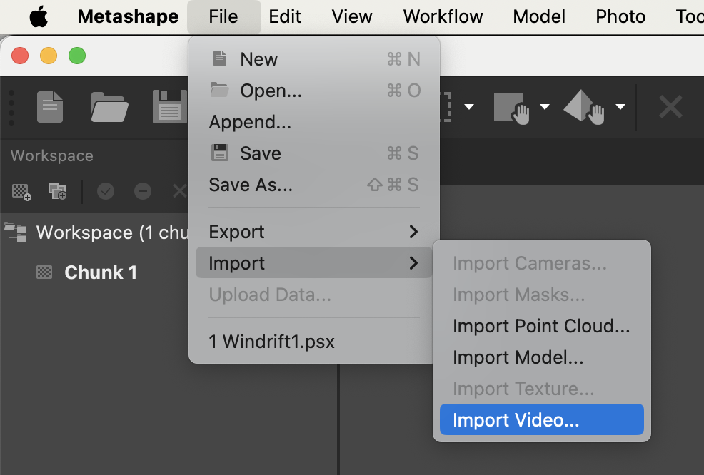
I’m not sure if the trial version of Metashape has the option, but you can import a video file. The file type is important (I use MP4 ), and you have to specify an output folder for the .PNG files the import converter creates.
Select a frame step - depending on the size of the video, too small a frame step results in hundreds of PNG images, which will make subsequent Metashape processing take much longer.
Thanks @Wintermute - I’ll add that to the list of things to have a go with soon
Edit: I might do both a hyperlapse and a video of a subject and compare them - intrigued to see how the sharpness compares with motion blur on the video
@JoeC nice one! Ive just started playing around with photogrammerty too. I used the standered version of metashape and building a new computer to help with that. Look forward too seeing more scans from you and others. Maybe we could have a thread of its own? ‘3D models by drones’ maybe?

")