Flight Restriction Zone Maps

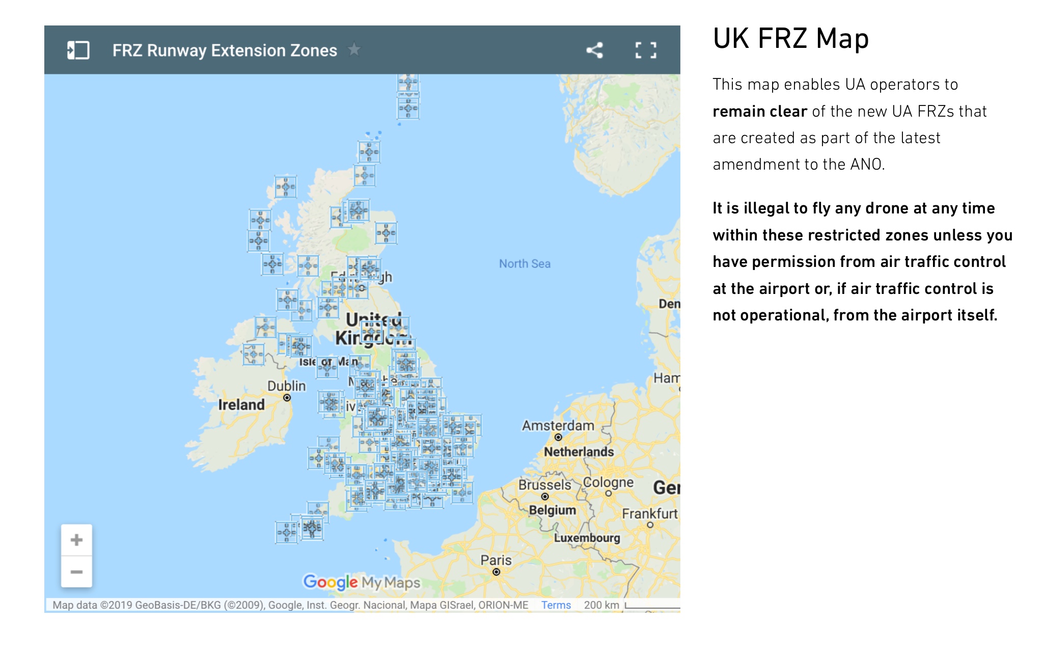
As I said in my last topic, there is a useful interactive map of the UK has been created by NATS showing the protected aerodromes with the flight restriction zones. Airfield restrictions - Dronesafe.

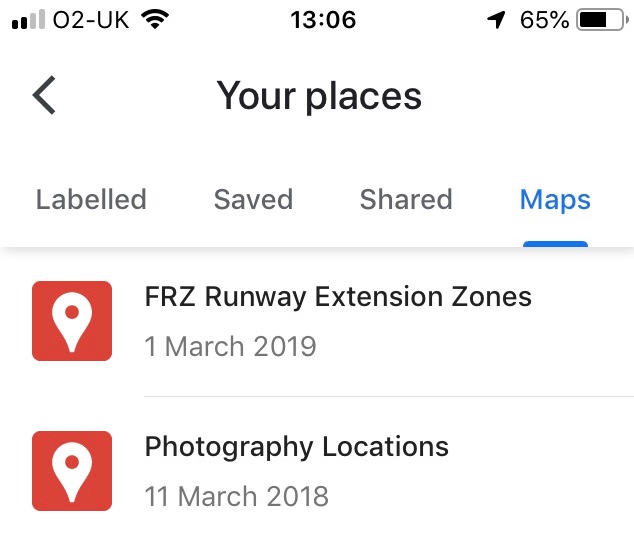
I should make clear this is for mobile devices. It does work with desktops but I haven’t used yet.

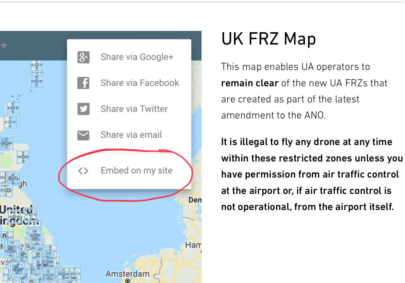
This is linked to google so you there is a way to have permanently linked to your google maps if you have a google account.

First make sure you are signed in to google on your device.

Then go to the Dronesafe website Airfield restrictions - Dronesafe

Go down the page to the map

Think click the share button top right and click ‘embed to my site’

You will then be taken to google maps

When you close Google you will loose the map. But as you have embedded as above just go to your places from the settings (top right)

Click on your places and maps and you will see your FRZ map which you just click and it will load again

And you can then go to the location you are interested in

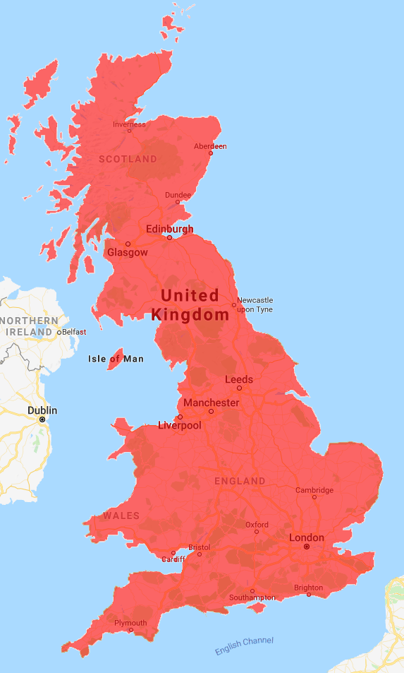
And zoom right in which shows that I can no longer take the pictures I had done previously of Goodwood Racecourse without ATC permission! But my take off location was legal

To reiterate. This is being done via iOS but others on the course did it with android no problem. Desk top seemed a bit more complicated, but for me having on phone and table is the best place anyway.

4 Likes

thanks Brian

2 Likes

Cheers Brian, Works fine on Android :+1:

1 Like

Thanks, and just checked and now working fine on google maps on my iMac.

1 Like

Thanks @BrianB all up and running on my android. Very useful indeed :grinning:

1 Like

Have used on my telephone and iPad very good app.

Here’s one from dji you can check before you go out to play,

Geo Zone Map - Fly Safe - DJI

I am afraid that this one does show the True ares of the Flight Restriction Zones at the moment. Be interesting to see if they get fence the entire FRZ’s.

If you drill they show the locations, and many more besides, but not the full areas of the FRZs ‘yet’! Goodwood covers about 80% of The city of Chichester! :pensive:

It’s all a mess …. wine involved … they all look the same.

1 Like

Does the legislation have anything about “drink-droning”? :stuck_out_tongue:

“Think - before you drink - before you drone!”

2 Likes

It’s not big and it’s not clever, please drone responsively :joy:

1 Like

You mean “responsibubbly”. :+1: :wink:

A “posh” version of “responsibeerly”. :rofl:

2 Likes

Ive had some interesting flights in the middle of ‘off the track’ France whilst under the afluence of incahol.

2 Likes

To say I’ve never flown after a drop of C2H5OH might be a fib … but I’ve always been moderately compost mintoes. :wink:

2 Likes

Hmmm … I seem to have diverted this thread off topic. #Ooops

1 Like

Flight restriction maps indeed.

Stay away from airports, prisons and football grounds. If you need more telling that, then you need a new hobby.

How long before DJI ‘decide’ to geofence the FRZ’s and spoil it for all not on .700

1 Like

It’s coming …

2 Likes

1 Like

And what if your green to the hobby, unsure of where you can or can’t fly safe.

Is it not better to have link/maps to show people a bit of an insight?