I was having a mess around with adding KML files from Airdata to Google Earth. I must admit it gives you a better picture of your flights but no data, or is there a way to add it?? …
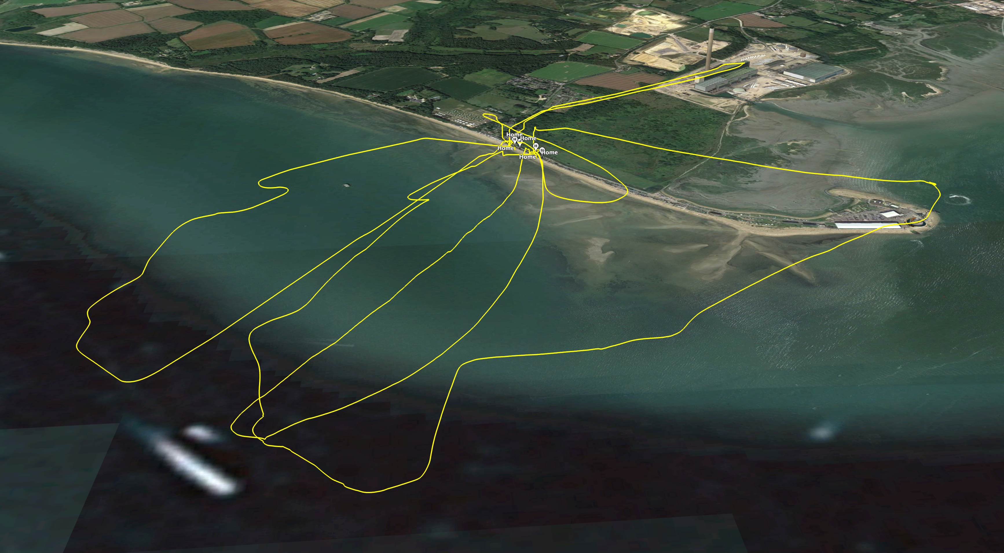
Download and add the KML files for the info you want (e.g. notifications KML, battery info etc.), they are then overlaid over your flight path. This allows you to switch layers on and off depending on what you want to see.

Here I have the flight path & flight notifications KML files loaded.
1 Like
Ahh got it! Many thanks, much appreciated. ![]()
1 Like
Just an addendum: you can also use CSV files to create a layer with data points from the flight. Once you’ve done, you can click each point to see all data recorded at that point in a pop-up. Alternatively, you can also set what details are shown for each capture point during the import.
2 Likes