Hi everyone. I just bought a DJI mini 2 and am brand new to this! I’m still trying to understand all of the restrictions on mapping apps. Could anyone help me understand what restrictions are in place on this picture. I hope it uploads ok!
It’s an area around Aberdeen, shaded in blue, says EGPH. The app won’t tell me if this area is forbidden or what restrictions there are. I’d be grateful for any advice. Thanks.

1 Like
It’s called Class D airspace, you can fly in this airspace just be cautious. Obviously the boundaries around Dyce airport is a no no. I’m in Ellon by the way. Welcome to the club as they say. I’m sure you will enjoy flying your drone.
1 Like
Hi Clare and welcome to GADC.
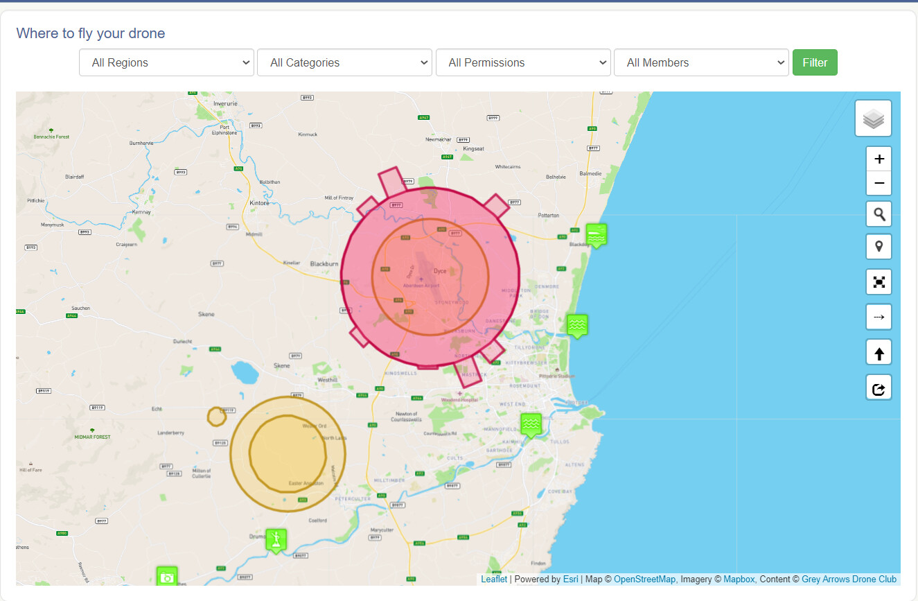
For places to fly and to check restrictions I’d suggest using our very own Drone Scene - Where can I fly my drone in the UK? - Drone Scene The red area is the Flight Restriction Zone for Aberdeen airport. You can fly in class D airspace as you are flying under 120M.
2 Likes
Welcome to the group Clare.
As previously mentioned this is termed as Class D airspace. As a drone user this has next to no impact on yourself other than to be aware that there will be General Aviation (GA) activity in this area.
As you have a Mini 2 you will unfortunately be plagued with the DJI App continually pestering you with a pop-up that you will have to acknowledge before continuing with your flight. This has ABOSOLUTEY NO LAWFUL implication, and is just DJI being a pain in the rear end.
Below is my area as depicted in Dronescene (bookmark this page from the link found on this site, it’s worth its weight in gold, if it actually weighed anything.).
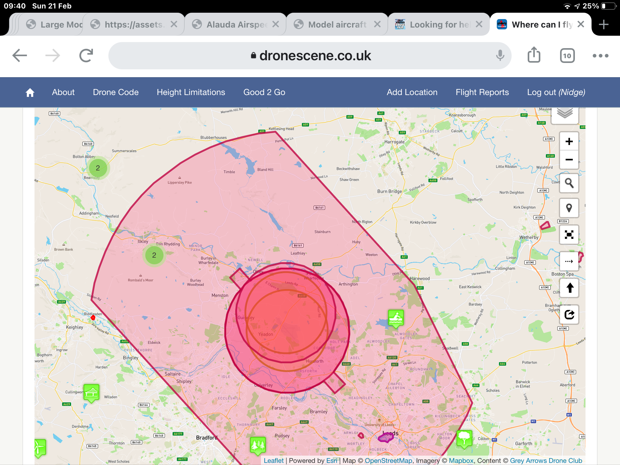
The large light red area is Class D airspace associated with Leeds and Bradford Intl airport. Also within this area are three very popular model flying sites, including the club of which I’m a member of. I am free to fly anywhere within this area subject to the regulations and guidelines stipulated by the “Drone Code” and those of the CAA regarding the use of personal SUAV’s.
Finally, do not rely on DJI’s interpretation of NFZ’s and restricted airspace. Use it as the flimsiest of guidelines as in many cases it is incompetently inaccurate.
This is another one of DJI’s self imposed NFZ’s.
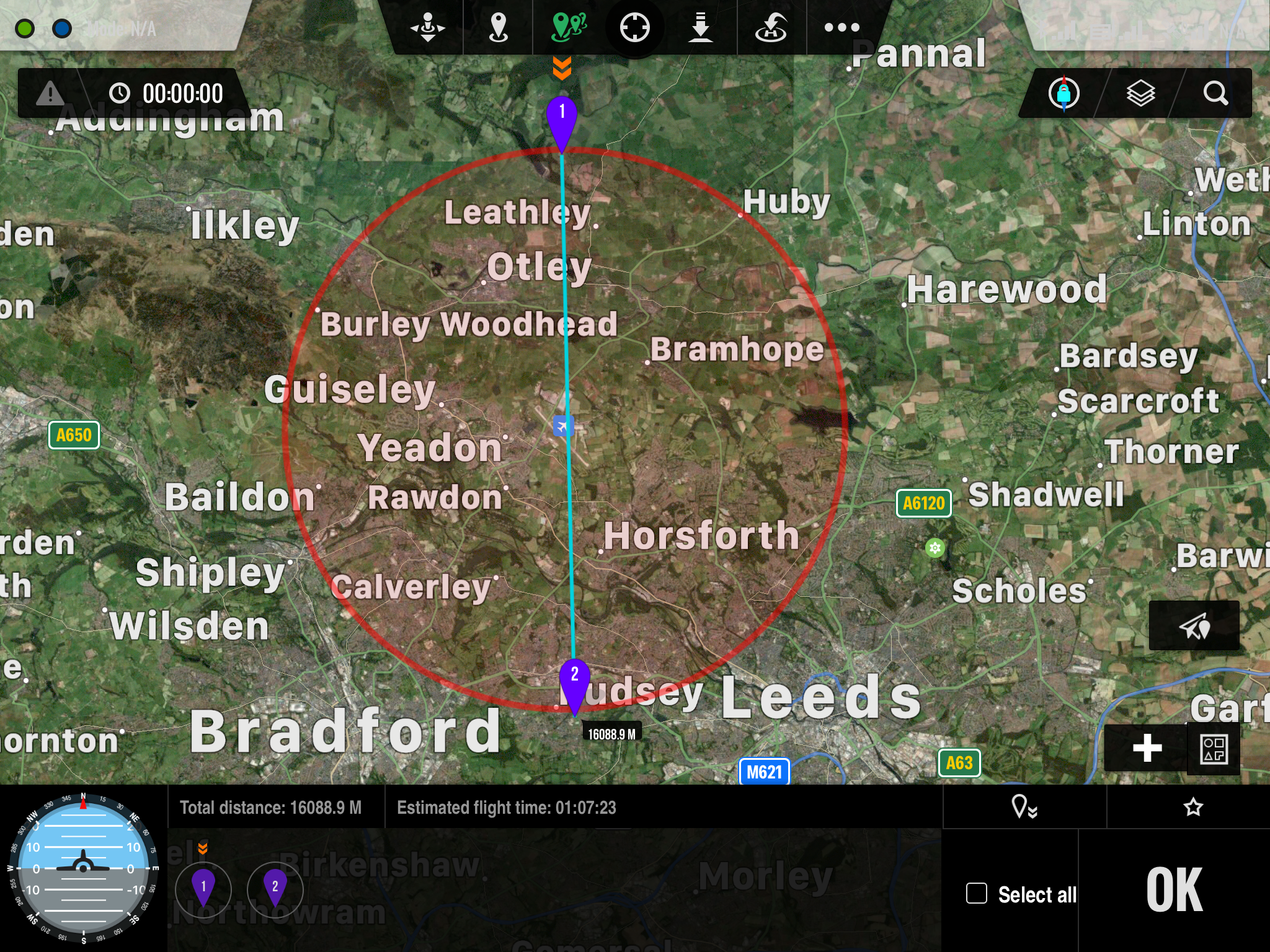
This is the NFZ imposed on my DJI F550 hexacopter with the DJI Datalink system installed. Within this area it is impossible to arm the Datalink hardware. My model flying club is also in this area, where we have permission to fly to a maximum ceiling of 1,000ft above the take off point, fixed wing models only. This further demonstrates why as a forum we highly recommend users to consult with the Dronescene page for the defacto definitions and not to rely on DJI’s, or any other, manufacturers guidelines.
Edit. @Drumsagard can type faster and more coherently than I can, he beat me to the punchline 
3 Likes
A post was merged into an existing topic: The development of Drone Scene continues!