I have just added this to the map of places to fly your drone at Drone Scene:
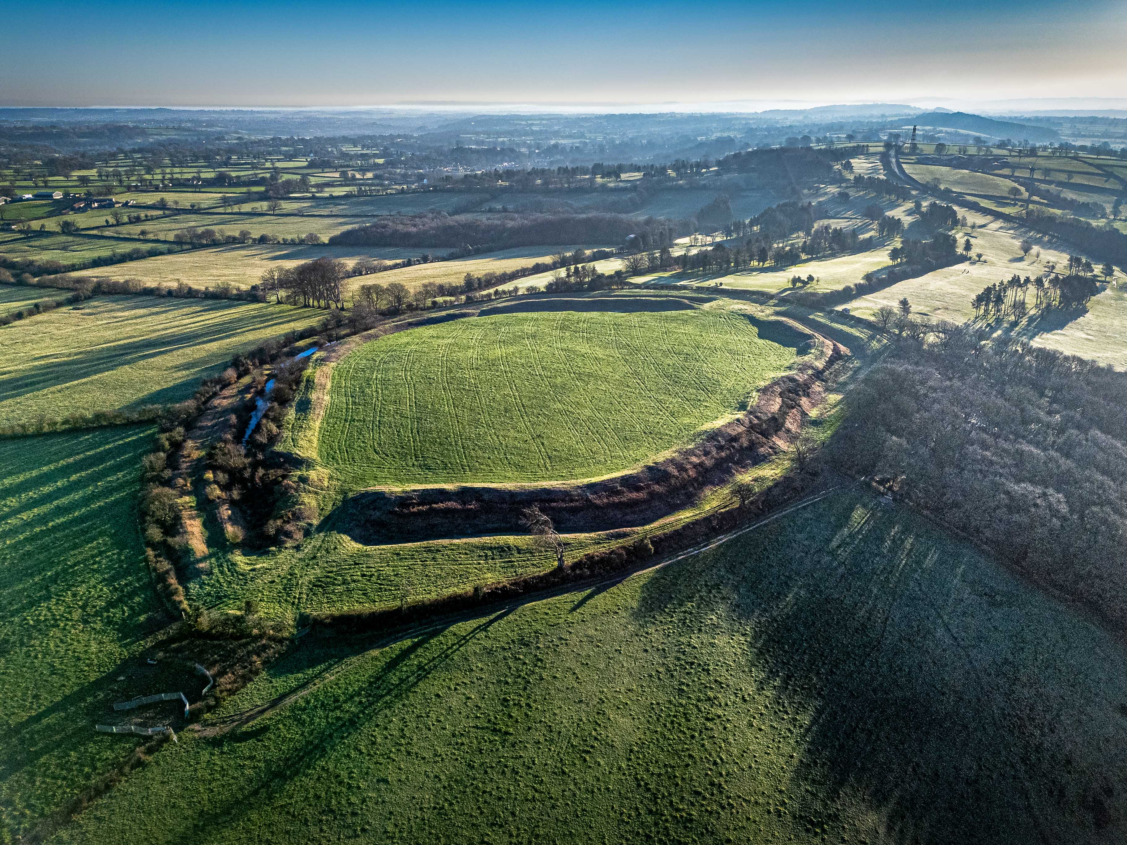
Maesbury Castle is a striking Iron Age hillfort situated on the eastern edge of the Mendip Hills in Somerset. Likely dating back to the 1st millennium BCE, its double-rampart defences (multivallate) suggest it was a significant tribal stronghold, possibly occupied by the Durotriges or Dobunni. Covering approximately 6 acres, the site offers commanding views across the Somerset Levels toward Glastonbury Tor roughly 8 miles to the southwest
Also visible from this location are the Somerset Levels - the vast, flat expanse of greenery stretching out beyond the hill is the “Vale of Avalon,” which was a shallow sea during the Iron Age.
Brent Knoll can also be seen. Further to the west, this isolated hill (another Iron Age hillfort) rises abruptly from the flat Levels and is often visible against the Bristol Channel.
On exceptionally clear days, the long ridge of the Quantocks can be seen as a dark line on the distant western horizon.
This image captures the site’s impressive preservation. The low-angled morning light emphasizes the concentric earthworks, revealing the depth of the ditches that once served as formidable barriers. It also illustrates how the fort utilises the natural plateau, with the steep southern slope providing a natural defence.
Parking was in a small 1-2 space layby approx 75m from where the public footpath up to the castle joins the road
The originator declared that this location was not inside a Flight Restriction Zone at the time of being flown on 14/02/2026. It remains the responsibility of any pilot to check for any changes before flying at the same location. Landowner permission may be required before taking off.