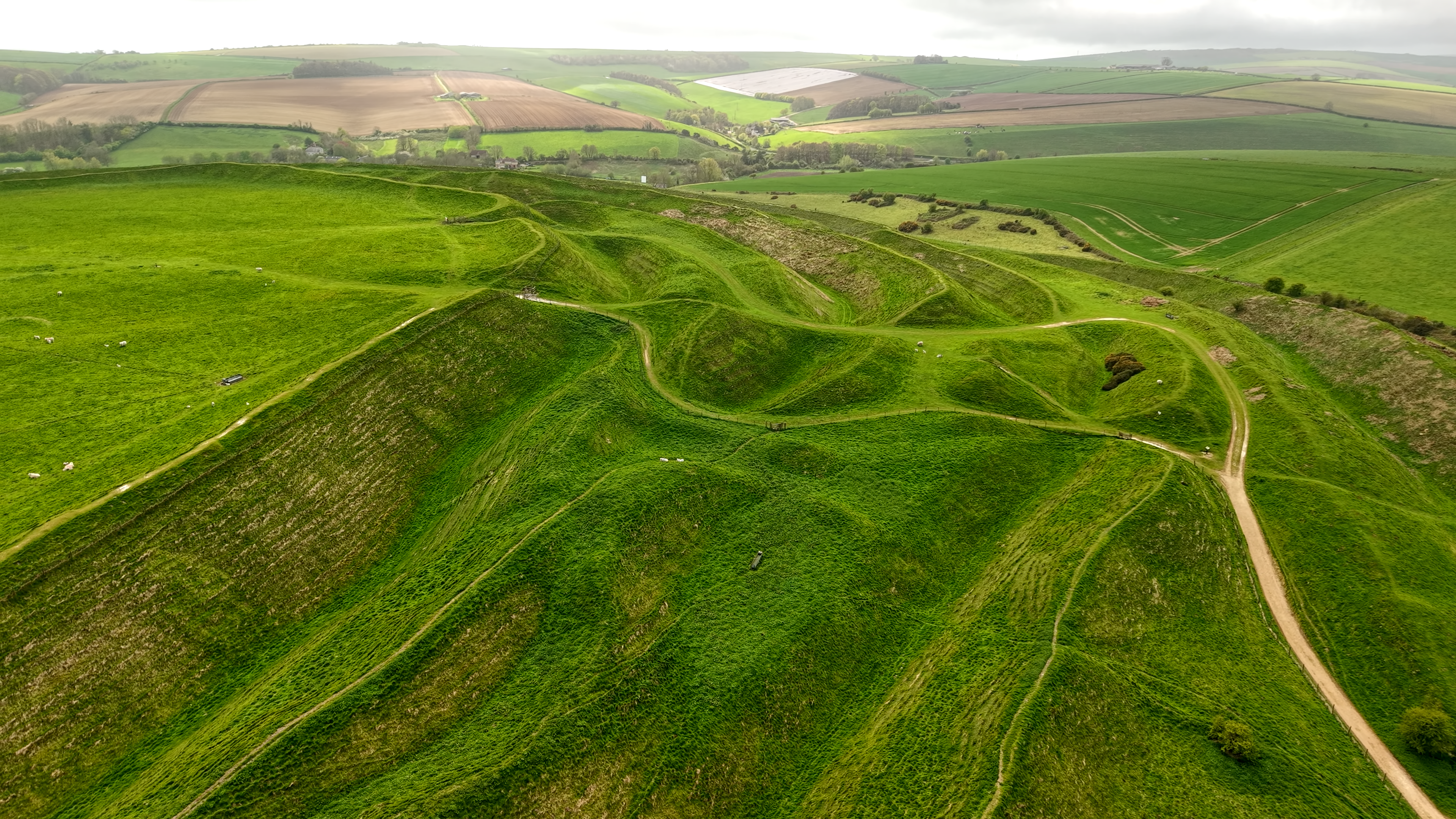
'Maiden Castle is one of the largest and most complex Iron Age hillforts in Britain. Its vast multiple ramparts enclose an area the size of 50 football pitches, and the site was home to several hundred people in the Iron Age (800 BC–AD 43).' (English Heritage)
There is a car park at the site and an area the size of 50 football pitches to fly from.
The originator declared that this location was not inside a Flight Restriction Zone at the time of being flown on 11/02/2024. It remains the responsibility of any pilot to check for any changes before flying at the same location.
Hi, yes - I marked on the map at DroneScene the location of the car park at Maiden Castle, and the spot where I flew from. It’s a large site and plenty of space to take off from. I just made sure that I wasn’t with a crowd when I flew.
Thanks Howard.
I did fly there after some checking. The Site belongs to English Heritage and states No TOL and Flying over the Site. (I was surprised about the ‘Flying Over’ as thought the Air Space belongs to the CAA). Anyway, decided to flying from Public Land at the perimeter. I got a few good video shoots. I had to be careful as it was very windy! I parked on a layby and walked on a public path to the site (3/4 miles). I will upload soon details.
My Parking Location was: ///calibrate.greyhound.metals (or 50.70894, -2.47623)
This parking spot is probably limited to 3 or 4 cars. There is a public footpath from this location to the site (3/4mile)
My TOL was to the west of: 50.69579, -2.47763
I flew to a max altitude of 90m from my TOL position and kept an eye on drift due to the strong wind gusts. My little Mini 3 Pro was absolutely fine.
Yes, I assumed with no one around it would be less harmful than flying over coachloads of visitors; you probably did the right thing! I hope you got some good shots.