I had hand controls fitted to my car 4 months ago, and keep seeing various flying spots now that I can drive around again.
I would like to be able to pinpoint them all on a map and wondered if dronescene had the facility to have a “personal” layer option?
If, as I assume it would be, expensive/difficult to implement, what free mapping facilities to do this do folk use?
Thanks
Hey Ian,
It sort of does…
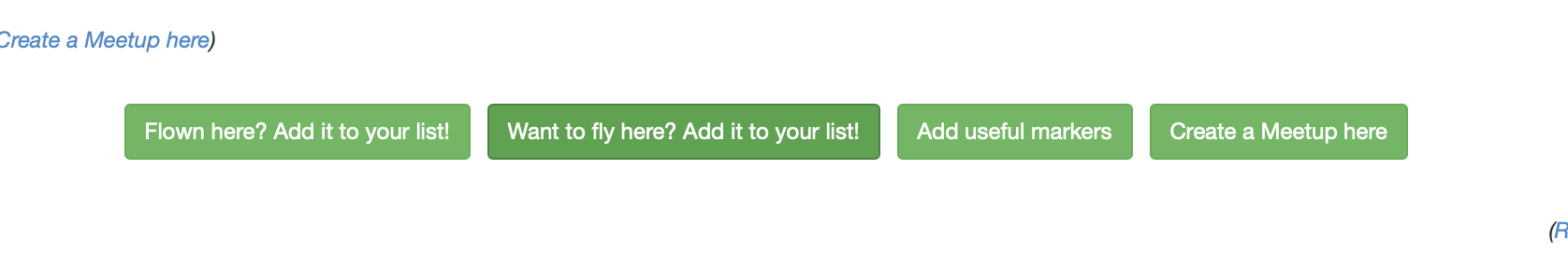
If you find a location you want to fly, open it and click on the button “Want to fly here? Add it to your list”
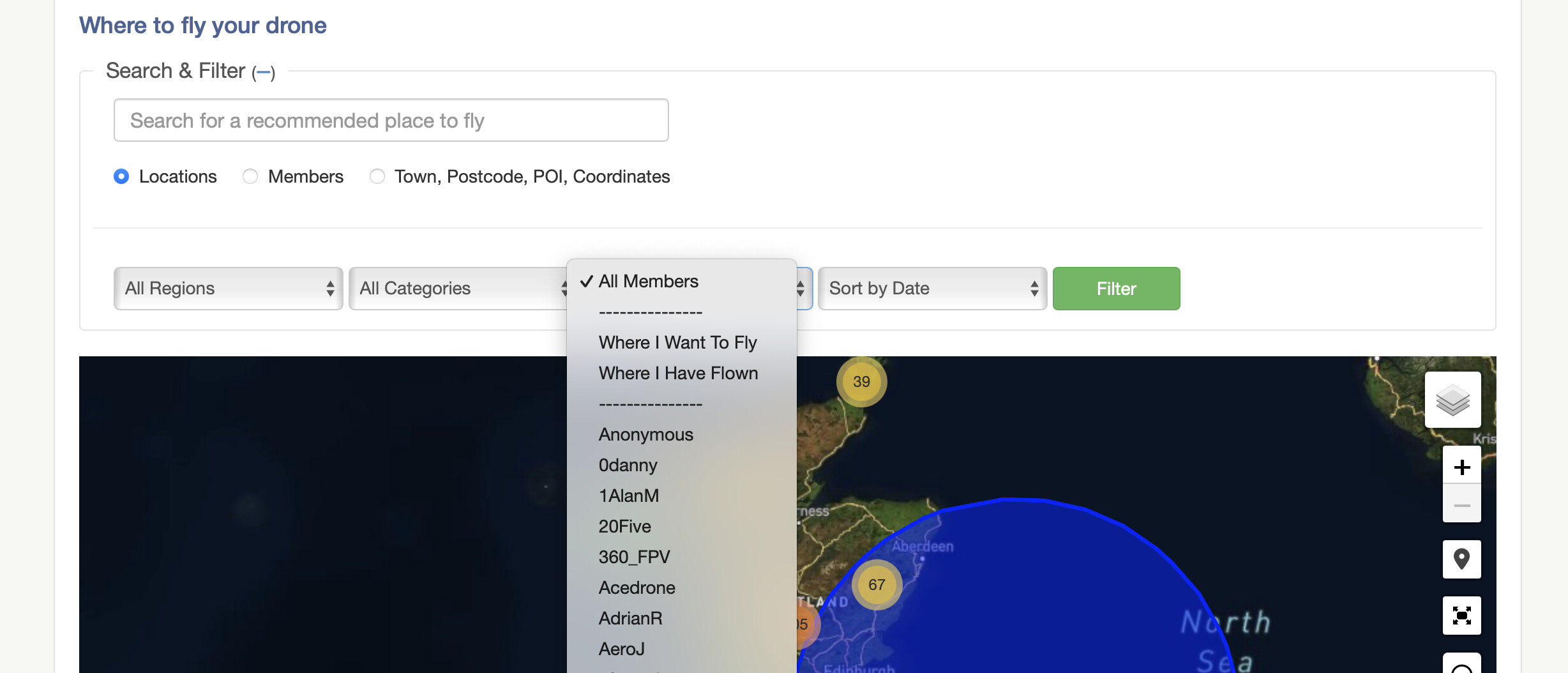
When you go in to the map, you can then select the filter for “Where I want to fly” and the map will show you them all:
I don’t know that there is an option to just tag places that you see which haven’t already been marked as a location by somebody else though (which I think is what you’re really asking?). But that would definitely seem like a useful feature request for the @Committee to ponder.
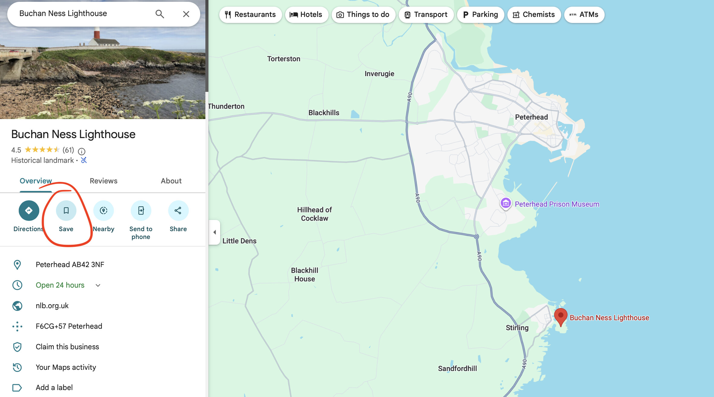
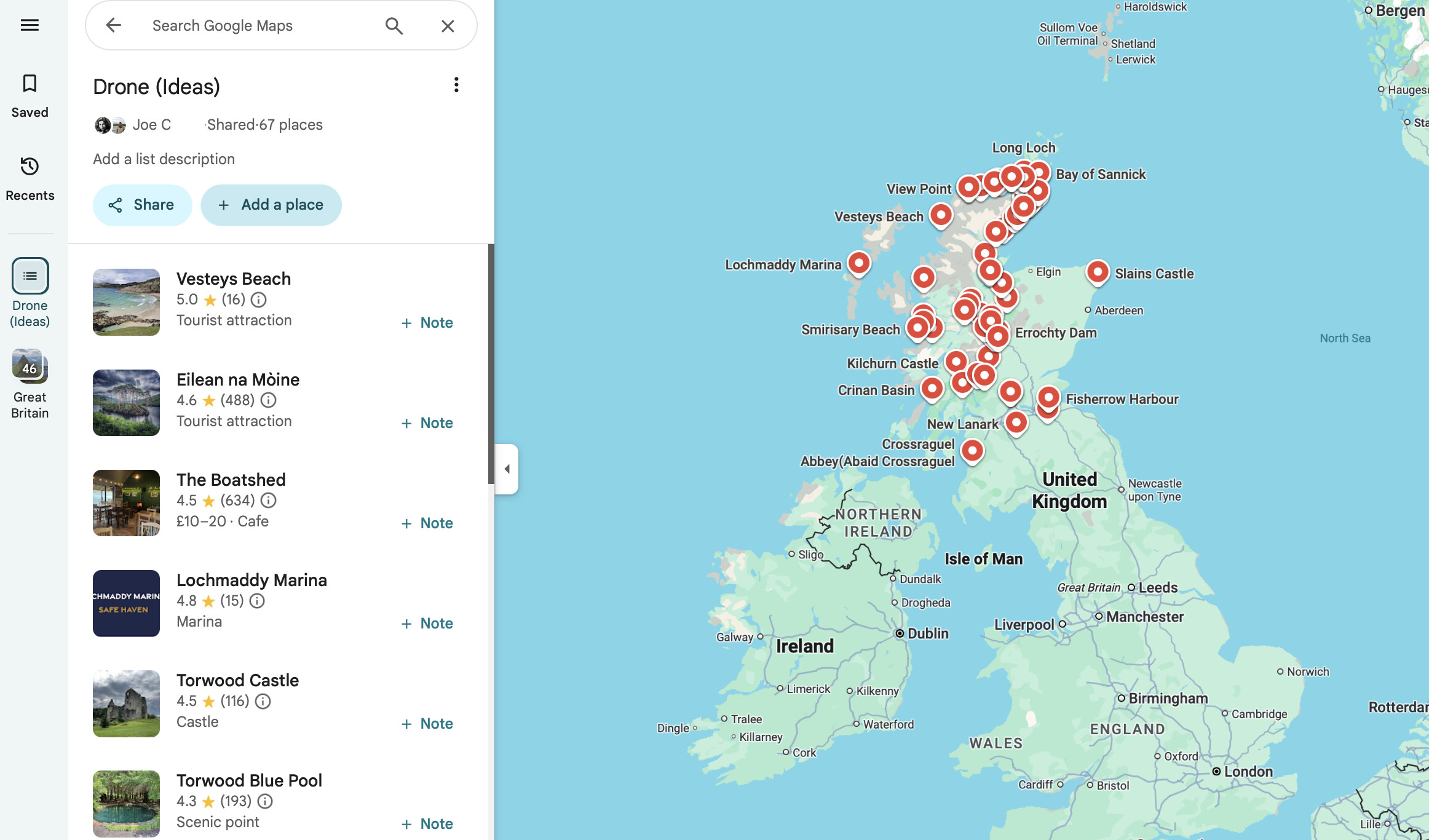
Personally, I use Google Maps for this. You’ll need to be logged in to Google, but if you are then just select the place (or drop a pin on it) and use the save feature to add it to a list.
2 Likes
Thanks Joe. I thought logging into google was likely to be the most used method, but one I am hoping to avoid.
I did your first suggestion with a nearby location a few days ago, which I think is always good to do just so that you keep posting them for others to benefit from.
Given this event currently taking place near Corby, I anticipate @Committee are preoccupied just now!
1 Like
I have been saving locations onto my tablets google maps (I’d forgotten that being android, it is always connected to google) over the past few days.
I do still wonder though if there is any way of incorporating a personal layer into dronescene, just so that they are in one place and easier to check for restrictions and hazards?