I’ve not watched the video in the first post.
“Auditors” ![]()
![]()
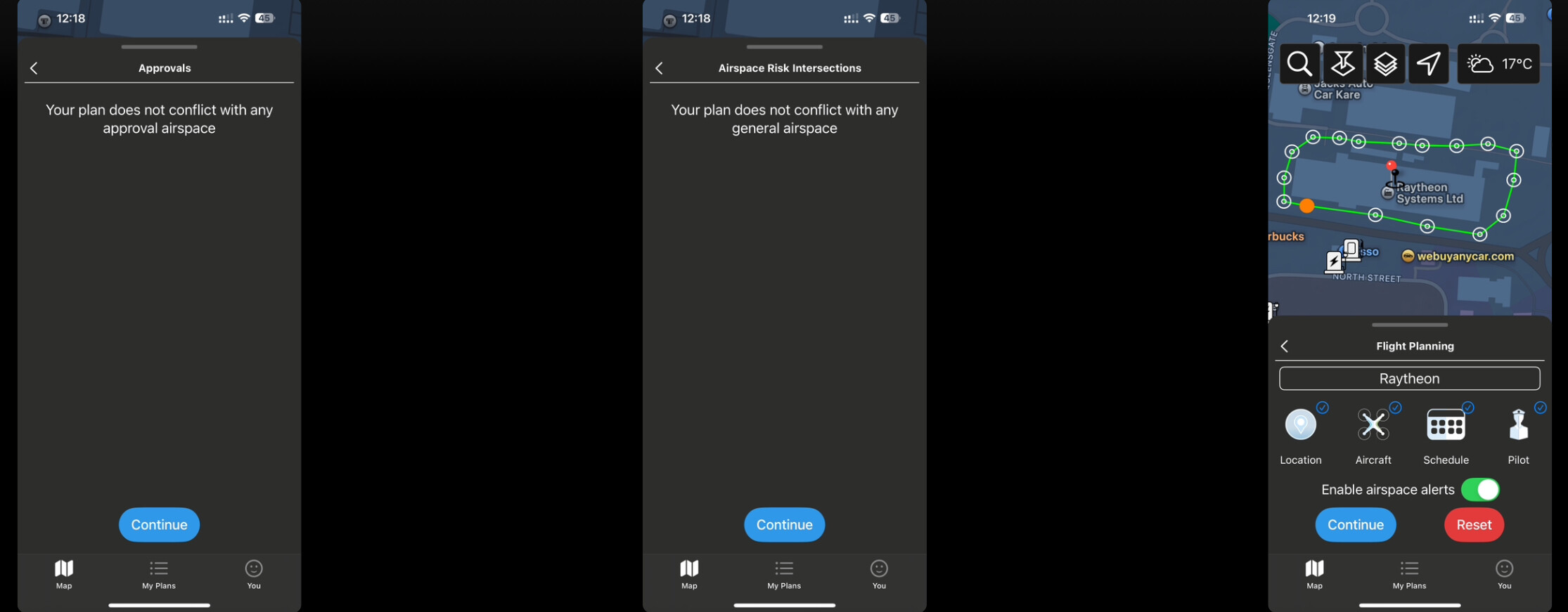
There are no UAS airspace restrictions showing on the NATS platform in the Glenrothes area:
The nearest restrictions are some distance away.
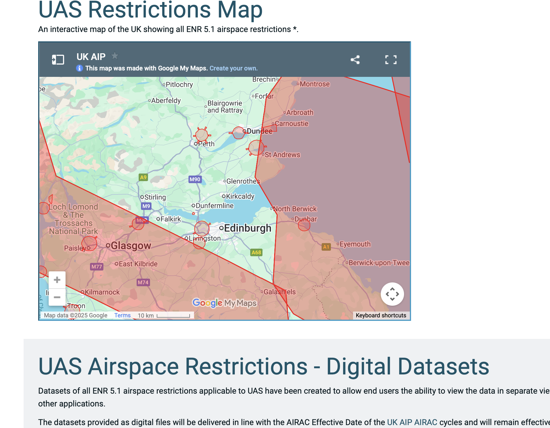
Source:
I’ve not watched the video in the first post.
“Auditors” ![]()
![]()
There are no UAS airspace restrictions showing on the NATS platform in the Glenrothes area:
The nearest restrictions are some distance away.
Source:
You are spot on Kirky, it’s not on Drone Assist, which was the app on the AA Site.
The CAA links to Drone Assist and Drone Scene as their defacto source for flying restriction mapping.
All that being said, there is no restrictions over the Raytheon site in Fife, there is that wee black marker, don’t know what that is, and using Drone Assist, I’ve created a flight plan around the Raytheon site and there is no known issues, other than the knowledge that they are a defence contractor, therefore ‘should’ be prohibited airspace.
If the CAA’s approved sources of flight approved mapping aren’t showing restrictions, how are we as users supposed to know, other than knowing they are a defence contractor therefore we should use logic and not fly.
This is one of those blackhole scenarios, enter at your peril, I suppose.
Its not always that simple as lots of companies do military and civilian.
Example near here we have a Thales unit. They make a lot of defence stuff. This unit however is nothing more than civilian network kit. No easy way of knowing. Especially if a drone operator taking off to take photos of the river and park 400m away and would involve overflight of it.
Just an example - signage really should be mandatory around those sites but that still wont help unless the general VLOS area is also covered by it.
That said, the auditors are absolute cretins of humanity and know exactly what they’re doing. And it causes problems for everyone else.
You couldn’t possibly know, you’re not psychic ![]()
As above, there are no drone airspace restrictions showing on the NATS platform (or any other airspace platform in the world to my knowledge).
But you wouldn’t know that if you didn’t know the area, didn’t know the company, took off 300m away and couldn’t even see their building from your TOAL point.
A touch of perspective might be all that’s required here ![]()
Thanks for your reply, much appreciated.
You are absolutely right, if you didn’t know the area, how would we know.
You also said above that you hadn’t watched the video. The person in the video knew exactly what he was flying over, because when the cops spoke to him and said it seems you’ve been flying over Raytheon, he said “ah, Raytheon, yeh, I have.”
I’m happy to play devils advocate and say maybe he didn’t know that they were a defence contractor, but his confrontational attitude was not helpful to the community, I would suggest.
This outlines things a little better,

As members find these sites, could they add a dronescene marker to indicate their existence, but no detail.
No, Drone Scene is a map of places you can fly, not a map of places you can’t fly ![]()
Not forgetting that all locations carry the caveat
The originator declared that this location was not inside a Flight Restriction Zone at the time of being flown on xx/xx/xxxx. It remains the responsibility of any pilot to check for any changes before flying at the same location. Landowner permission may be required before taking off.
In a nutshell, don’t be a dick