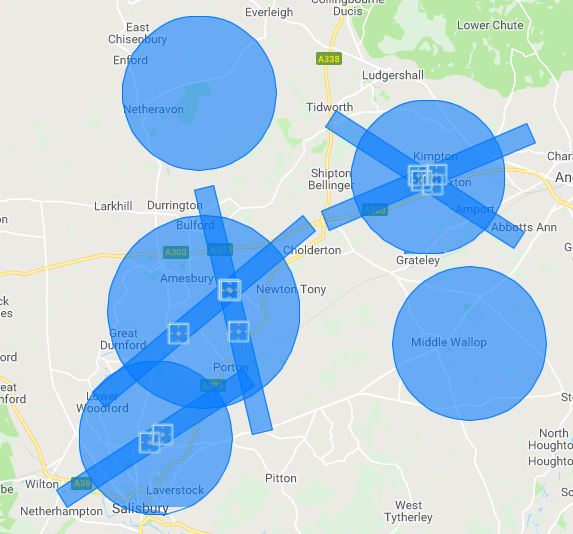
Looks to me like the end of the runway, which to be honest is what I would expect. But that 2 or 2.5km radius could depend on the length of the runway. Thinking on Edi where the runway is about 2.5kms in length and Heathrow runways are 3.5km and 4km (approx). Perhaps more detailed airport brains can help here?
So - since the runways at Heathrow are over 1km apart, that area I’ve squiggled isn’t protected.
What are people doing this weekend? Fancy a flight over Heathrow Plane Maintenance??
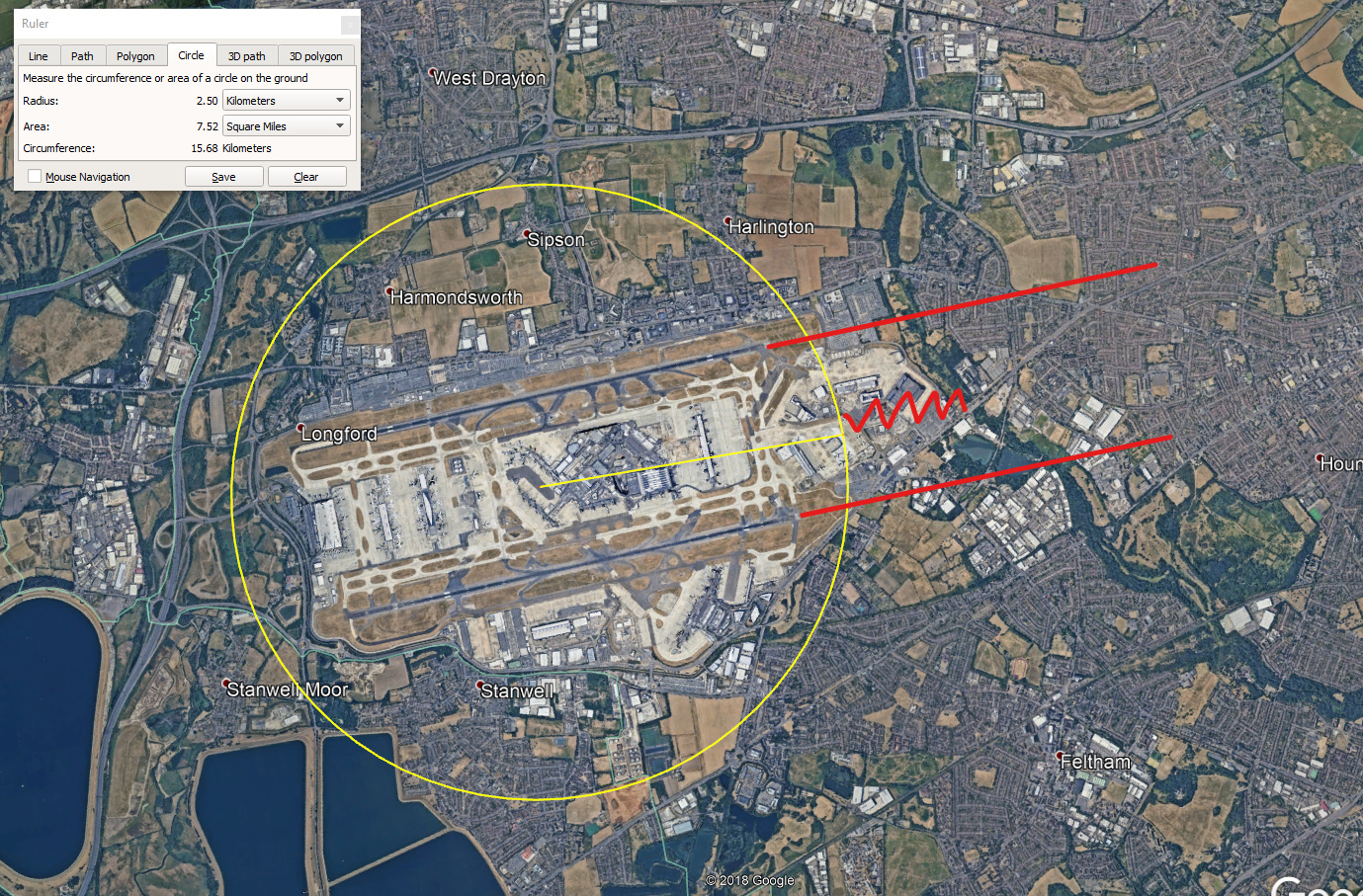
But their 5km long oblong is shorter than their 2.5km radius … because they don’t understand scale.
It’s chucked together by someone let lose with Powerpoint.
1 Like
This is getting way too complicated not helped by press hysteria.
The reporting of all drone news is becoming more inaccurate and sensational.
1 Like
In that diagram, too, why is the circle centred on the one runway?
If you drew one on the other runway you’d have a different area covered.
How the Eff is anyone meant to know which they draw their circle around!!
Yes - apps, etc … but that’s not my point. This is vague, ambiguous, chucked together knee-jerk fashion, and deserves to be lambasted.
I trust all of this refers to an active runway with air traffic control and not to farmers grass landing strips. It has not defined airports or airfields. All most confusing!
2 Likes
Just what i said John !
It doesn’t really matter whether it’s measured in metres, miles, pints or litres, it’s not going to stop the nutters who’ll still ignore any regulations!
3 Likes
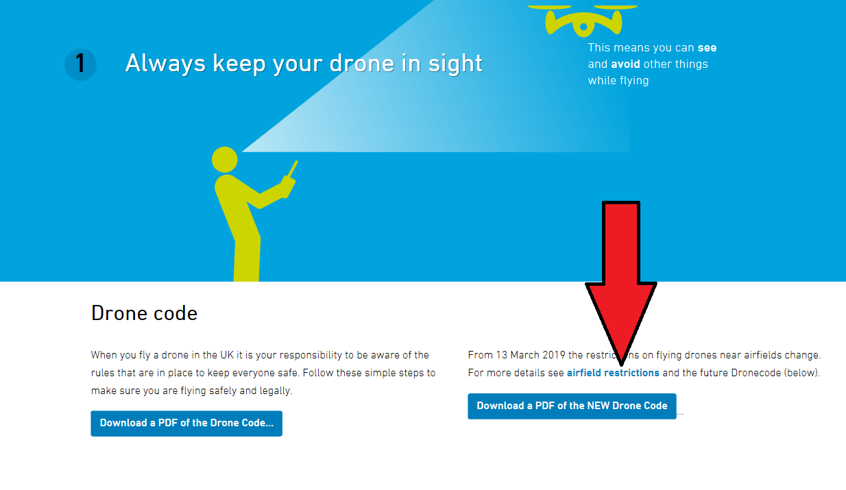
The dronesafe link (shown with my big arrow) is not working for me, anyone else having the same issue?
1 Like
There’a a link to it further up this thread …
1 Like
Thanks @OzoneVibe I caught that one, but was curios what was behind the link on the Drone Safe site labelled Airfield Restrictions. It is not linked to anywhere.
Maybe they will provide a list for different airfields.
As an aside, NATS already provide ‘free’ plates for all airfield in the UK Here .
Maybe they could provide free plates for drone users to reference. That info could also be embedded by DJi and other manufacturers.
I appreciate that it becomes a ‘chore’ and some will just fly regardless (sadly), but if regulation is introduced correctly then at least we know what rules to obey. These new rules seem a little vague, especially when airports change the direction of a runway based on the wind.
Just thoughts…
1 Like
The link is now working:
https://dronesafe.uk/restrictions/
2 Likes
Well - having read the thread on flying in Portugal … and “The B Word” … time to move. 
1 Like
I sold my Mavic Air on Monday, was about to buy the Mavic 2 Pro Fly More, I think I will wait……… As I was able to fly in a local country park, but under the new rules I am unable 
I’ll still fly - just less. And the legislation isn’t putting me off upgrading - just general lack of money exacerbated by having bought other naughties recently.
1 Like
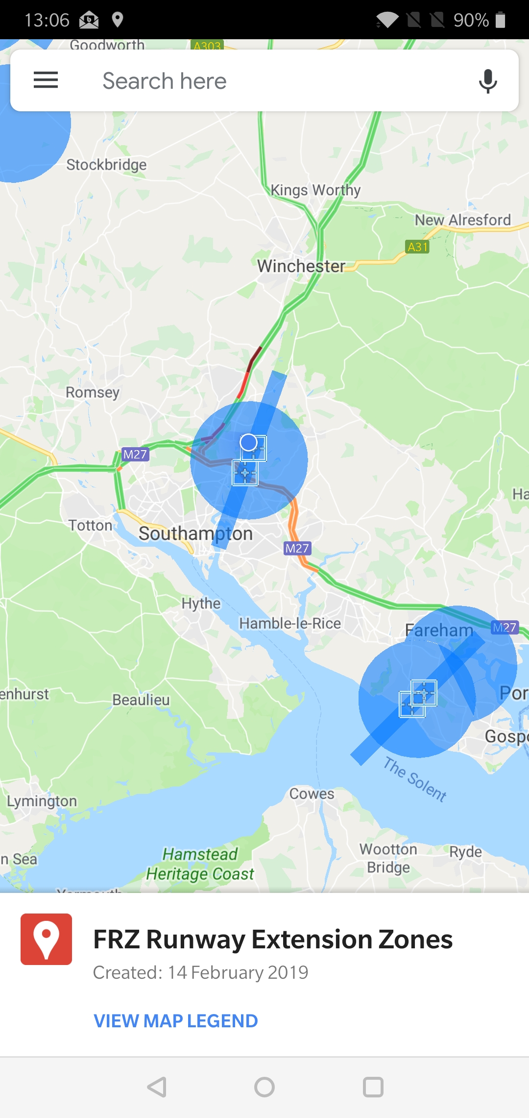
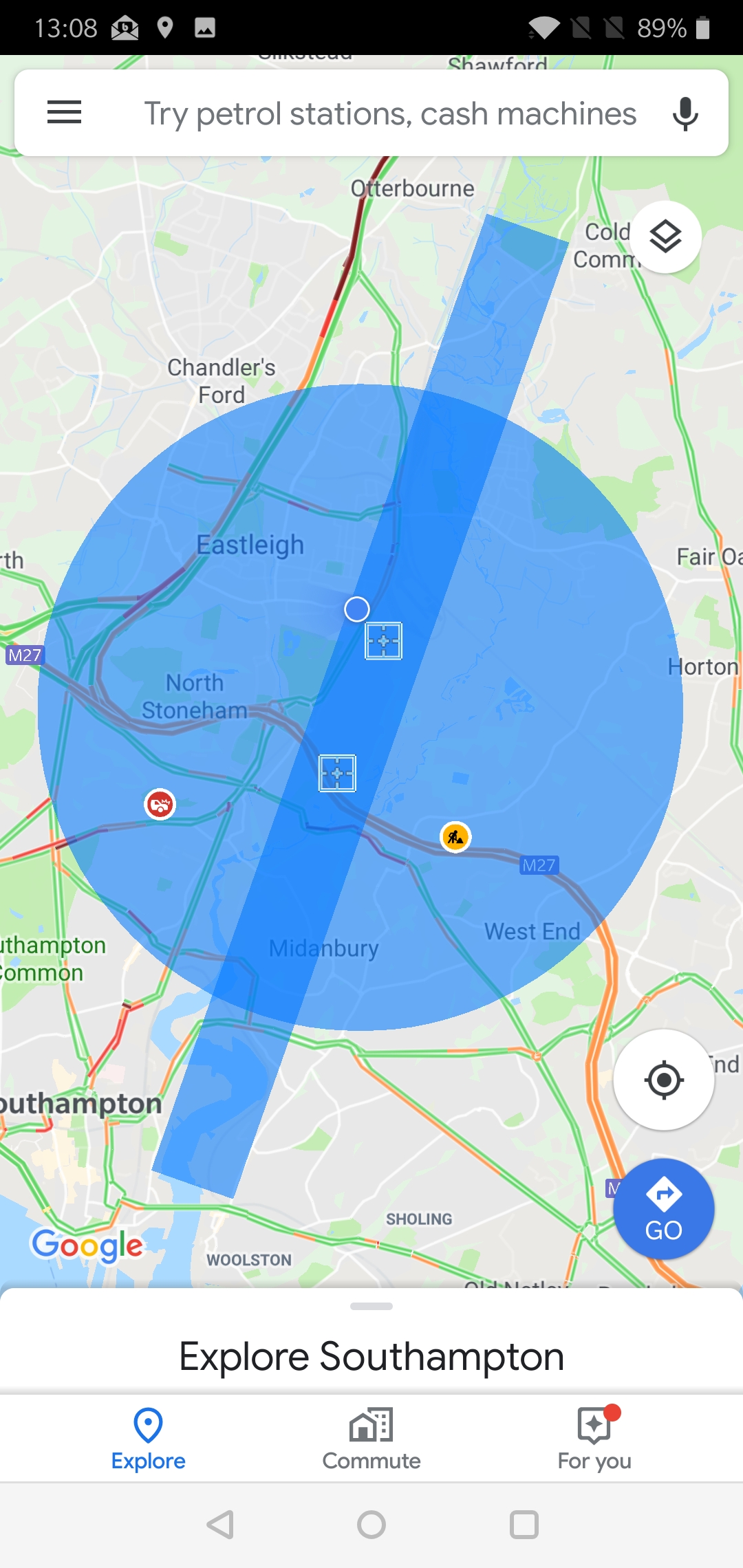
The Google Maps link for the new zones.
At least these are damned accurate.
(No - I’ve not checked them all - but Southampton is down to the millimetre, so I guess they all will be.)
Edit: :  Actually - you can link your phone Google Maps to that page and have it easily available to you … and, as a result, always up to date.
I’m really screwed. Radius AND runway threshold. LOL!
2 Likes
News just stated most drone can fly upto 60 mph
Obviously done his homework…
It’s a yellow circle, but has been closed for years.
It’s not on that Google Maps link from NATS - so all clear.
It is only the larger airports - not farmers’ private strips, etc.
1 Like