I have just added this to the map of places to fly your drone at Drone Scene:

Land owner permission not required.
Parking: in their car park
TOAL: 51.769037, -2.849012
Lovely castle, it's CADW, they allow TOAL from the land outside the car park.
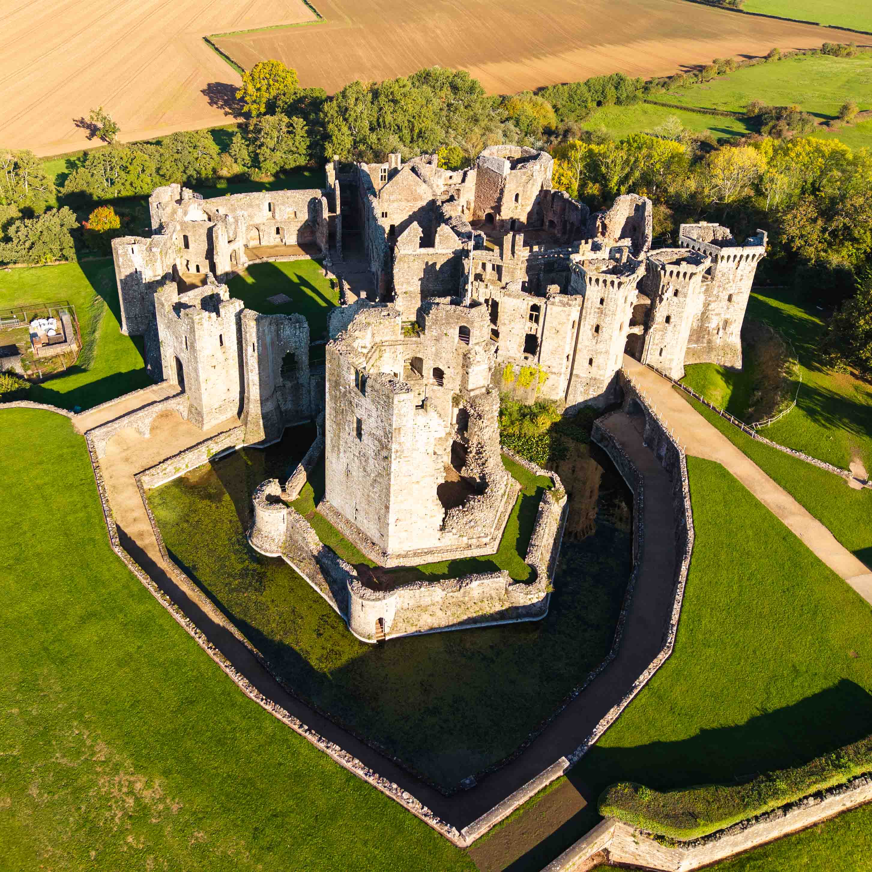
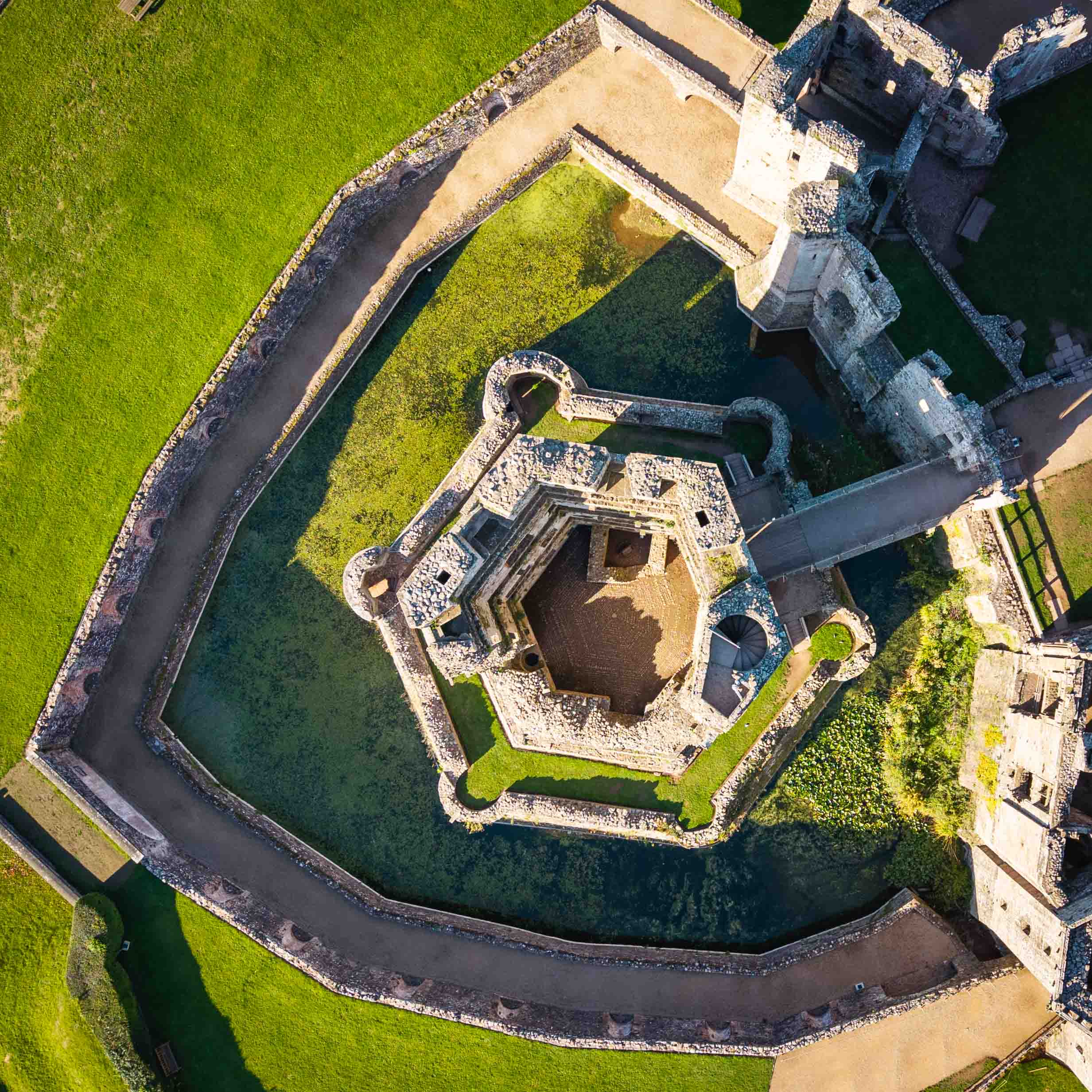
Raglan castle is an impressive late medieval building and although now ruined, it remains a striking presence in the landscape of south-east Wales. Much of what remains at Raglan dates from the 15th century, the period of the Wars of the Roses and the rise of the Tudor dynasty. The Great Tower is the most impressive of the buildings from this period, dominating the two courtyards of the castle.
Sir William ap Thomas was a veteran of the French wars and started work on the structure around 1435 including overseeing the construction of the Great Tower.
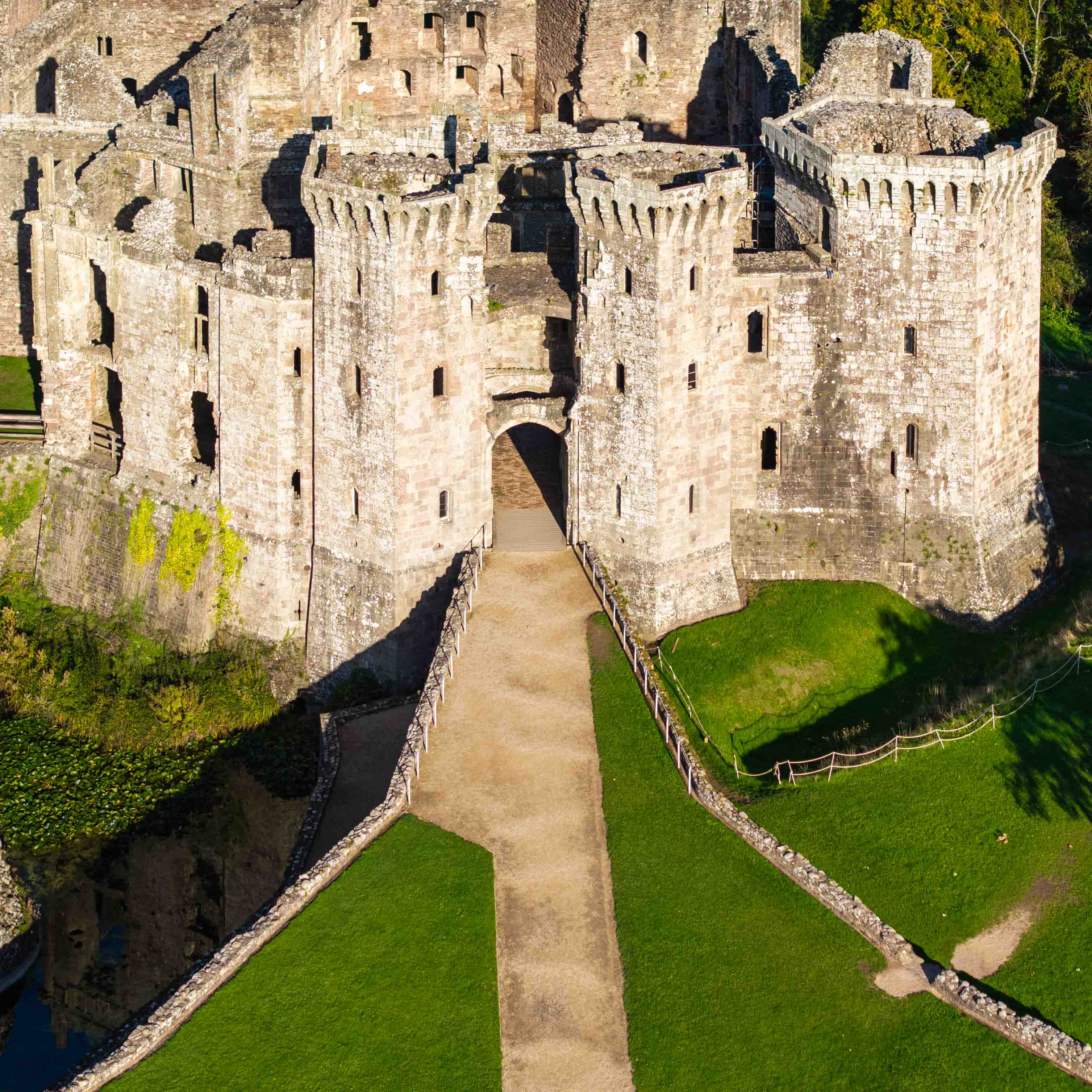
After Sir William’s death in 1461, his son William Herbert became Baron Herbert of Raglan and embarked on an ambitious building programme to reflect his new status. He developed suites of accommodation around the Fountain Court, built the Pitched Stone Court, and constructed the gatehouse to both impress and intimidate visitors to the castle.
Sir William Herbert was a key figure in the politics of the late 15th century. During the War of the Roses he supported Edward IV. The reward for his loyalty was considerable, providing him with the title Earl of Pembroke, and sufficient resources to convert Raglan into a palace like fortress.
In 1469, Sir William Herbert was captured by Lancastrian supporters at the Battle of Edgecote and put to death. At this time the work was unfinished.
Raglan underwent its final transformation when the castle passed to the Somersets, earls of Worcester. William Somerset, the third Earl of Worcester, remodelled the hall range, built a long gallery and extended the Pitched Stone Court. He also created a garden with long walled terraces and a lake.
The castle was besieged for ten weeks in 1646 by parliamentarian troops and ultimately destroyed. In the years that followed Raglan was abandoned and left to decay.
The originator declared that this location was not inside a Flight Restriction Zone at the time of being flown on 22/10/2023. It remains the responsibility of any pilot to check for any changes before flying at the same location.