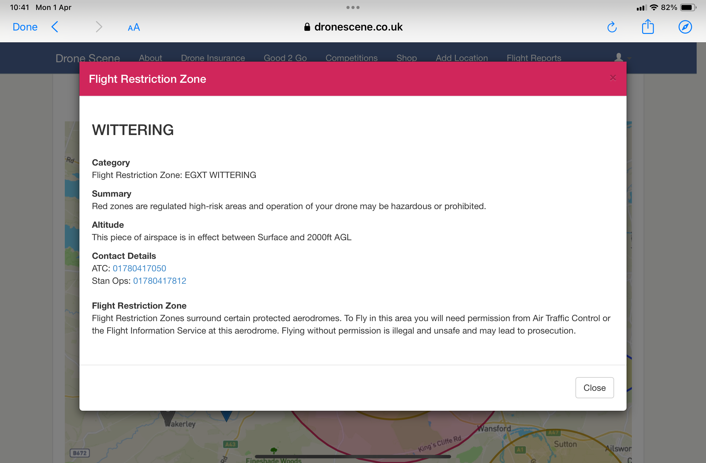
Hi : I would like to get some air photos of the town of Stamford, Lincolnshire, with my mini 4 pro … I see it’s in a FRZ ( EGXT Wittering ) been try for the last 4 days to contact ATC wittering for permission to fly , but have no Answer… I only presume they don’t run Everyday ! Also contact Stan ops. Still no answer …
Anybody know how to get permission or to speak to somebody? Also can anybody tell what the EGXT mean ?? Thank you … Steve. .
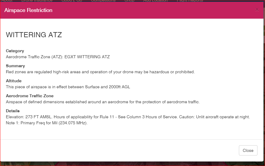
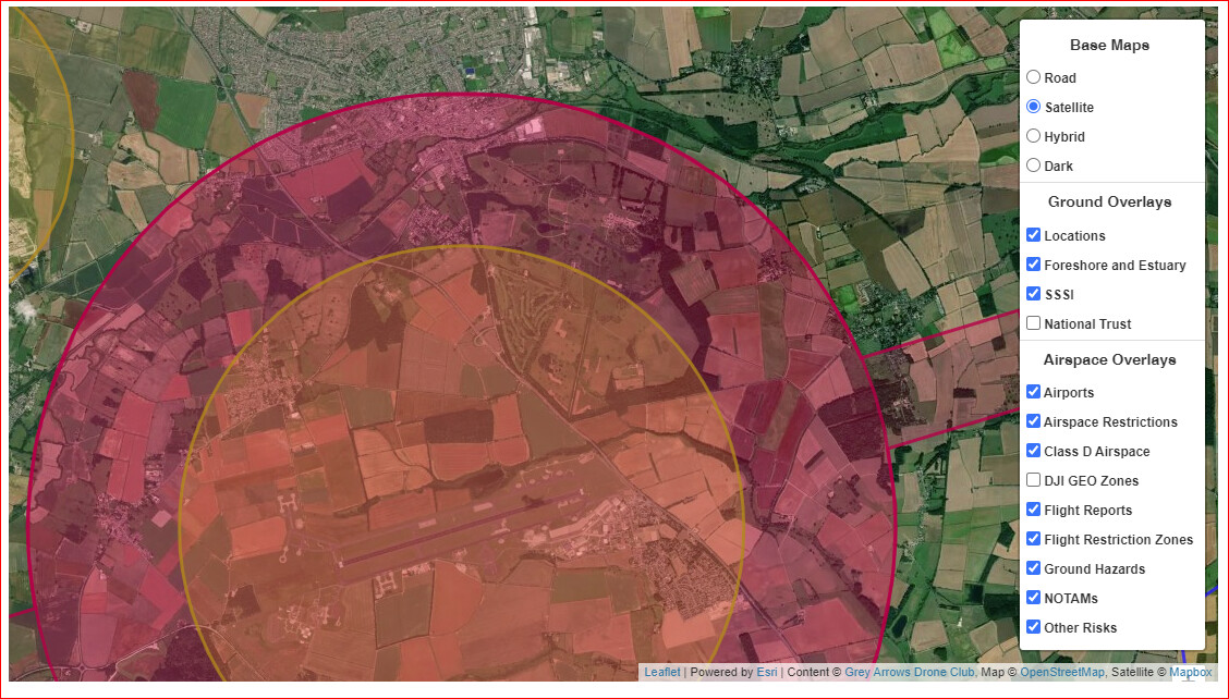
Ok. I get your version if I click on the rectangle on the right of this image but my version if I click on the red circle over Stamford. I don’t understand why those two areas generate different popups but I am fairly new to this and happy to be educated.
In this case the Airspace Restrictions layer is over the top of the Flight Restriction Zones layer. I seem to remember that there was a recent alteration to Drone Scene that would show both layers information for overlapping zones? I only got the information for the top layer. What have I done wrong?
Steve, sorry but you have no chance of a response at the weekend let alone a bank holiday weekend. The service’s are very much a part time affair theses days. I used to fly my glider out of Whittering, it has a lot of storage there now.