The label doesn’t give any specific timings but the AIP lists it (one of many) with a contact number for Range Control. Does anyone have any experience of contacting them in this area and what was the outcome?
If its anything like the danger zone for the Pembrey range in south Wales it will normally be activated by a NOTAM - so as @PingSpike - Rich says - give them a ring - the worst thing that can happen is that they say No
There are some nice places further North. Try up towards Cwmtydu and maybe New Quay (although a bit touristy and crowded). Aberaeron is so so and can be touristy. there are a few places towards Lampeter and if you don’t mind travelling, the Elan valley is pretty sweet as well, especially towards Rhayader. I haven’t gone further South, so don’t know what you will find in Pembrokeshire.
For long range, Ynyslas/Borth (north of Aberystwyth) is pretty good if you fly early morning. You can rack up 4-8 mile round trips along the beach/dunes with clear LoS for miles, if you launch from the War Memorial on the cliffs.
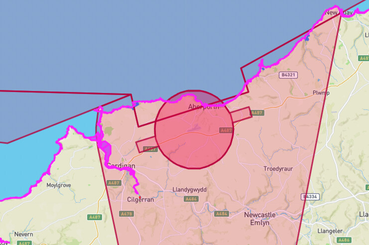
Pretty sure Aberporth used to be something to do with Qinetiq and next gen naval weapons. I think it’s still owned by DSTL. Not somewhere I would fly, tbh, regardless of permission. Not that i think you will get it.
Interference is one major one. Don’t know what they do there now, think its UAV related and experimental signals related, they did radar and sea weapons years back. I honestly wouldn’t fly around or near military stuff, especially if Qinetiq/DSTL is doing stuff there. But that’s just me. Have known a few people (from Uni) who’ve done stuff for them in the past and they said to just avoid those places (without any elaboration) and they were pretty solid people. So I tend to avoid those places.
Fair enough, thanks. Probably head to the west around Poppit unless I’m going further afield. I’m sure that danger area has grown over the last few years!
West Wales Airport/MoD Aberporth is busy enough they’re not likely to grant permission often, certainly not weekdays.
Danger area itself isn’t always active (and is NOTAMed). I also dont think the danger area itself is a flight restriction zone at all.
For example tomorrow its only active 1300-1900z. Generally its used when they’re trying to not crash their Watchkeeper drones into a local school or football pitch.
Thanks for that, very useful. I had come across the site before but I didn’t realise how much you could tailor it. I had more thought of it as a GA tool for airport and enroute stuff.
Interestingly the applicable NOTAMs cover a much larger area than the danger areas.