I fly in a particular area which has always been OK according to Altitude Angel… checked it recently and a new NOTAM indicates a NFZ, but it’s a bit cryptic.
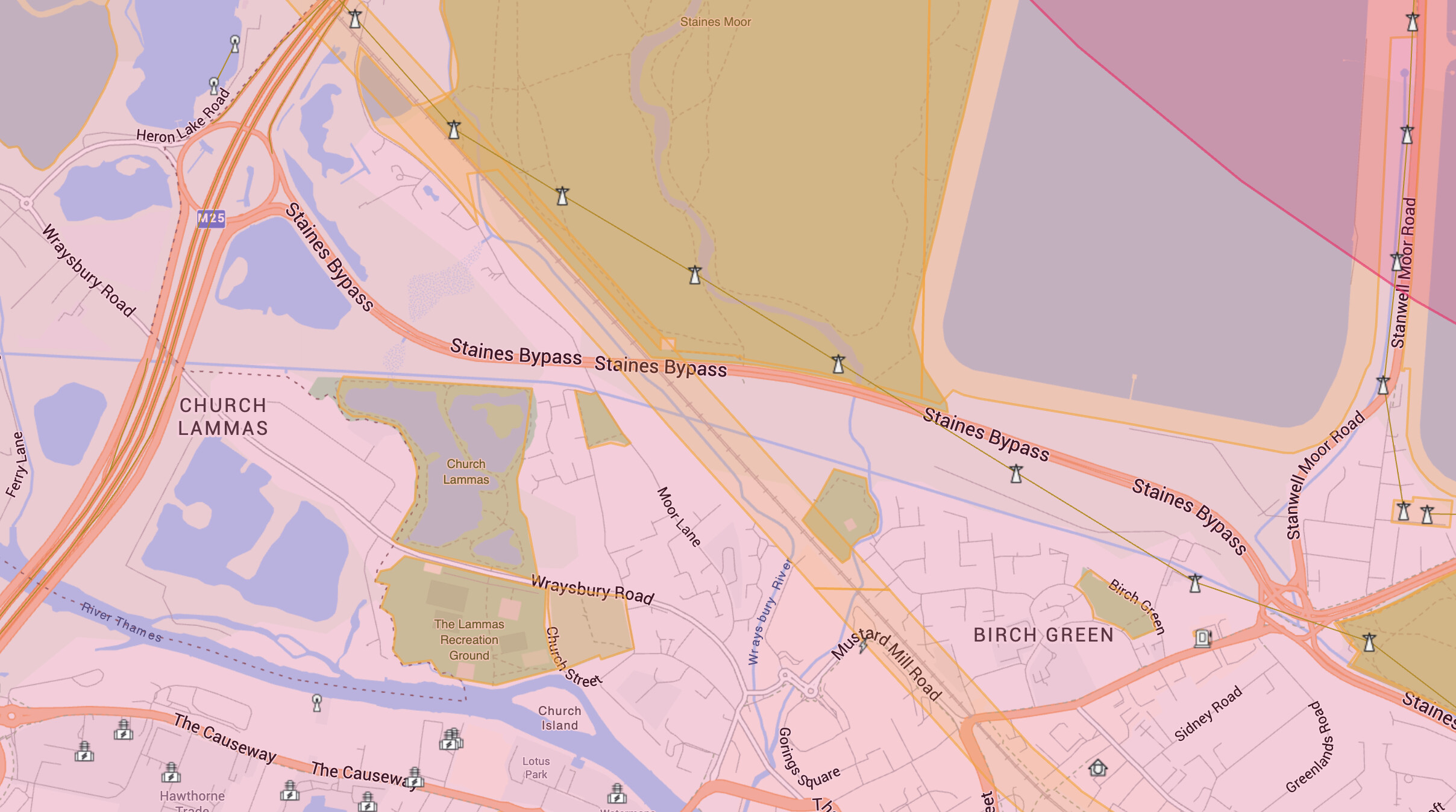
I Googled and searched, and can see SPS stands for “Standard Pressure Setting”, but I can’t determine what it actually is in relation to Sea Level and Ground Level at my location. See map below. The TOAL point is in the non green patch below the row of electric pylons, no yellow or red layers
This piece of airspace is in effect between 9500ft SPS and 21500ft SPS
Temporary Flight Restriction
This is an official ‘No Fly Zone’ (a Temporary Flight Restriction) and it applies according to the following criteria, in the region indicated by the boundary shown.
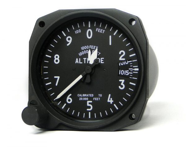
It’s not relative to anything other than where the standard pressure (1013.2mb) is found at that time.
Air pressure changes all the time… so the pressure at any altitude also changes. All aircraft fly at Flight Levels (SPS feet / 100) above a certain altitude (Transition Altitude) on the way up, and revert to regional/local pressure setting at the Transition Level on the way down.
This is a standard that prevents aircraft crashing into one another by having different altimeter pressures set.
… will always be WAY above anything a drone will be at … in the UK, at least … and won’t be a million miles away from 9500ft asl … depending on air pressure at any particular time.
Thanks, Yes I saw the 1013mb measure, and figured if my height ASL is 250m, then 9500ft must be very high, obv more than 400ft which is my limit, I just wonder why it shows a warning like this (I prob need to change filters) on the app.
What I meant was ‘according to the warning shown on Altitude Angel’, not a reply to a query… the full warning is below:
Vertical limits
This piece of airspace is in effect between 9500ft SPS and 21500ft SPS
Temporary Flight Restriction
This is an official ‘No Fly Zone’ (a Temporary Flight Restriction) and it applies according to the following criteria, in the region indicated by the boundary shown.
Active Now
Active: Thursday, May 16, 2024 12:00:00 AM (UTC) until Wednesday, April 15, 2026 11:59:00 PM (UTC).
Full NOTAM Text
Q) LFXX/QRTCA/IV/BO/W/095/215/4807N00126E272
A) LFBB;LFEE;LFFF;LFRR B) FROM: 24/05/16 00:00 C) TO: 26/04/15 23:59
E) TRANSITS AND FLIGHTS OF STATE DRONES - AIP SUP 091/24. SUBJECT : CREATION OF 94 TEMPORARY RESTRICTED AREAS (‘ZRT’) AND OF 4 TEMPORARY DANGEROUS AREAS (‘ZDT’). THESE AREAS WILL BE ACTIVATED BY NOTAM. THIS AIP SUP IS AVBL AT WWW.SIA.AVIATION-CIVILE.GOUV.FR
Yes, good point, weird - I put the link above to the location, you see the Transit Warning : TRANSITS AND FLIGHTS OF STATE DRONES - AIP if yo click anywhere that is ‘free’ of any visible warning colour.
I had re-installed Altitude Angel on my phone and for some reason it had the Upper Airspace ticked to ‘on’ - I should have figured that out and then would not have seen it or asked the question
Sorry to spoil everyones Sunday and thanks for the responses