
4 Likes
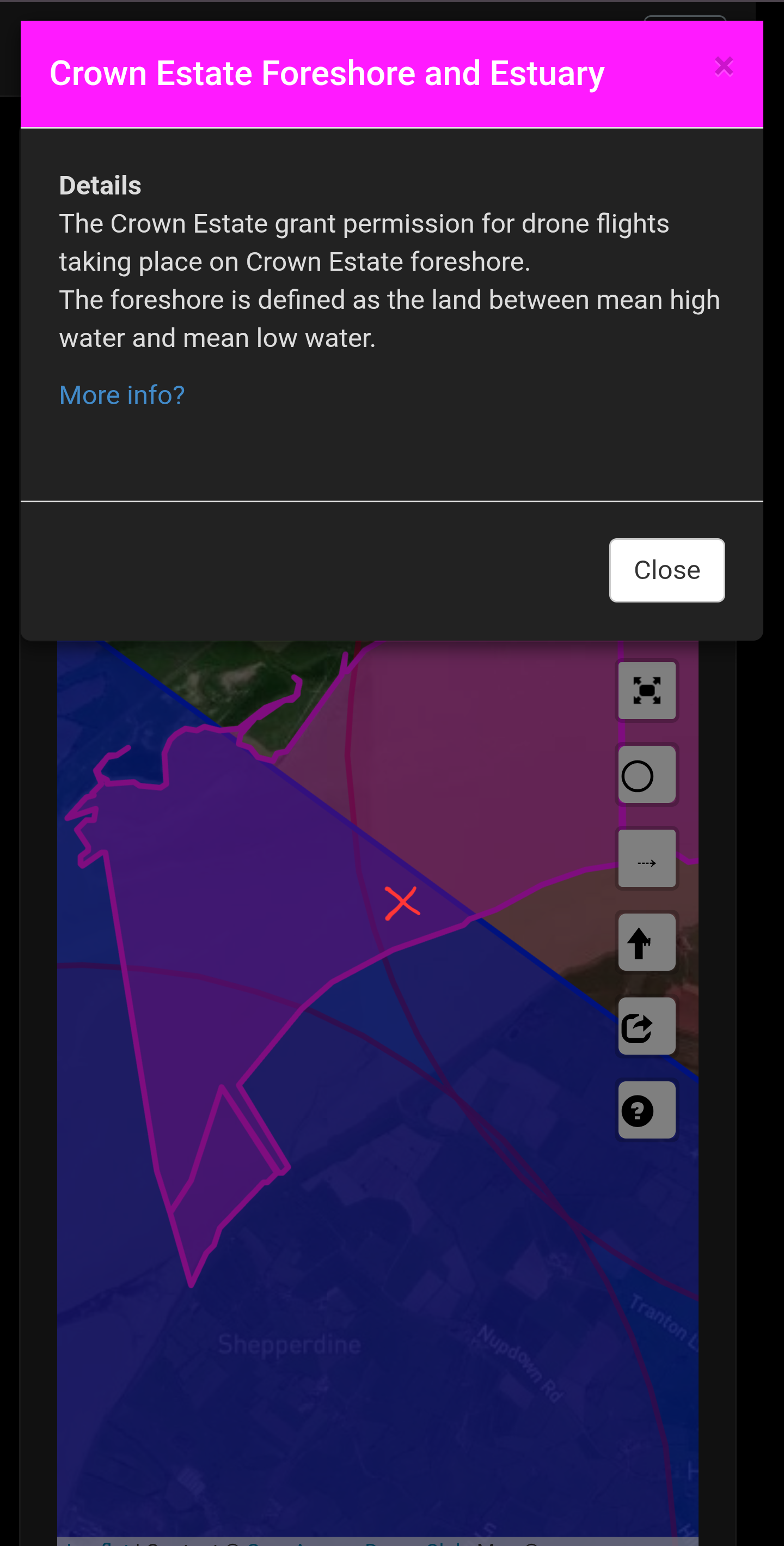
Are you sure? I’ve just tried it and it doesn’t seem to still down into the layers. It does still into all items in the same layer (like when there are multiple NOTAMs for the same area over a few days but it doesn’t show. Here is an example, I clicked where the X is…
I have to say, I love DroneScene but also extensively use Altitude Angel.
Also, the add NOTAM with DroneScene needs to be linked with your Altitude Angel account. Without that, i suspect it will not function.
Works perfectly for me, but as the layers are listed together, you may need to toggle them on and off
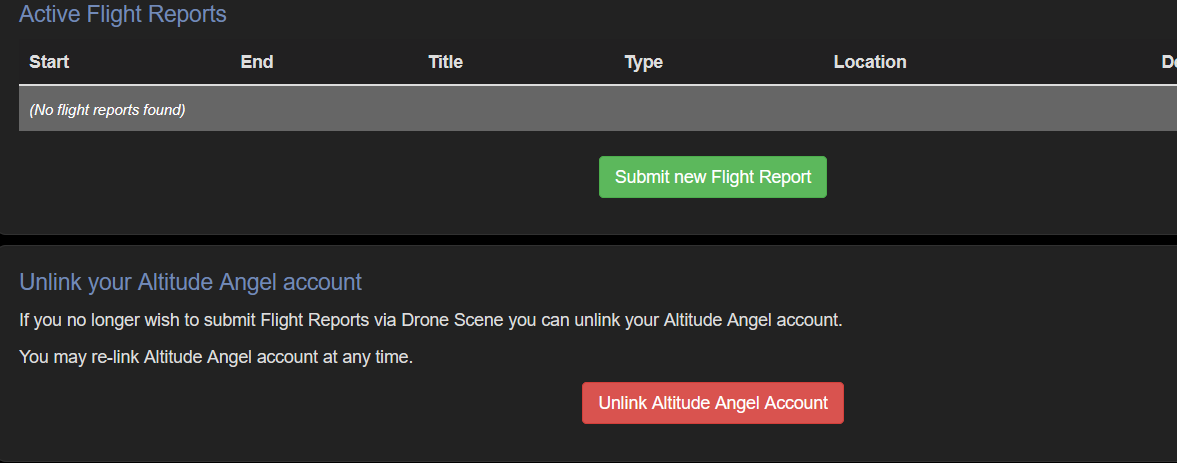
You can’t add a Notam, but why would you
On the other hand, you can add a flight report
That is linked to AA, but that’s no use anymore
1 Like
You really shouldnt charge for government information that is provided for free and is required for legal operation of something.
Amongst other things most drone users wouldnt pay and therefore would not have access to the information.
The administration isnt the app. Thats a tiny, insignificant part. Their business was based around airspace deconfliction and applications. Thats what costs actual money and what failed. App is a side thing and of no consequence financially to them.
1 Like
Similar.
I find DS performance, being web based far worse, especially on my tablet or phone in the field when scrolling around. As you said, layers refresh, redraws plus the inherent inefficiencies of doing all that in a browser window.
It works but its not pretty. DS for me is more of a check at home before going somewhere and then use DA in the field to fine tune and see if anything changed.
1 Like
DA is also web based in a app wrapper
Put it in airplane mode and see how it does
They failed because they thought people would pay to fly in places they can fly anyway for free.
1 Like
DA is web based in a stand alone wrapper.
I cant get anything like the refresh updates, smoothless, lack of stuttering on DS using Chrome, Edge, Brave on my Samsung tab, pixel 9 or before that, pixel 7.
Airplane mode really doesn’t make any difference here. Its the engine itself and all the gunk associated with a web browser. Its fine on a desktop PC but often like pulling teeth on Android, especially if scrolling around lots looking for things.
Well you pay your money you take your chances.
1 Like
The majority operating system globally with perfectly decent performance for tasks.
Its a browser/website trying to draw multiple layers in real time whilst scrolling. A very inefficient way of doing it.
DA and other apps work fine so its not really an issue. Its only trying to scrolling graphically intensive, multiple layer webpages in a browser which is something most people will never need to do.
Rather than blame the entire platform or OS for the performance of one website its easier in the field to just not use that and use something else that works.
So far at least DA is still parsing the data for flight restrictions. If/when that changes it’ll be time to look for a new app but i suspect that isnt going away any time soon as most people need access to an app.
2 Likes
While we generalising I would guess that the majority of drone users rely on the inbuilt (shite) mapping in the Fly/Go apps.
1 Like
That’s a worse problem. The fact it exists and isnt accurate.
If it wasnt there people would be persuaded to check official sources. Having a “sort of” map in the official app and no clear explanation does lead most people to think it IS accurate and use only that.
Its a failing of DJI but also the CAA that really doesnt go near this at all in the drone code, training materials or website.
Providing an inaccurate map in an official app is worse than providing no map.
No its not and the lack of an actual unified data feed makes it more fiddly for people to develop their own. Separate lookup for a NOTAM database and so on.
Or if anyone wants to be sadistic about it, parsing the text direct from the AIP.
They really should make it clear though that inbuilt DJI maps are not an official source. As should DJI.
I can perfectly understand currently someone buying a drone, loading the app, checking the “official” map in the “official” app, seeing its clear to fly and then doing so. Theres little to no mention yet alone emphasis on what to use and what to not trust or use.
Blame shared on both sides here with CAA and DJI.
1 Like
We had a commercial flight booked within an international airport FRZ before the company went into administration.
The airport have asked that whilst the app is down to email directly in with any further FRZ flight requests. Feels like a step backwards but hopefully it’s only temporary. Big gap in the market currently.
What was the fee for that ?
1 Like
Absolutely and also how many drone pilots have ever read Sections 3.1 & 3.2 of CAP722C… ???
I was recently a party in a flight where an airport tried to charge a so called ‘ admin fee ‘ to fly into a small section of their FRZ. The flight which a NOTAM was filed and approved eventually didn’t take place due to weather conditions but they were never going to see a penny even if it did. A complaint was filed to the CAA for their attempted fee charging.
1 Like
Yet how many paid AA to act as a middle man.
(not enough obviously)
Not many, and probably even less have thumbed ANO 2016
2 Likes
Obviously you don’t want to shame the guilty party [ cough ] Solent Airport [ cough ].
35 quid last time I looked at permissions from them.
2 Likes
These people need to be challenged when CAP722c is very specific regarding airspace charging. ![]()
I’ll be honest, I didn’t mind the charge that Glasgow ATC have (I guess ‘had’ now) when applying via the portal.
If you were happy to wait however long it took for approval (never taken more than a couple of hours for me, but I think it’s advertised as up to a week) it was free, if you wanted them to drop everything and look at it immediately it was something like £20.
Fair play. I wish I could add a £20 surcharge whenever anybody interrupts my day with an urgent email at work ![]()
1 Like