The blue ellipse in the pictures, is the DJI NFZ, I can override this as already stated, the BHX FRZ is the red circle, I can’t override this as easily and causes the drone to land.
I don’t care about Retford, but, What I ALWAYS do is use my NATS app on my 'phone to check before flying ANYWAY, job done!
1 Like
You may not care about Retford, but it serves to show the potential difference between FRZs and NFZs, and the need to understand which is which.
Your posts continue to show that you believe you are getting warnings for FRZs … and you are most certainly not.
Then what AM I getting warnings for?
Any of these DJI Geo Zone areas …

But never an FRZ.
As said before - they MAY be the same in some places - but you are never getting a warning for an FRZ.
4 Likes
To add, the warning reflects the ‘Warning Zones’ as posted above, which basically is the equivalent of, “heads up, there is somewhere DJI/your drone won’t let you fly without going through their verification or authorization process close by”.
1 Like
To sum up… In the ideal world, DJI zones would match the UK legal zones covering airfields, military, risk areas etc. Sadly they don’t. In some cases the DJI zone overstates the risk (is larger than the legal restrictions) and in some cases it understates it (is smaller or misses the restriction altogether). This is why some people choose to remove the manufacturer based restriction and fly to the UK legal position.
6 Likes
I believe I live inside the LGW 2.5 nautical miles FRZ, however the interactive map on dronescene has 2 circles, i’m outside the inner circle but inside the outer circle. What difference, if any does this make?
Welcome to Grey Arrows @Chaz 
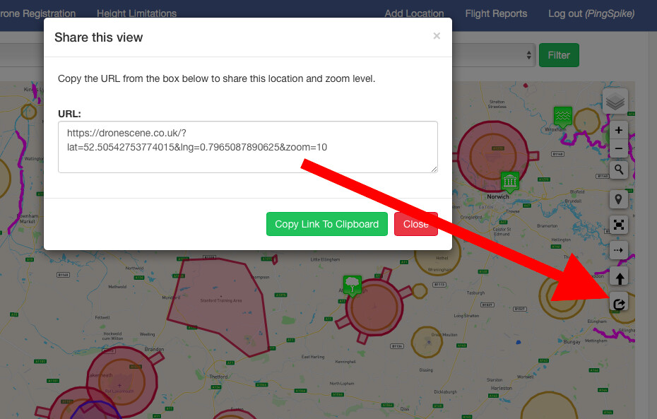
A link to what you’re looking at would be really handy 
Zoom in to the location in question and press this Share button:
And what layers do you have turned on? 

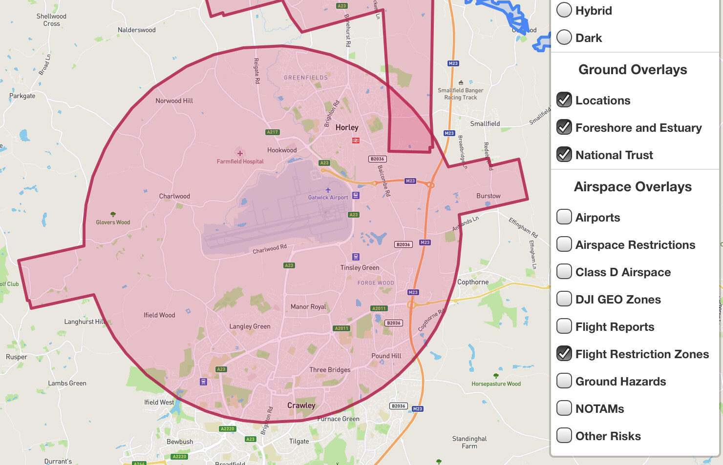
What is the larger red circle witch covers the frz but extends to a radius of about 5miles?
Most likely an FRZ bump. The inner one is the FRZ as measured from the centre of the longest runway. Because Gatwick has a large boundary, an additional km is added to the airport boundary to create the total FRZ.
1 Like
Moved your post, and replies, over to a thread that’s dedicated to questions and discussions on the same topic.
1 Like
Hi PingSpike,
Here is the link:
I have all layers checked except Class D and DJI Zones.
Ive only hovered my Mini 2 indoors so far. Guess, I will have to mothball it until COVID restrictions are relaxed.
Yes, JoeC
Hi Leeheyes,
The outer ring is 2.83 miles from the centre of the runway according to Google maps
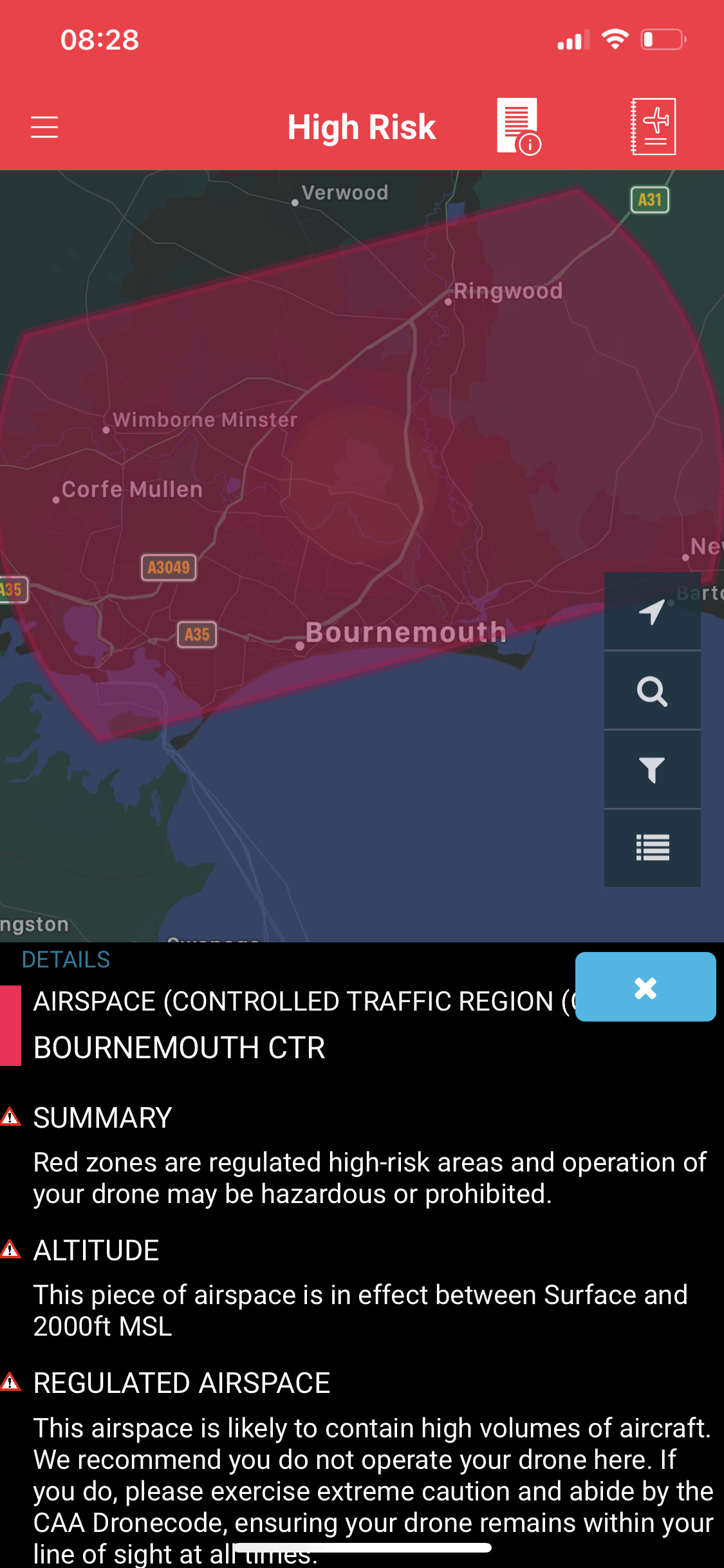
On the DJI App it does not state that this is a controlled airspace but on NATS Drone Assist it states it is. I am assuming I need permission to fly in this zone? It is very confusing! Again, drone noobie here so sorry if I come across naive!
It’s the FRZ you can’t fly in, you can fly in controlled air space as you are under 120M.
Here is the airport’s FRZ.
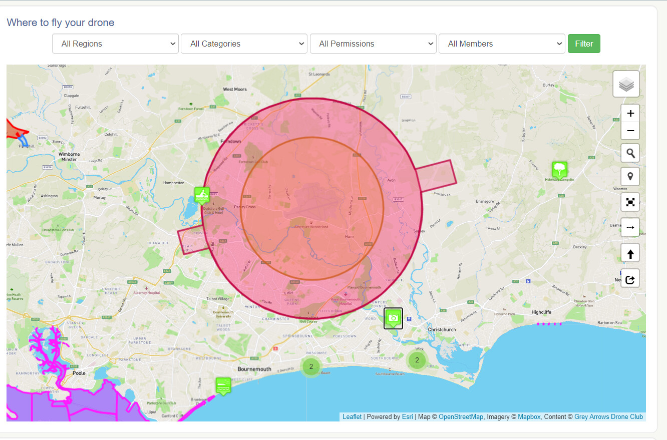
DroneScene is your friend
3 Likes
Familiarise yourself with the UAV flying rules as laid down…avoids trouble with
Plod!