Guessing the height - Manned aircraft!

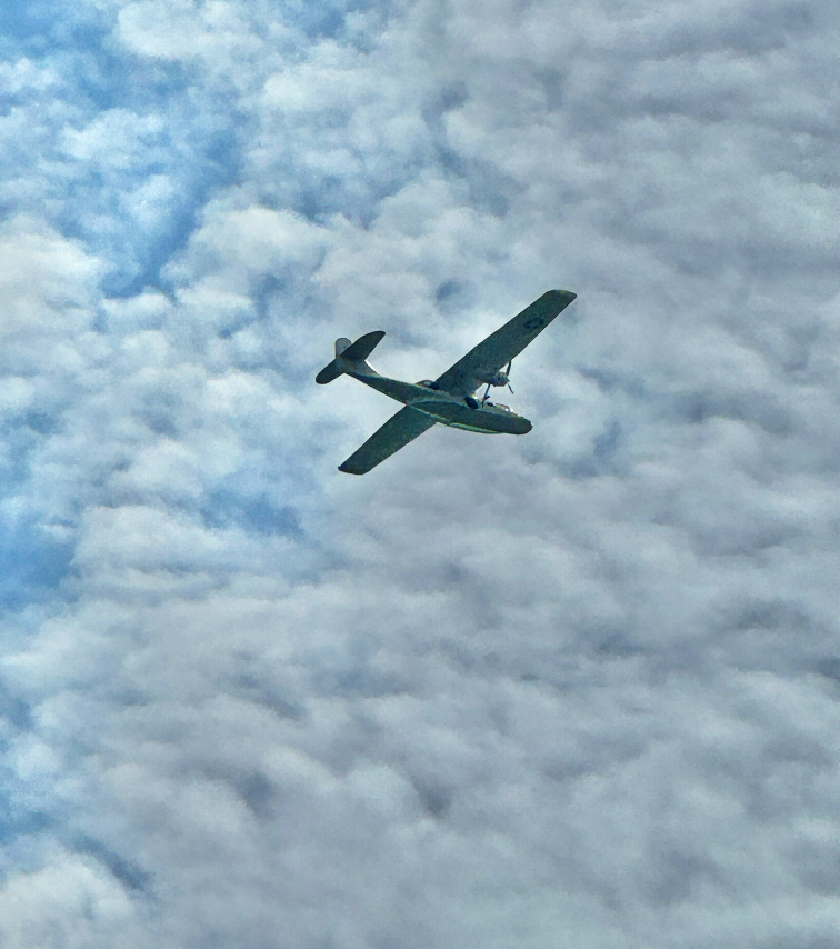
Having seen a veritable shit-load of them recently as I attempt my Summer flyings, I have been thinking a lot about low-flying manned aviation of late, and if anything can be feasibly done from the ground about estimating the height of these errant private planes as they fly past, seemingly way under their minimums and over built-up / residential / recreational areas.

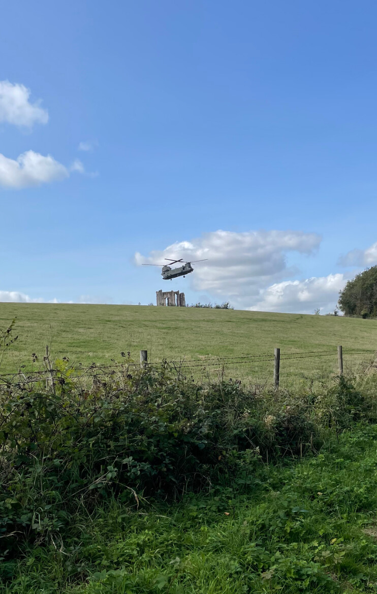
And as I was browsing around dronescene for places to fly, I came across the listing for the Vandalian Tower in Hampshire.

And then I saw @PitchFader’s photo (cheers for that !) of the Chinook low above the tower…

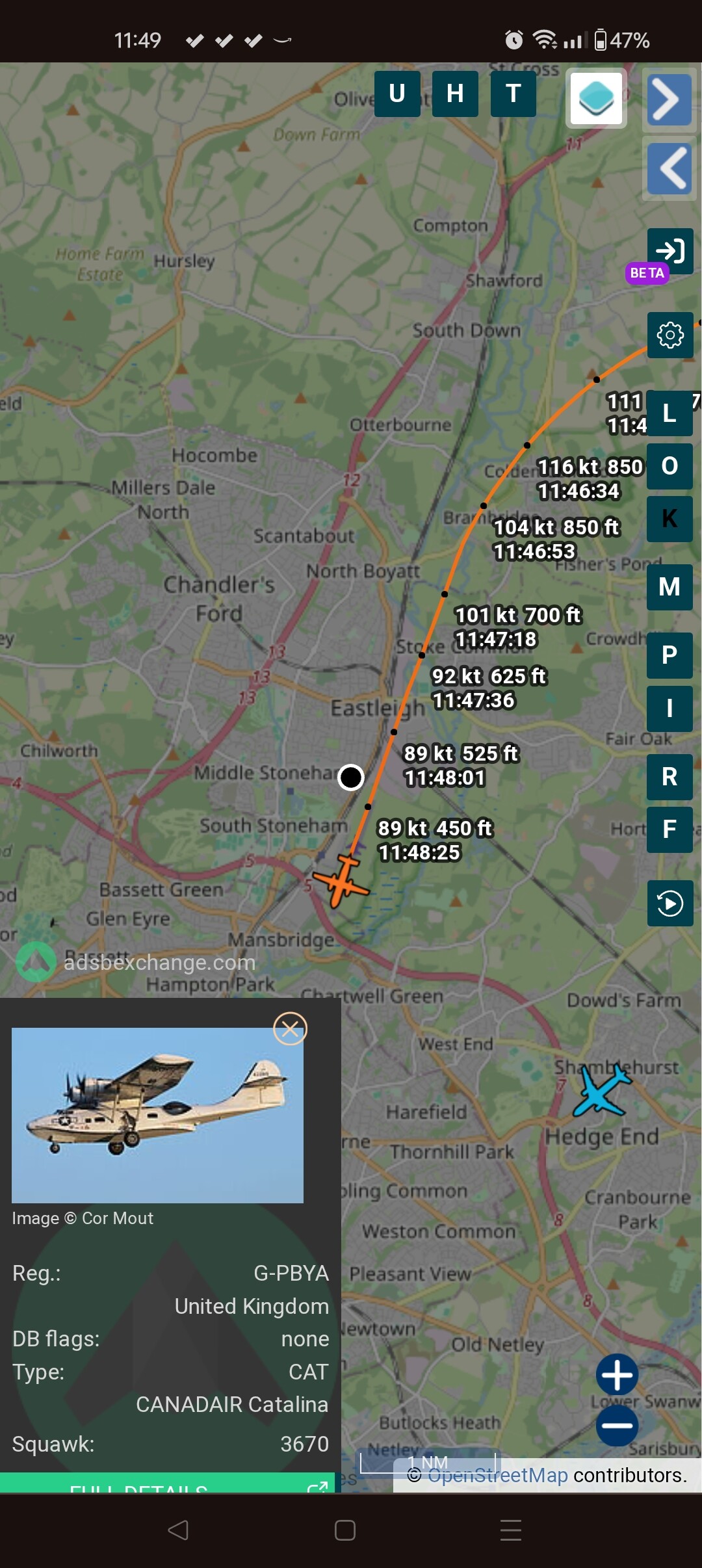
So, most of the time, small private planes I see, and subsequently look up on FlightRadar24 have reported barometric altitudes of around 1500-3000 ft. And yet my own visual estimation for some of those can be as low as 200 ft, which is quite some discrepancy, which I am seeking to better explain !

Now, at AGL 500 ft+ I have accepted it is very difficult to tell what altitude small planes and helis are at, so I have more or less given up trying that, but in the Chinook photo we have a lot more to go on because it’s a lot closer to the ground and other points of reference we do have size refs for.

In that example we know the height of the tower (40 ft), the height of the hill it stands on (500 ft MSL), and we can extrapolate the height of nearby trees, which is a reasonable start. We can judge the relative size of the Chinook and the tower vertically, but of course we also need to know if the heli is behind, over, or in front of the tower to be sure, and to know how far both are away from us the observer, which are rather more difficult to gauge.

So, out of curiosity, would members mind having a look at that photo, and guessing the actual height (AGL) of the Chinook ?

When I see that although seemed very very low, it was further back than the tower & the top of the hill, also if I can remember rightly that hill drops off below where the chinook is, so it’s probably not as close as it looks but more of an optical illusion in the way the picture was captured at the time, but was low nonetheless .
They were probably using the tower as a poi for their exercise maybe.

1 Like

The tower has several sections two of which include openings for window or door, given that doors/windows have a recognised use, ergo size, along with the other stone sections would be larger than the size of the chinook

This would lead on to the chinook being much closer to the Picture taker @PitchFader in this case, than the tower. Also the contour of the land cannot be seen from the position the picture was taken from…

Thus, I submit it is difficult if not almost impossible to estimate the height of the said Chinook.

While there is other data to assist with the estimation, like the known height of the tower, the estimated height of the trees, there is still not enough confirmed data to estimate the height of the chinook. Using Pythagoras (if memory serves correctly) you need one angle and at least one confirmed length. We have a length in the height of the tower, but that’s where it stops…

Unless someone has another idea…???

There are many occasions where aircraft can, and do, legitimately drop below 500 ft. Best judgement for such occasions is to use your ears (assuming, of course, hearing is not impaired) and bring your drone down until they pass. :hugs:

Low-flying fast jets aside, you can usually hear them way before they reach your airspace (and in the case of a Chinook, feel the vibration from your toes upwards). :rofl:

The height reported on flight radar is correct if air pressure is 1014 hPa, the chances are that the current air press is not and so needs to be adjusted.

1 Like

Exactly what I did this morning over the Solent when Europe’s last remaining Catalina flying boat appeared from nowhere at around 500 feet.

2 Likes

It didn’t appear from nowhere, if came from Duxford via my house. :zany_face:

1 Like

At the end of every flight, for starters. :zany_face:

2 Likes

A tad difficult to be looking at ADS-B Exchange and flying at the same time. :rofl:

and take off, if we’re being pedants! :rofl: But these are generally in a FRZ, are they not?

Emergency helicopters and military training aircraft also stray into “our” airspace without warning too. :wink:

If we are being pedants they don’t drop below 500ft for takeoff as they are already below 500ft.

2 Likes

To figure out whether the Chinook is in front/behind/above the tower

  1. Start with a high-resolution image
  2. Count (in graphics software) how many pixels are taken the tower width, and how many by the chinook body, that gives you relative visual widths (they look very similar)
  3. If you know where you took the photo from (GPS as a rough guide) you can locate the camera in Google Earth, get the distance to the tower and find out what the actual width of the tower is from that angle. So you now have a distance, a width, and the occupied field of view related to the tower, and how many pixels that requires.
  4. Find out what the actual length of the Chinook is (accepting that we are seeing it at an angle so it will appear narrower than its full real length
  5. Do some clever maths, reversing the above tower-width stuff, to figure out how far away the Chinook is!
    I can’t figure out this last bit off the top of my head, but I’m sure its do-able if this really mattered!
    In theory, you could also figure out the angle between the top of the tower and the base of Chinook, and, having figured out the distance of the Chinook, that would give you the elevation…
    Ugghh, sounds like a lot of hard work!
2 Likes

:joy: don’t it just …

Haven’t got one

To me it’s not :rofl::+1:

If you do work it out let us know, but as far as I can remember on that day when I was there that very chinook kept popping up from behind the tower & the brow of the hill, I did have some other photos somewhere I’ll see if I can find them, however I waited patiently until it buggered off for good .

1 Like

True - it is merely interesting to know what height it was at. It doesn’t matter because the only thing we could usefully do with that information is share it with CAA as part of a complaint / report, but as it’s a) an RAF vehicle and b) exempt from altitude minimums, then the CAA consider it none of their business, and the army can do what they like !

1 Like

I live near RAF Benson. Chinooks trundle round here day and night, but at least you can here them coming! I was once on Bald Hill near the Stokenchurch gap trying the paraglide. A Chinook came in very low to the bottom of the hill practising hovering a few feet above the ground for quite a while. Needless to say, I waited until they cleared off.

1 Like

Yes
Also they seem to do things without putting up any warnings / NOTAM etc as I did also check dronescene before & when I was there as I know from experience that, that tower is not a million miles from RAF Odiham which at an educated guess is maybe where they had come from .

Edit : tbh when flying anywhere or not to far from these places you have to use your second set of eyes & ears, that said, that goes for flying anywhere really as anything is possible .

Yeah most of the RAF stuff round here comes from Odiham.
And there is that number we can call to get our flights entered into their conflict awareness systems…
Just not at weekends, when apparently they don’t do exercises or open that switchboard !

1 Like

I must be missing something here; it’s late and I’m not operating at peak efficiency (and my peak efficiency’s nothing to write home about), but doen’t barometric pressure equate to height above sea level, i.e. the height derived on FR24 from the difference between baro at sea level and that on the a/c’s baro as indicated on it’s transponder?

This means that the height ASL of the point on the ground that the a/c is overflying. Normal a/c are not permitted to come below 500’ AGL (except when taking off, landing, or crashing of course), not ASL, so an a/c reported on FR24 to be flying at 1,000’ ASL viewed from a ground height of 300’ ASL will be 700’ AGL. Military & Police a/c are not restricted to 500’ AGL.

.

As a rule of thumb, if you can read the planes ID with normal vision it is below 500ft. If you can’t then it it’s above 500 ft. QED.

1 Like