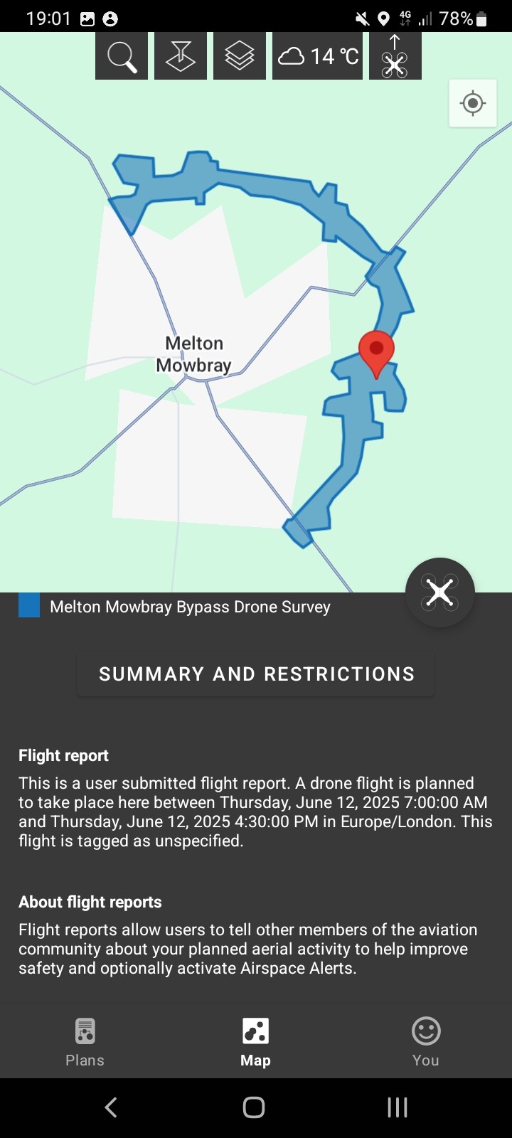
Looks like they’re putting the Typhoon through its paces.
1 Like
A post was merged into an existing topic: ADS-B Exchange - (better) live aircraft tracking alternative to the others
@ committee. It now doesn’t make sense as it relate to the post above!
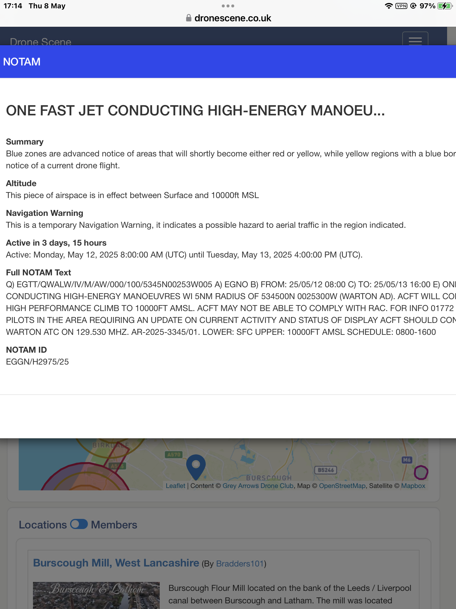
As it says, they’re just flying fixed wing model planes, nothing special ![]()
The NOTAM is just to advise of the 1,000FT altitude that they might be flying at.
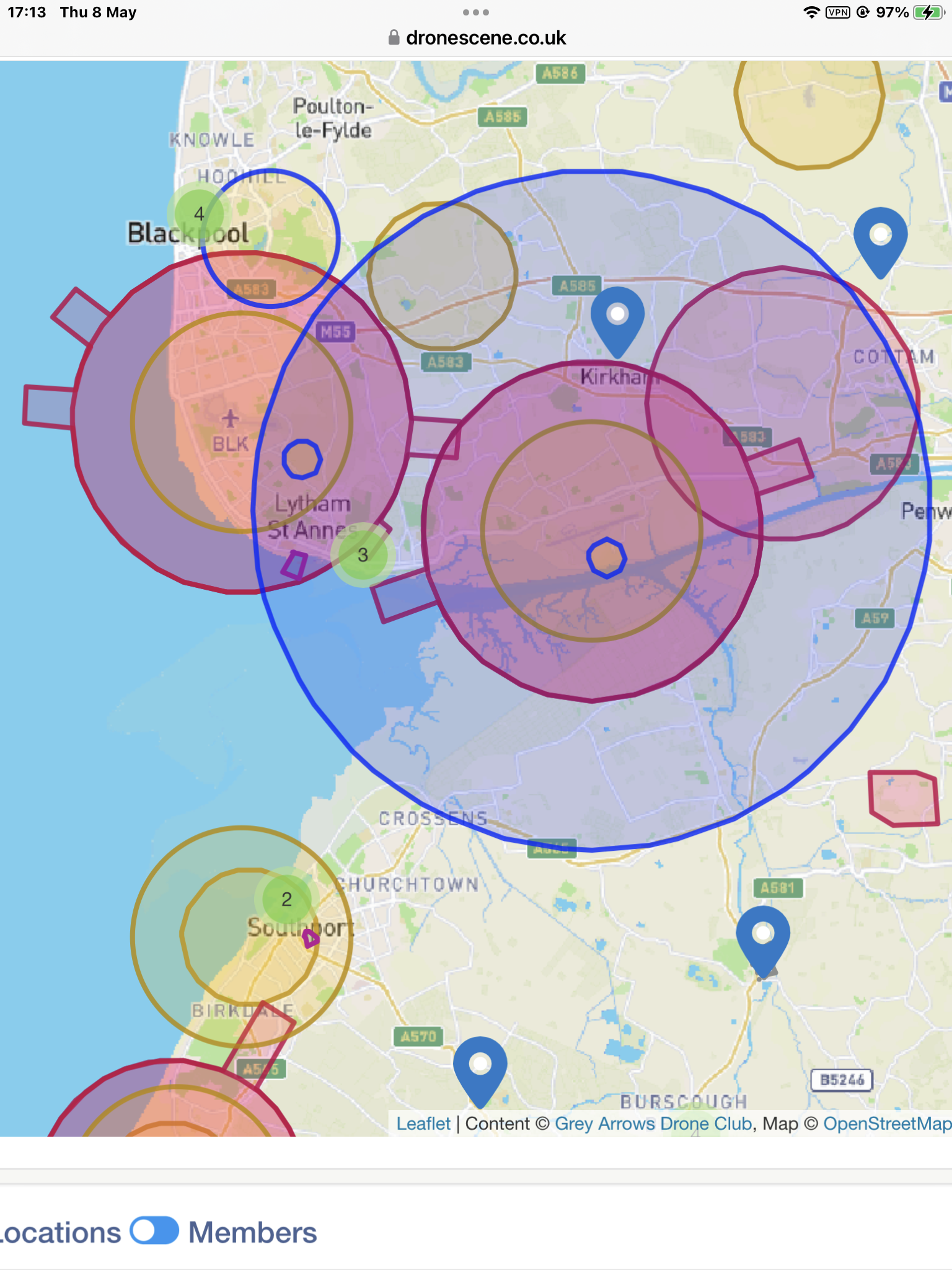
There was a model flying club who used a field outside the old Yearby tip. Not been past it since I was a kid but the NOTAM centre point is pretty spot on.

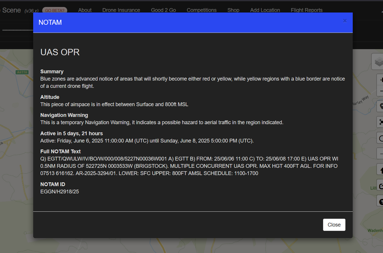
Bomb Shipwreck
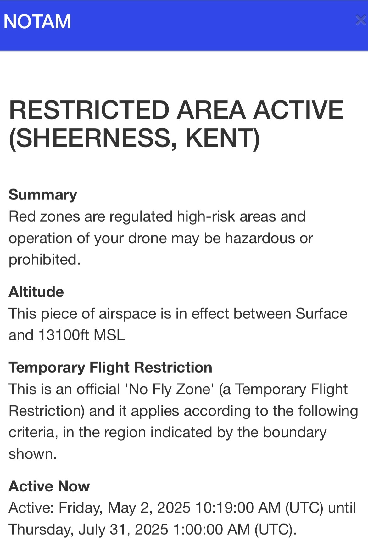
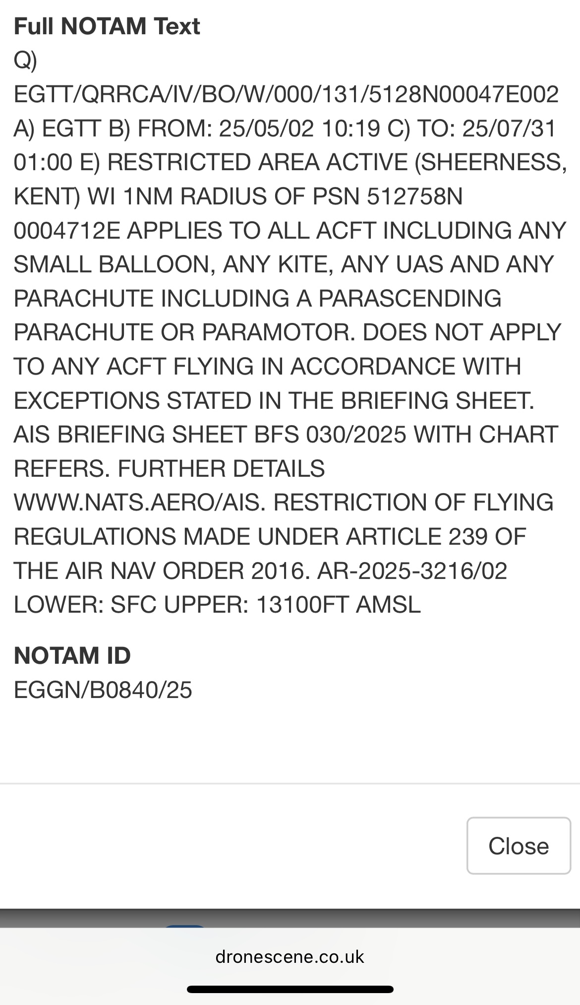
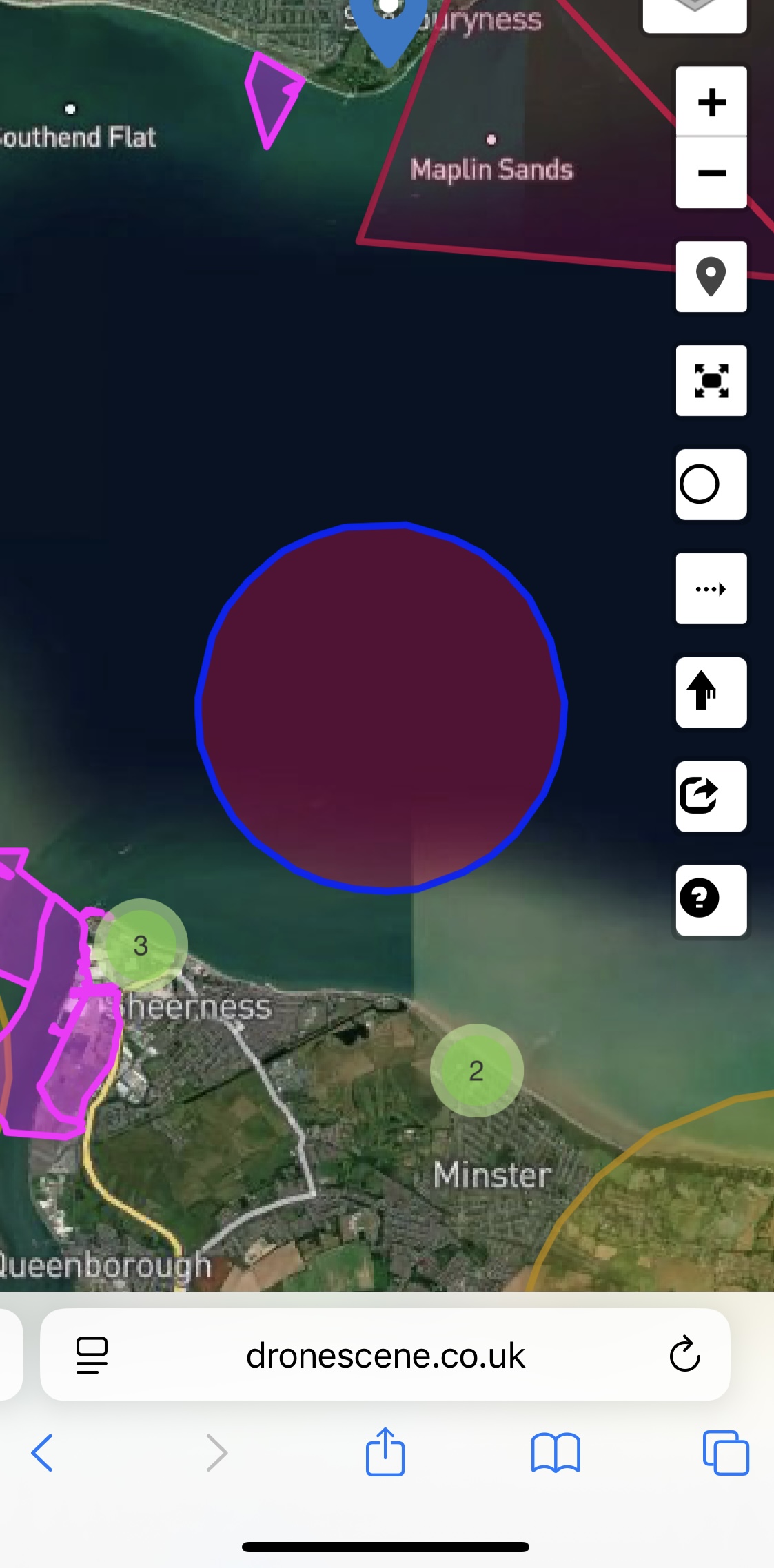
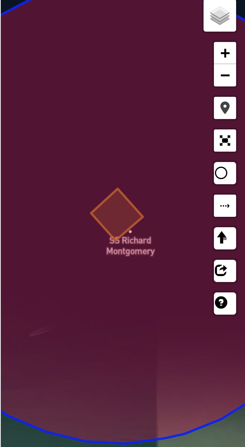
https://www.kentonline.co.uk/sheerness/news/new-no-fly-zone-put-in-place-over-bomb-shipwreck-325279/
I saw it’s masts just protruding on the low tide last weekend when i was flying off the Isle of Grain.
It’s been a navigation restriction zone for years but interesting a NOTAM has recently been flung around it.
If I can remember rightly I don’t think this is to far from a boat graveyard, which I was going to try & get to for one of the RTF comps some months back but never made it .
1 Like
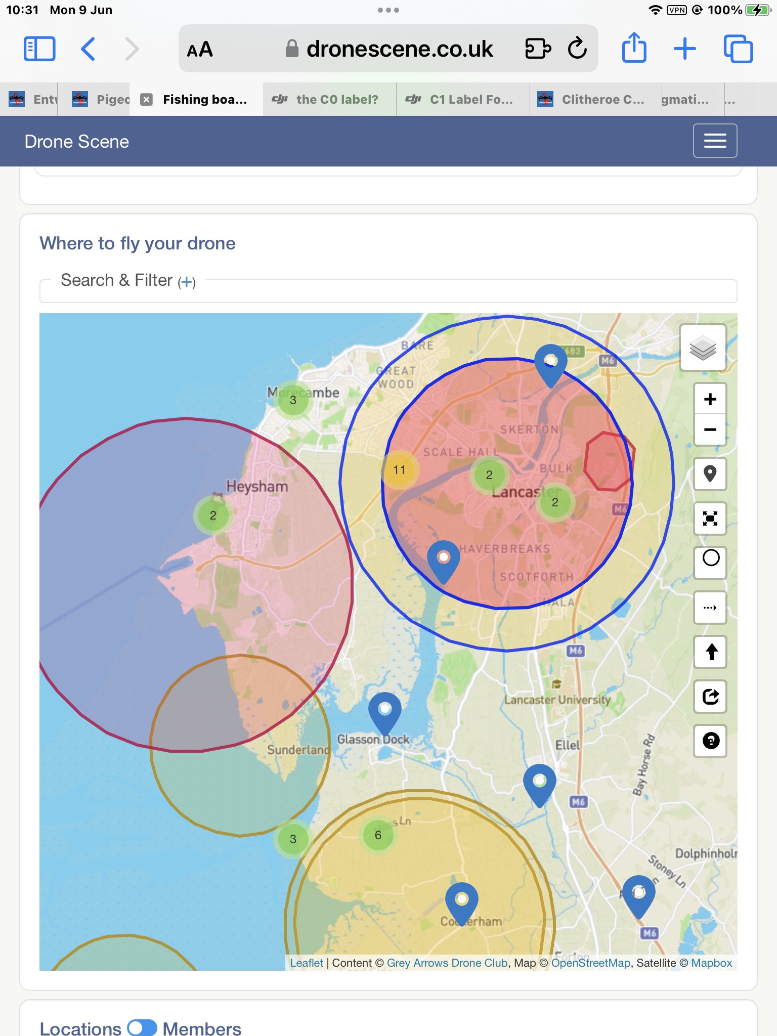
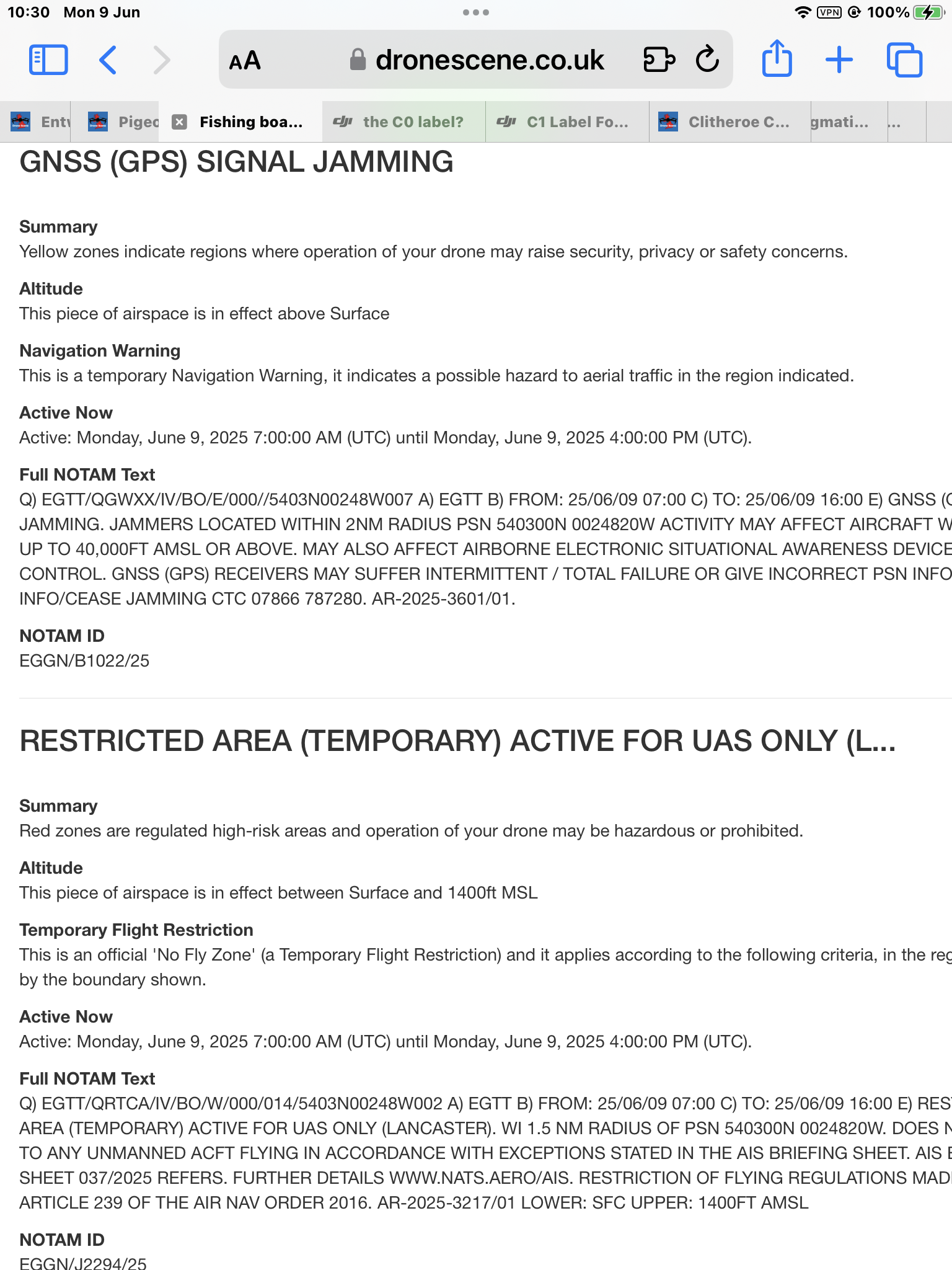
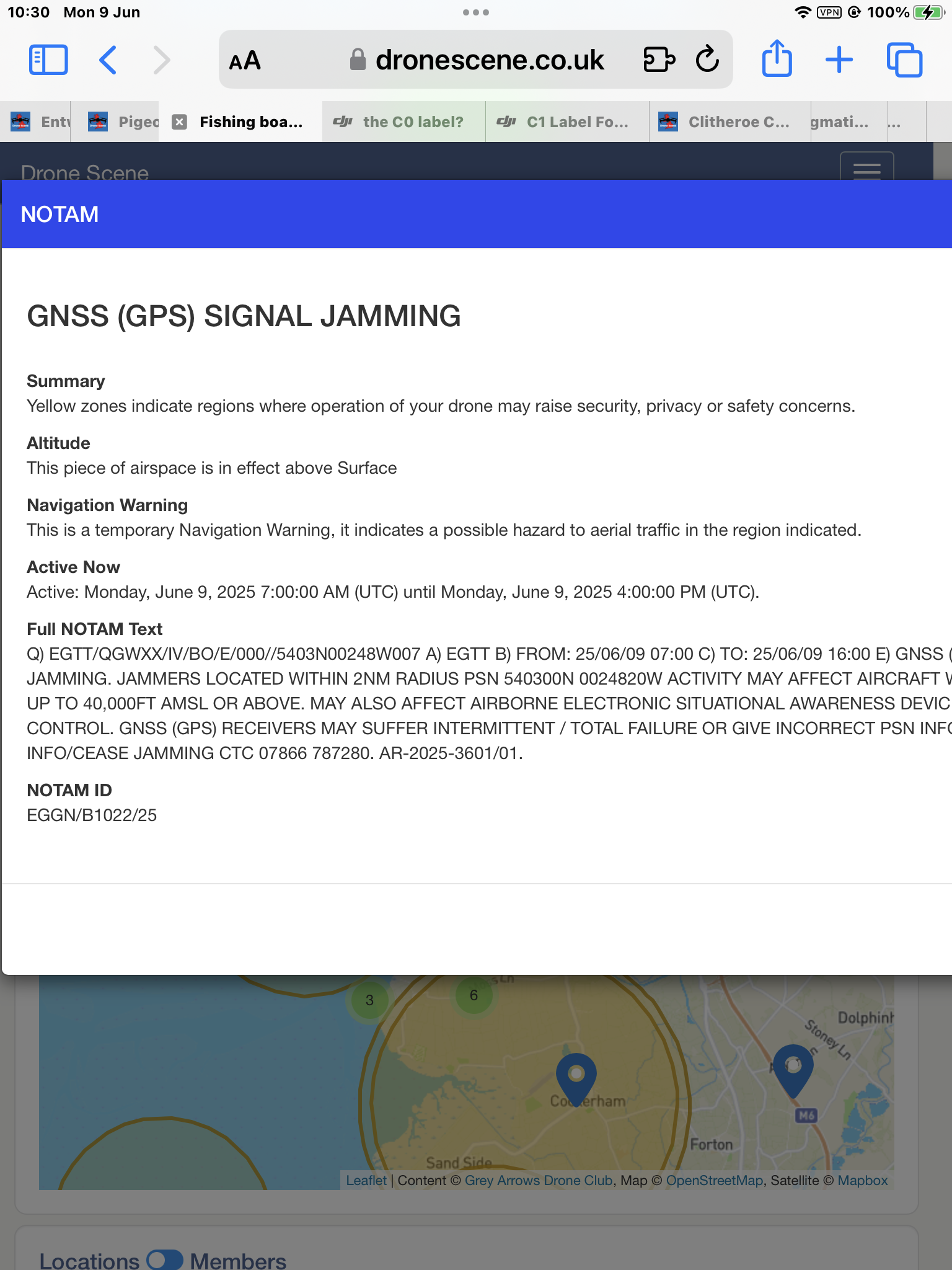
I wonder if this would affect drivers using satnav on the M6 & local roads.![]() . Afraid I can’t really be bothered taking the car out to try it out. Anyone driving in Lancaster vicinity today?
. Afraid I can’t really be bothered taking the car out to try it out. Anyone driving in Lancaster vicinity today?
They’re have been SO MANY of these GPS Jamming NOTAMS in the almost eight years of GADC, and not a single member has reported an issue or has even seen any reports from any drone pilot that these are an issue.
Don’t forget commercial airlines use GPS, and there are no reports of one getting lost as a result.
I’d happily fly near one .. exercising relevant caution and awareness.
As soon as one is happening near me I’ll be going and having a fly. ![]()
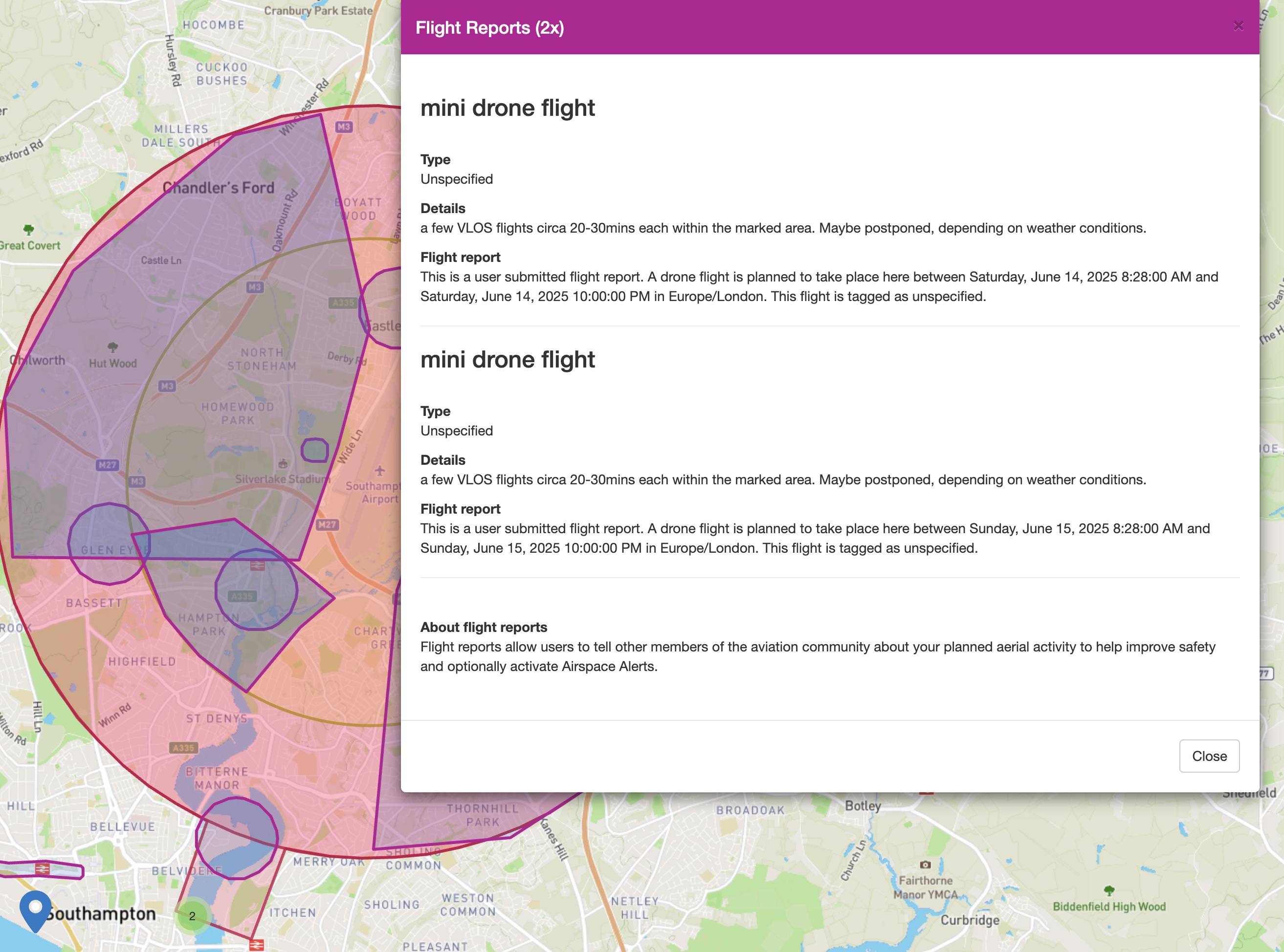
Is anyone else having issues with the drone assist app on Android at the moment? On the app I’m not seeing any NOTAMS or FRZs, just a totally clear map?
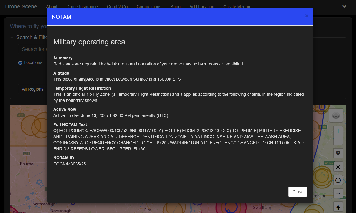
Checking the website however and there’s a huge Temporary Flight Restriction zone across all Lincolnshire and into Nottinghamshire, Leicestershire and Norfolk.
Wouldn’t know, I don’t use it. The only resource I need is
It uses the same data set, but has wayyyyy more useful tools.
3 Likes
@NylonTieFighter you can open a support ticket with them here:
1 Like
@ryan.holt94 check out this thread for more details on that specific NOTAM ![]()
2 Likes