Too many things don’t stack up.
Loss of connection at only 2.2km with clear line of sight to it when it was still flying.
Reconnection when Chris was on the ground at the assumed site of it’s demise (much lower down), to a point on the ground 6km away … with this intervening elevation profile.
- Vertical scale may be exaggerated …
 #NotInTheAlps … #Hopefully
2 Likes
Also …
3.9 miles in 11 mins 19secs = ~20.6mph … which certainly isn’t impossible.
However, the wind was ~35mph (or more) perpendicular to that route.
Vector addition means that it’s actual airspeed was ~40mph (or more) … somehow, probably not in sport mode … which is getting quite fast.
Worth a shot I suppose, but the other facts as you’ve pointed out plus the existing reconnects when initially looking for it wouldn’t add up for it to be 4 miles away surely.
2 Likes
We may never know … it’s one helluva conundrum, for sure.
Unfortunately, I think the key thing here is to ignore all the data past the last known good data, and to continue to treat it as a real needle in a haystack SAR mission, based on predicted routes. The likelihood is that the reason the data makes no sense is because it’s completely screwed up 
That said, I still believe that there’s every possibility the many many steps that Chris and others are putting into the SAR mission will reap rewards…eventually 
I’m almost 72 … time is limited …

Daft question, have you found anything else of worth on your travels?
1 Like
Only the muddiest and most rutted route back home.
2 Likes
Now - had I had a metal detector … we might have covered the cost of a replacement.
That was my thinking, has anything happened in them there fields in the past, loads around us have found roman and viking bits and bobs as they probably walked through (they reckon)
It’s close to an old WW2 airfield, now a solar farm …
… and the field I walked has lots of concrete amongst the grass, and I was looking earlier as to what that might have been at some point.
Could have been wartime barracks for the airfield?
1 Like
Sorry to take the thread of course but we have similar round me, and at the end of the war 000’s of uniforms (hemp) were shredded and scattered over the fields, people are constantly finding buttons and belt buckles (me included)
1 Like
It might have raised concerns from the farmer had I used a metal detector on the heifer stomachs … LOL!
2 Likes
More so had you gone the Herriot method ;o)
1 Like
Yeah - the heifers were definitely below the age of consent!
2 Likes
Couldn’t find anything 
Airdata shows it here:
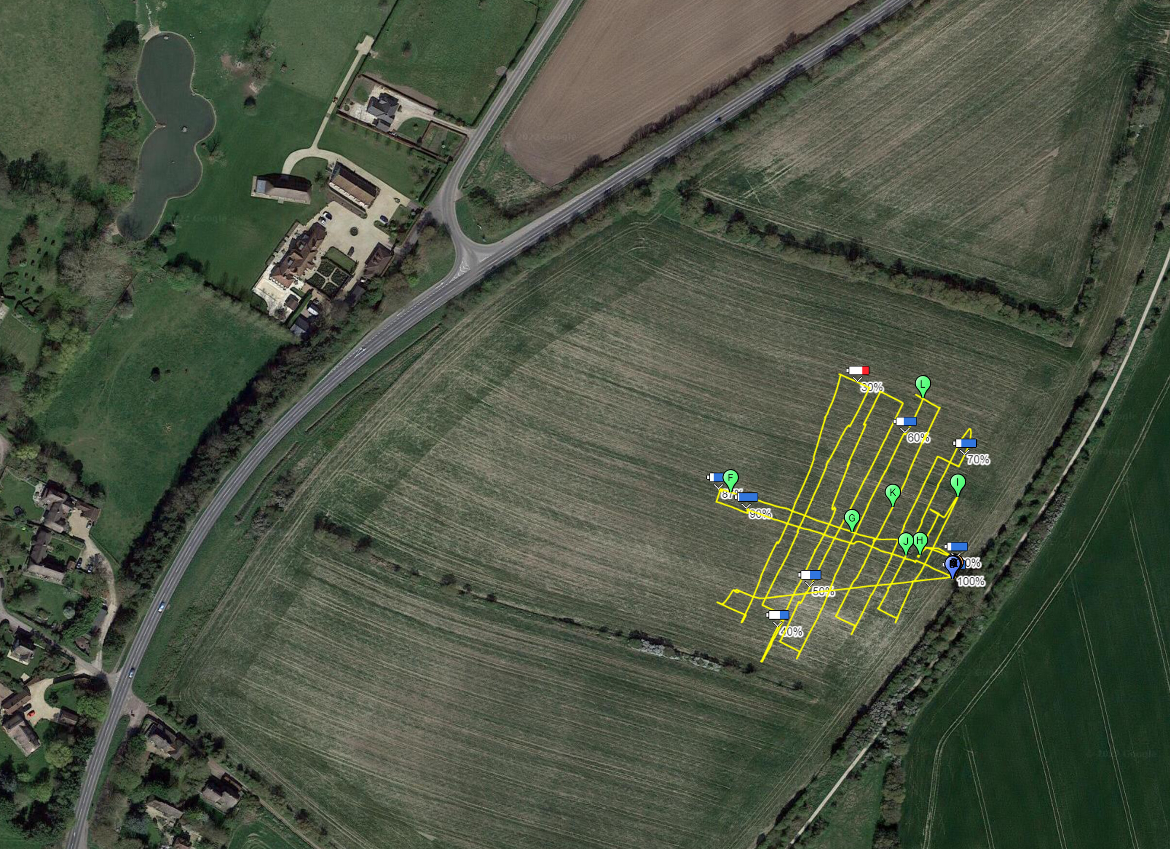
I walked up and down the field first (only 6,000 steps today):
I used the M2P to search the area:
First battery, Air Data:
Second battery, Air Data:
Third battery, Air Data:
I have about 150 photos, split into 5 batches, I will share via We Transfer, in case anyones gets excited about looking at a field in 4K UHD detail 
7 Likes
Ogbourne St George, Batch 1 of 5:
Ogbourne St George, Batch 2 of 5: