TOAL from the lane outside the English Heritage site. Free parking is available at the bottom of the lane.
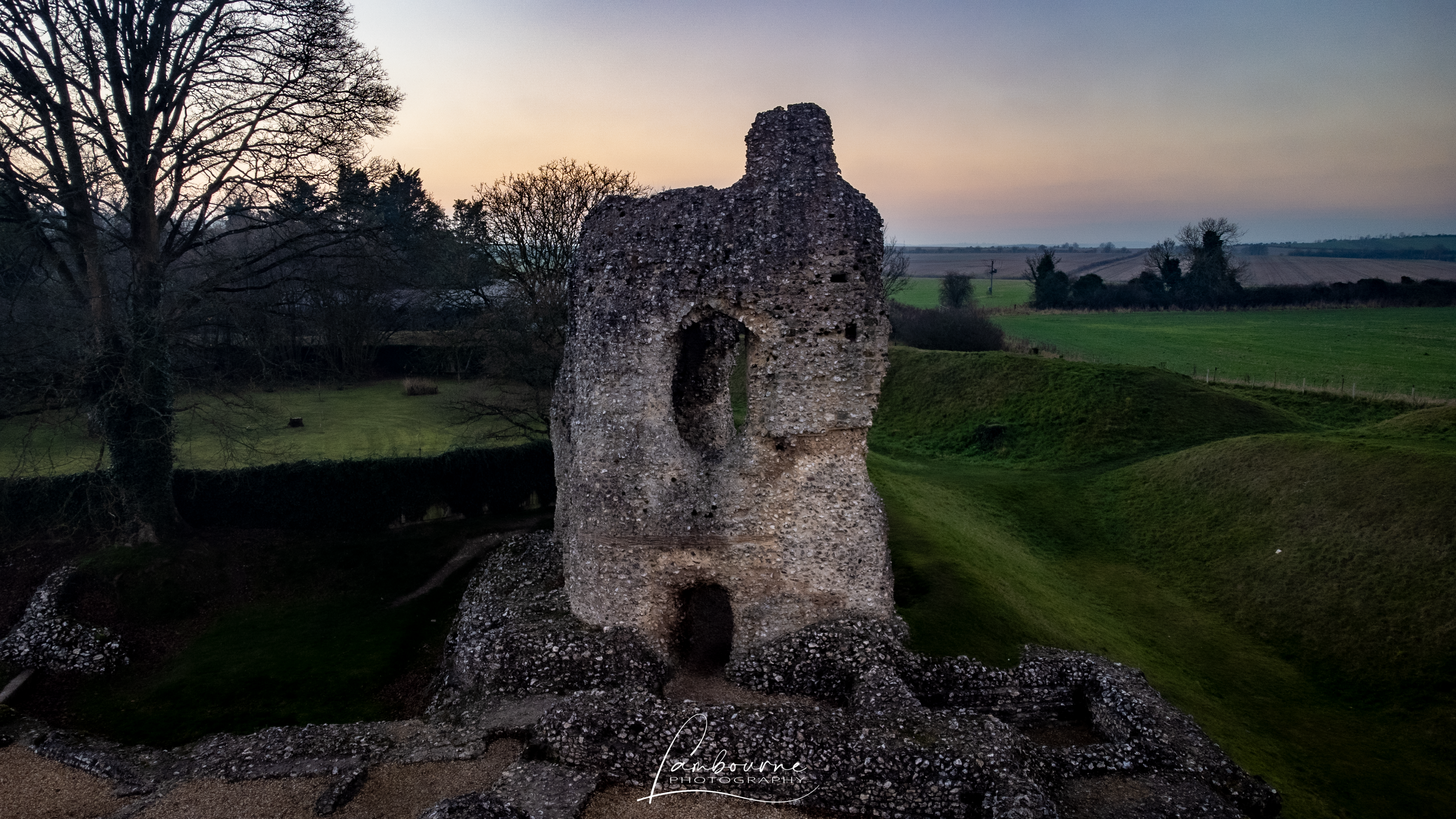
Probably begun in the late 11th century by a sheriff of Wiltshire, Ludgershall was much improved in the 13th century by King John and his son Henry III, who used the castle as a hunting lodge. Three large walls and extensive earthworks survive, while in the centre of the nearby village are the remains of a 14th-century cross.
The originator declared that this location was not inside a Flight Restriction Zone at the time of being flown on 18/12/2021. It remains the responsibility of any pilot to check for any changes before flying at the same location.
I was hoping to get there this summer but cruel circumstance prevented me from entering the Birthday Challenge and poverty now confines me to pictures within walking distance …
So well done for putting in the effort and taking the time to write-up each of the visits you have made, let’s see you get the diamond!
The bad luck is continuing I’m afraid. Like last year it looks as though I will still be on the Challenge Committee when the 5th Birthday Treasure Hunt comes along
Bit confused this is very local to me, just got my first drone and looking at where I can fly. Doesn’t the castle fall within the red “BULFORD” danger zone? I assumed this would mean your not allowed to fly here?
As @PingSpike has mentioned, BULFORD is a Danger zone, not a Flight Restriction Zone. Danger zones are one of the “for information” layers. Personally, I only have these layers visible (below), as this clearly shows me we I am and am not permitted to fly. And as you can see, Ludgershall Castle’s nearest FRZ is 2.1KM to the South.
Thanks @PingSpike & @clinkadink it is a little confusing bot being red so thought it also meant it was a nfz, but thanks for clearing this up. Will probably make this on of my first places to try as it’s only a short walk from home