In Windows 10 > download the image > right click > properties
In Chrome, it is actually ‘Save as’, rather than download. But it’s the same thing.
In Windows 10 > download the image > right click > properties
In Chrome, it is actually ‘Save as’, rather than download. But it’s the same thing.
Could the 2.7m below sea level be that they left home with the drone switched on?
This metadata detail is all new to me and I can assure you the drone, thankfully, never went below sea level  Will have a look on pc tomorrow at some of the other images and try and make sense of it.
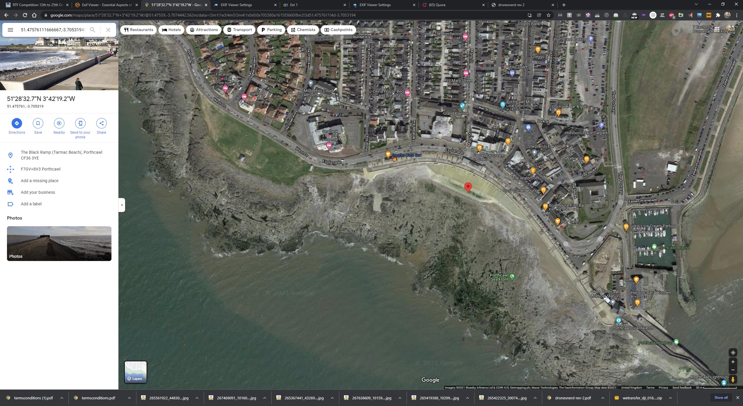
If it’s any consolation you have been tracked to within an inch of your life - this is definitely Porthcawl. Unless you have an EXIF editor of course …
Time to fess up, Rich. We all know you took that shot 2.7m underwater in Belgium 
I might have an EXIF editor for all I know, what is it
Ok I admit it, I was underwater. Do I get extra points for that?
No. But it’s an ingenious way to shelter your aircraft from the wind! 
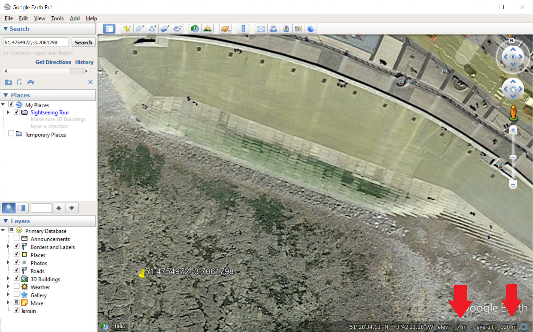
Google Earth Pro (desktop version) has elevation and eye altitude, which makes planning any shots pretty easy.
In the image below, I have zoomed to 120m eye altitude. You can see how smal the steps are this distance.
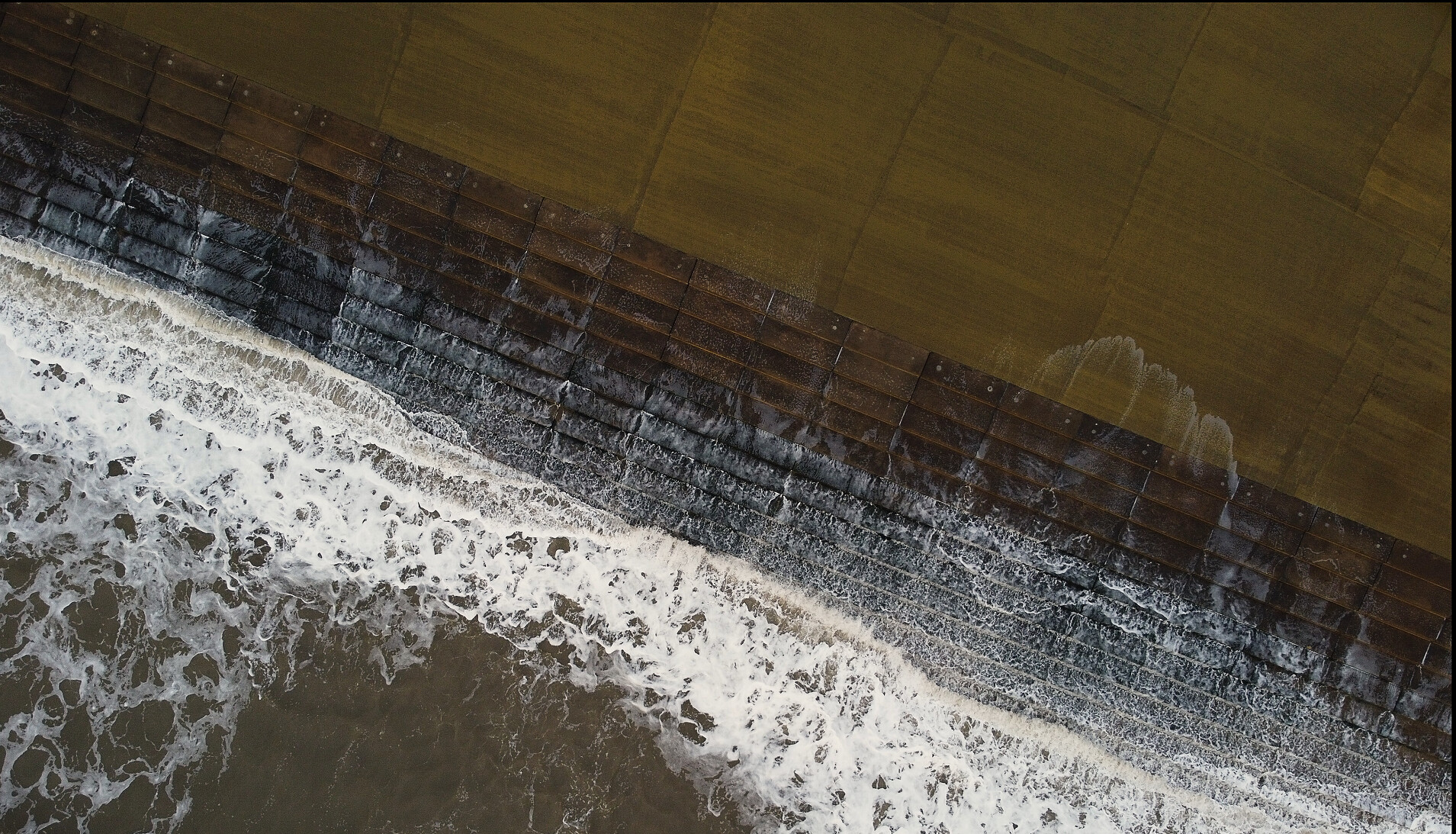
The steps in the photo below are about 3 times bigger. So my guess is that its at about 40m.
So what 35mm equivalent focal length is Google Earth set to? Or is it set to the field of view of the human eye, which is very wide in comparison to most cameras.
The MM has an equivalent focal length of 24 mm.
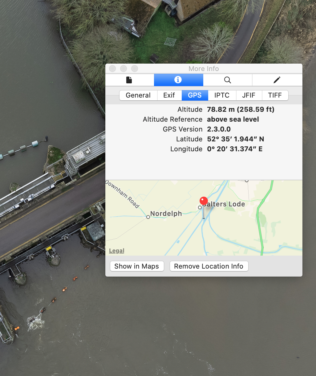
Something not quite right doing this. I just checked the data on my photo of the sluice and the info gives height at 78 mts. Yet I was definatly at 120 mts as the geo fencing kicked in and wouldnt let the mini go any higher.
Im not sure using that info inside the photo is reliable
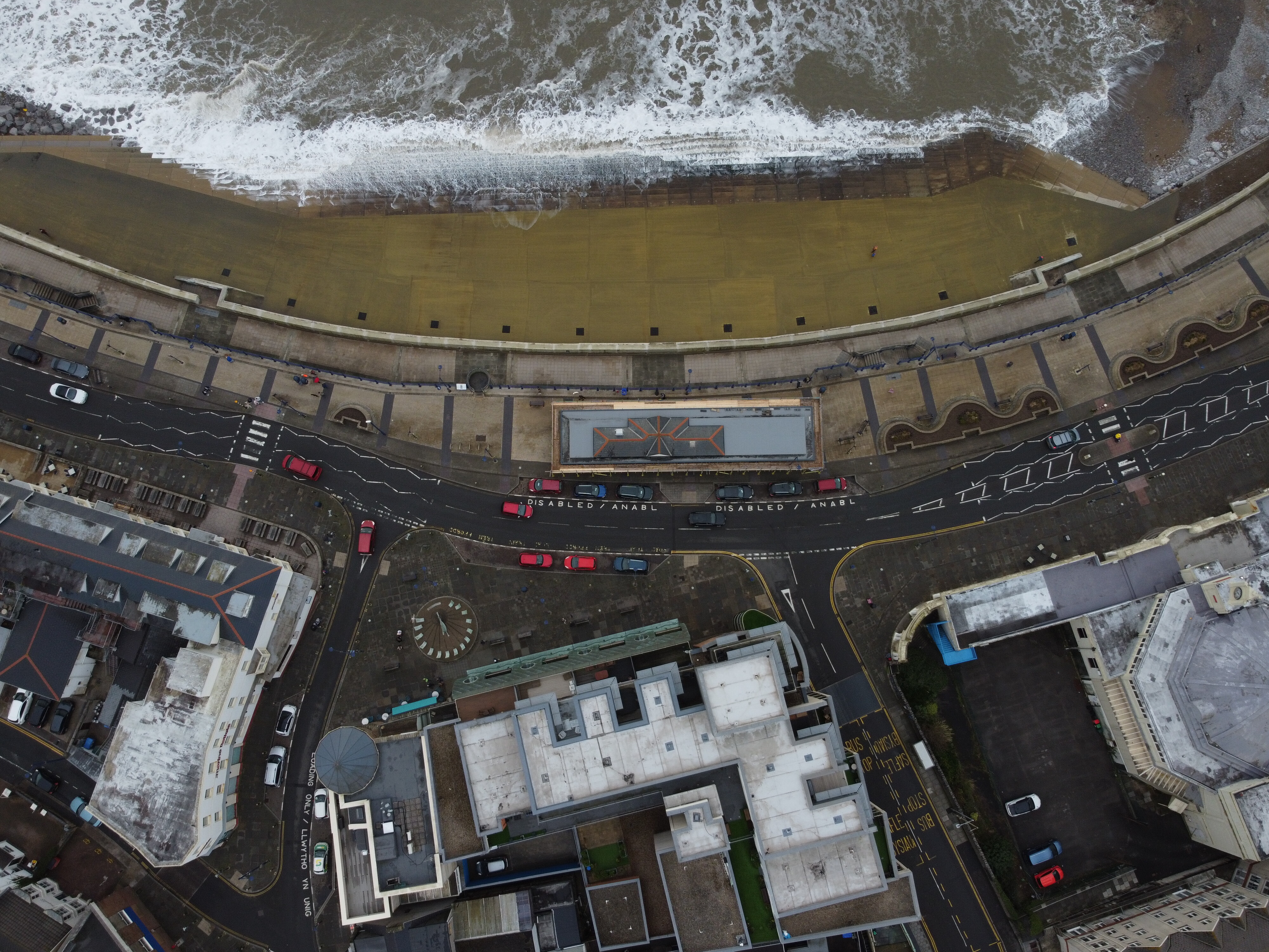
I’m sure my height wasn’t anywhere near 400’ but I suspect it was higher than 40m. Here is another image showing the steps and surrounding seafront, the metadata shows the altitude as 82 somethings (meters/feet or maybe bananas?) Not sure how reliable this metadata info is based on my previous underwater shot For the images I was positioning the height of the drone to get the composition I liked rather than sticking to 400’ as I thought the idea was a straight down shot by drone rather than it had to be at exactly 400’.
Apple says you were not either, and your shot does not look like 400ft TBH.
Check the AirData maybe for some clues
120m is 400ft.
Might just have m/ft mixed up?
Well that’s a bit of a departure, you’ve previously left it up to the voters to decide what we would accept!
And in any case, it’s illegal to fly at that height without an Operational Authorisation. ![]()
This comp is a bit of fun:

To my knowledge, the DJI Fly app displays the ‘Above Ground Level’ (AGL) altitude. Whereas, EXIF will always report ‘Mean Sea Level’ (MSL) altitude, i.e. the altitude of your location above sea level + your AGL.
None of that explains the EXIF figures above though  I will do a test later and see if mine is out too - then compare with AirData as @milkmanchris has suggested. I’ll post back my findings
I’m gonna fit a plumb bob and 400’ of line to my mini just to be sure