Or park it alongside something you know is 120m ish tall ![]()
1 Like
Someone may want to clear up this thread, as we have clearly gone off topic 
TL;DR … DJI has mapped it’s EXIF metadata incorrectly. My data is reporting incorrectly too.
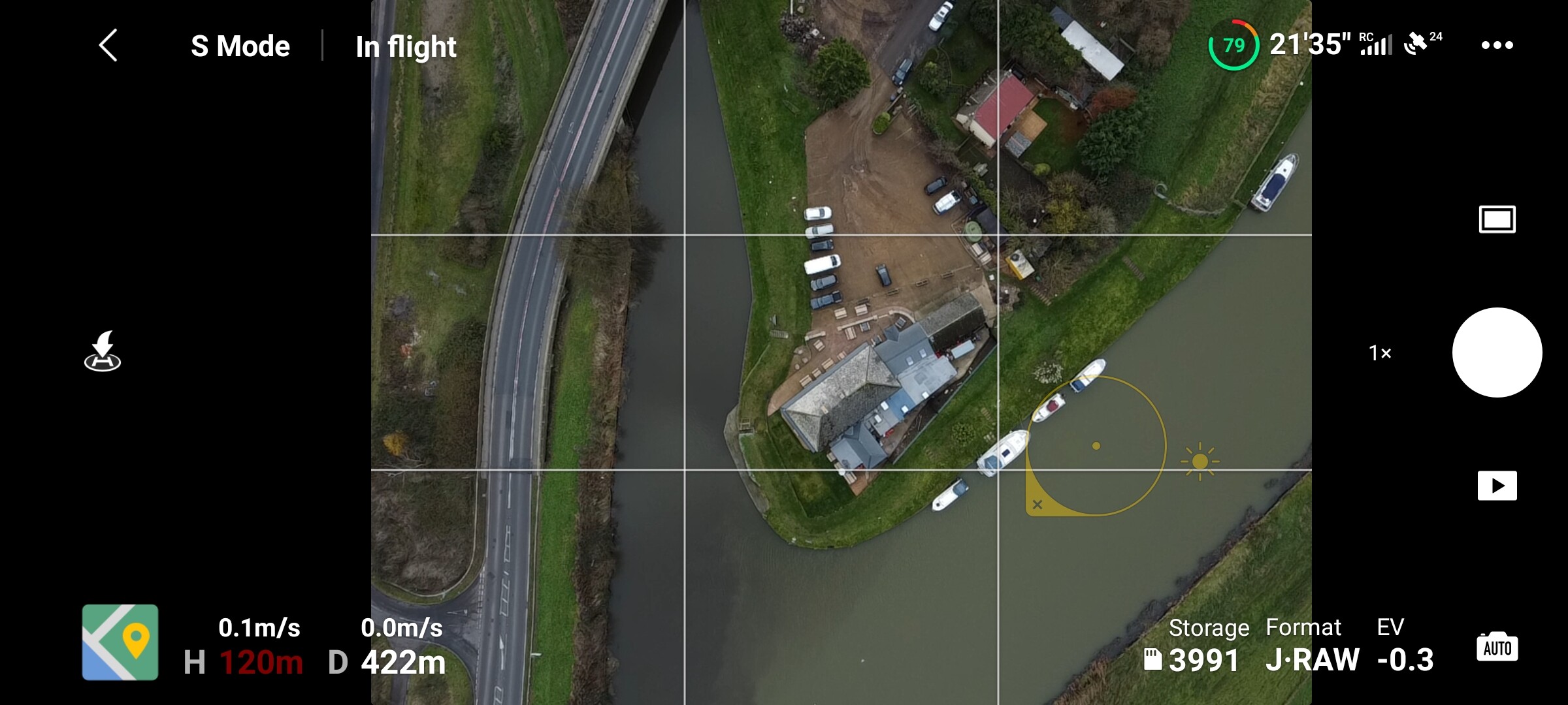
Just flew up to 400 feet and grabbed this screenshot off my phone. As you can see, I am bang on 400 feet.
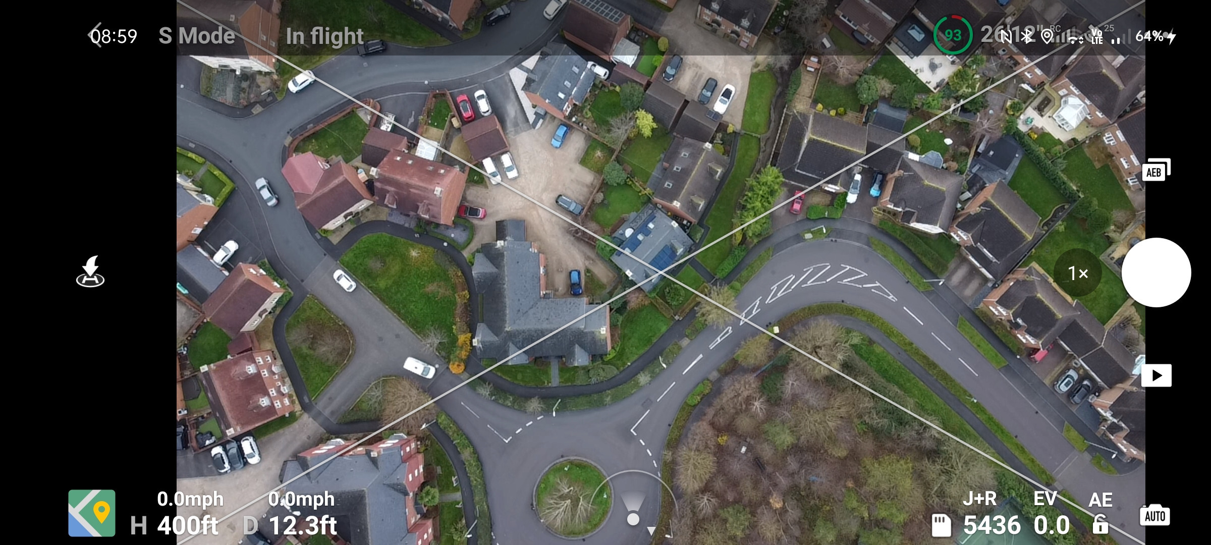
AirData confirms this too …
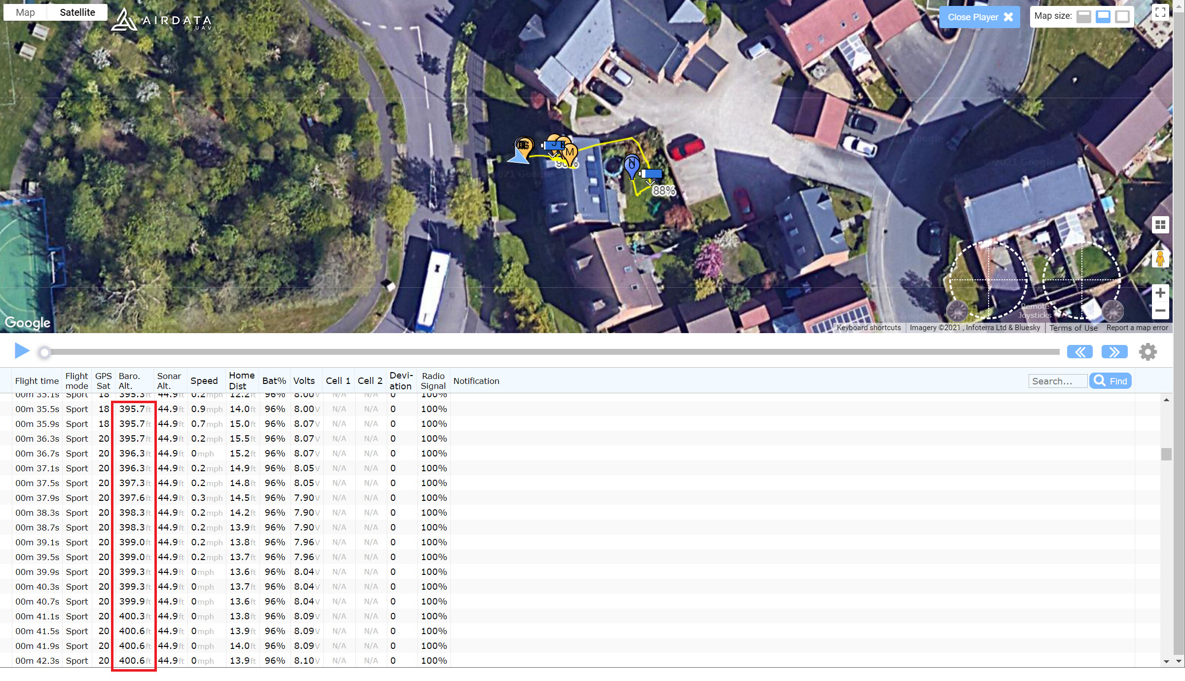
Using that online metadata checker that @Acedrone posted …
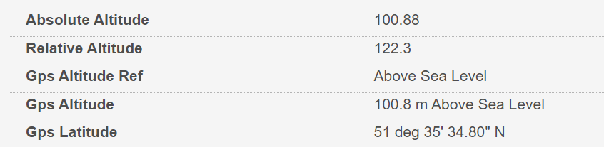
- My TOAL is actually 100.8m above sea level.
- Absolute Altitude is showing as 100.88m. This should show 120m. I.e. distance above ground.
- Relative Altitude is showing as 122.3m. This should be my MSL, i.e. 120m + 100.8m = approx 220m.
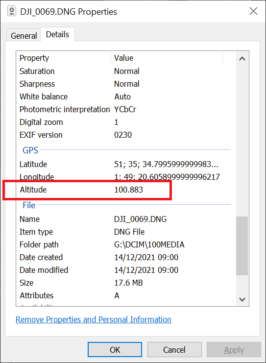
Which is why the EXIF data in Windows is incorrect too:
So that rules out anyone flying at 120m ![]()
![]()
1 Like
What has a photo of Boris Johnson in the morning, go to do with it? ![]()
We miss the old days. When the Birthday Challenge struck terror into everyone foolish enough to be enticed to enter. Impossible tasks (so we thought ![]() ) and draconian rules.Our word was LAW!
) and draconian rules.Our word was LAW!
But then we decided to let you guys police yourselves. Not our cleverest decision. But, for one last time before next year’s challenge we are going to flex our muscles -
GET BACK ON TOPIC OR ELSE!
3 Likes
Well I have checked I was at 120 meters on this one
Above view of the pub at Brandon Creek on the River Great Ouse, Norfolk/cambs border. Taken today 14th December.
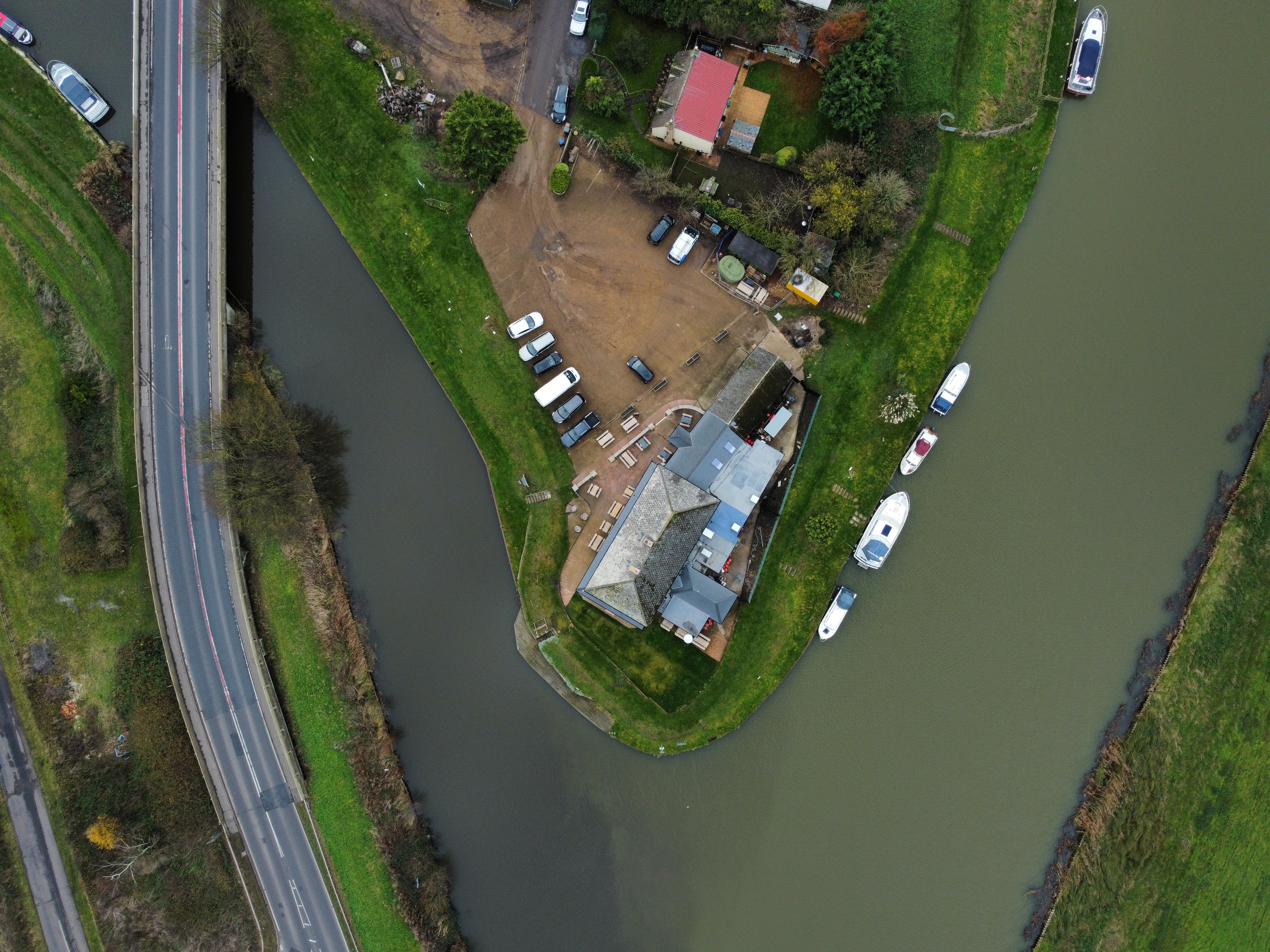
Screenshot of proof of height
3 Likes
So I fly at 400’, no problem. If I then crop my image which I think is allowed, will you think I’ve been cheating and flown lower than I did ought to have?!
As @kvetner has kindly pointed out the pictures and the rules are judged and administered by your peers. all we do is provide the space for the competition to happen.
The RTF competition is more about getting out to fly with a certain purpose in mind thanit is about strict rules and regulations. As long as it looks like the picture it was taken looking straight down from a height it will be ok.
What about the competitior who measures an accurate 400 feet from the take off point - which happens to be in the middle of a model village … 
God, yes, I am looking forward to doing just that ![]()
Won’t be much to see ![]()
Good, just what I was hoping the challenges committee might say👍🏻
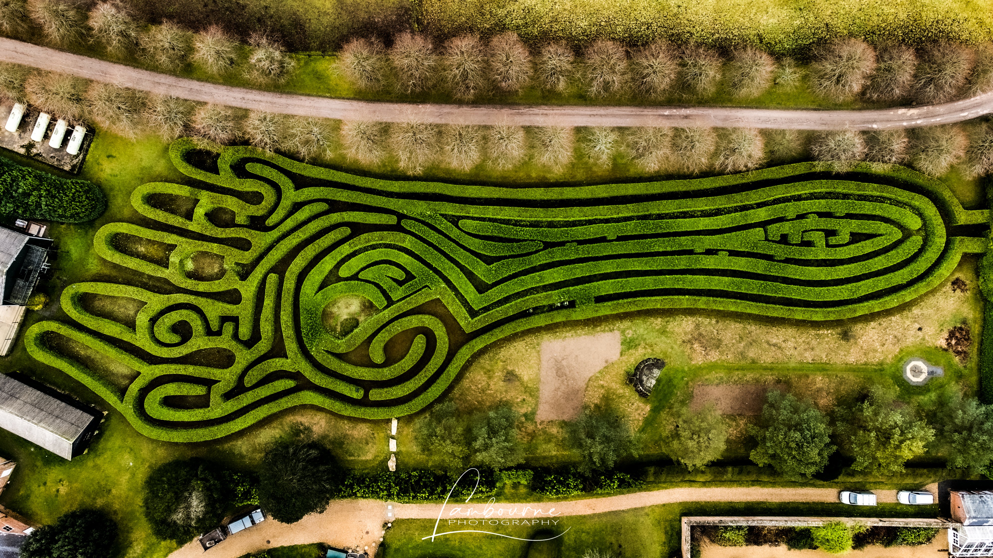
◦ Location: ‘Foot of a Giant’ maze, Conholt Park Estate, nr Andover
◦ Altitude: 400’ exactly
◦ Time and date: 2pm today
◦ Aircraft/camera used: Mini 2
The ‘Foot of a Giant’ maze is the largest maze in the shape of a foot in the world.
8 Likes
Chris, are you entering the 360 as well or is that just to give us more of a look around the estate?
1 Like
Good question. I was only adding so people could have a better look around 
No way were you that high. The maze fills your photo, but as everyone can see, it’s only just a foot long.
 Nope visiting a lot of HS2 sites, trying to get a good day when it’s not too windy or wet to fly over a building site of our depot, unfortunately I live dam near to Luton airports flight zone. But hopefully I’ll get out over the weekend at nighttime somewhere
@clinkadink …amazing !
That buggered me then, the M2 only goes up to 393ft!!!
You must have it limited in your settings… it can go way way above 400ft
Not that I’ve tried it 
Highest I’ve been is 399.99ft
1 Like
Mine goes to 400 feet … and sometimes over.
Agreed. Even without Drone Hacks, my old M2 went the odd foot or two over 400’.