The development of Drone Scene continues!

Hot on the heels of our update a couple of weeks ago that saw National Trust layers and Satellite base maps expand the feature set, we’re pleased to announce another update to Drone Scene!

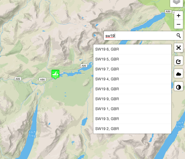
Some notable changes in this release see the addition of a Search Box.

In the search box you can enter a street address, a town or a postcode, or a set of co-ordinates in a “lat,lng” format, eg: 56.88971, -4.673288

You will also notice that we now display the co-ordinates of each Location that GADC members have added.

This should be ideal for using on other mapping applications and/or entering in to your sat nav:

Another great change that we’ve made is to cluster the Location markers.

Displaying several hundred markers on the map was making it look very cluttered:

Screen Shot 2020-01-06 at 19.25.22

We now cluster them in to neat groups!

You can simply click on a cluster to zoom in and expand it, or simply pan and zoom around the map and the clusters will automatically expand and contract as you go.

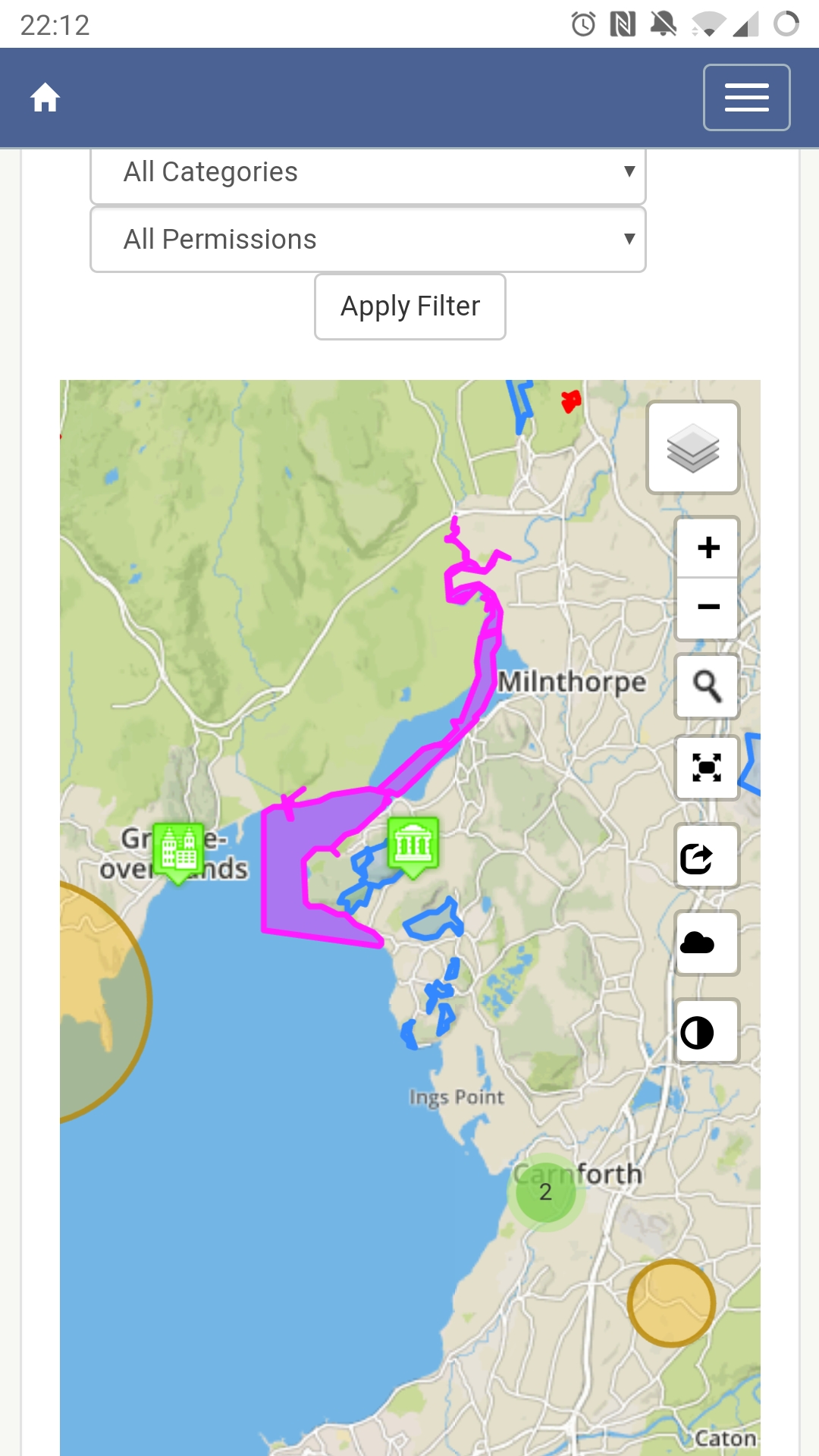
We’ve also changed the way we handle the adding of Locations when they fall inside a FRZ.

Previously you needed to tick a box to confirm the Location was not inside a FRZ. This was counterintuitive as some Locations inside FRZs can be flown perfectly legally with the correct permission having been obtained.

We now ask you for a few more details about the flight itself:

Screen Shot 2020-01-06 at 19.32.11

We also squashed a couple of bugs and made a coupe of minor changes elsewhere.

For the technically minded / curious:

Release notes (click to expand)
  • Added a Search box
    So you can quickly jump to an area

  • Added the co-ordinates of each Location in to the info-balloon
    And also in to the Details section below the map

  • Added the Category and Region to the Location Details
    Because we were displaying them in the page <title> tag and nowhere else

  • Fixed a bug that prevented images being uploaded if the file extension was in capital letters (eg. filename.jpg would work but filename.JPG would fail
    Thanks to @macspite for reporting this issue

  • Fixed an issue that prevented text from wrapping around an image
    When viewing a single Location, the description text was pinned to the right hand side of the screen instead of wrapping neatly around the image preview

  • Fixed an issue that caused the location marker to display somewhere other than where you placed it
    If you tried to drop a marker pin on a location that had a Layer element in the same place the marker pin would be added to the location on the map that you last clicked on
    Thanks to @OzoneVibe for working out how to replicate this issue

  • Improved the performance of the Location markers
    As loading 500+ markers was taking a couple of seconds. It now takes less than 0.3s

  • Cluster the Location markers
    In a heat-map type arrangement

  • Persist the viewing location when changing pages
    Clicking on Add Location used to reset the map back to the whole of the UK
    Thanks to @mockingbird71 for this Feature Request

  • Changed the way we handle Locations being added that fall inside a FRZ
    As some flights can be legally made inside a FRZ with the correct permissions having been obtained
    Thanks to @stubbyd for this Feature Request

  • Prevented layers being clicked on while adding a Location
    When trying to drop a marker pin on a location that was over a Layer (eg. Parks, FRZs, etc) the info-balloon was appearing (as expected) but what you really want to do was drop a pin on the map

  • Fixed a bug that meant photographs need to be uploaded again if the form wasn’t correctly completed
    Thanks to @OzoneVibe for finding this bug

As always, we hope you enjoy these new features and please do keep adding your locations to the map!

15 Likes

This just keeps getting better and better - thank you for a most valuable resource and all the effort to put it all together :+1: :+1: :+1:

4 Likes

Yeah - Rich codes, and I pick the holes in it. #GreatTeamWork :stuck_out_tongue:

3 Likes

I have to say, Rich has done a fantastic job. It’s all become really tidy and slick. :+1:

2 Likes

Glad to hear it :slight_smile:

We’re all ears if anyone has any feature requests to improve Drone Scene even further :+1:t2:

Which reminds me, I must ask for that Devil’s Advocate card back :smiling_imp:

3 Likes

Loving the cluster aspect, and that I’m basically the cause of one of them :rofl: :rofl:

2 Likes

Awesome work!! Very nice

1 Like

It really is a superb piece of work. Well done.

2 Likes

We’ve made some more changes to Drone Scene today.

  • Changed the stacking order of objects inside a Layer
    – This should help make some items “more clickable”

  • Split Airports out in to a Layer of their own
    – So you can now view them separately from the Flight Restrictions Layer

  • Split NOTAMs out in to a Layer of their own
    – See below

  • Made NOTAM Layer always display “above” other Layers
    – Some Airspace Restrictions are the exact size and shape as some NOTAMs, meaning you could not always see/get to the NOTAM because it was below the Airspace Restriction
    @JoeC this will help with your Birkhall example recently

  • Made the Titles in the Location balloon popups clickable links to the Location URL itself
    – Just because :man_shrugging:

  • Changed Search function to exclude full addresses and instead start at Town level
    – Much as we love the search tool we introduced, it was always trying to match an address first
    – This made it almost impossible to simply find a town or area
    – We no longer try to match addresses meaning you can search for “Birkhall” and get usable results
    – Postcode searches will still work
    – As will Co-ordinates in a "lat,lng" format

6 Likes

You guys are relentless! Thanks for the hard work, it’s a brilliantly useful tool :slight_smile:

4 Likes

Drone Scene has gained another significant new feature today!

You can now submit a flight report to NATS, directly from Drone Scene :tada:

Not only that, but you can also manage all of your existing active / future flight reports and also view your historic flight reports too.

We’re hoping this new feature will be quite self explanatory but in a nutshell:

  1. Click on Flight Reports at the top of the Drone Scene site
  2. Link your existing NATS account to Drone Scene
    – You can unlink it at any time
  3. You’ll then see all your current / future flights
  4. Click ‘Submit new Flight Report to NATS’
  5. Drop a pin on the map for where your flight will be
  6. Give it a title, tell us if it’s Recreational or Commercial, add a start date and time (or click ‘Today’ if you’re flighting right now)
  7. Job done - your flight will be pushed to NATS and their partners within a second or two

That’s it - as simple as that!

You only need to link your account once, not every time.

Enjoy :smiley:

8 Likes

Oh, forgot to say, we’ve also done away with the red/yellow/green banner at the top of the page which tells you to zoom in to reveal more detail.

This notification has now been moved to inside the map itself, as previously when viewing the map in full screen you couldn’t then see the message telling you to zoom in :blush:

4 Likes

Also, an added bonus for the the Android users amongst you.

You can now add the Drone Scene site to the Home Screen on your device and it’ll launch in it’s own window as a dedicated web-app :+1:t2:

Before:

After (with more screen real-estate available):

FYI, the GADC forum also takes full advantage of the Android web-app behaviour too :+1:t2:

Apple users (myself included), sorry everyone, they fucked shit up after iOS7 and we no longer have this available to us :pensive:

6 Likes


This is a screenshot around Arnside, Cumbria. The purple area, marking the estuary, I’m 99% sure wasn’t there when I checked about a week ago. Can’t find an explanation of the colour code to know what it’s for and clicking in the area doesn’t pop up an explanation.

There’s a similar shading along the west coast north of Barrow-In-Furness.

Can someone point me to an explanation or tell me what it means? The areas are not marked Drone Assist / Guardian.

(Moved your post to this thread.)

If you turn off individual layers (hint - Foreshore and Estuary) you’ll see which section something belongs to.

The features recently added to DroneScene, including this one, can be read about above.

1 Like

I changed & applied the filter to.just Places of Worship expecting only Places of Worship to be displayed but it didn’t change anything, everything is still displayed including the coast & estuary markers. I’m on Android launching from a saved icon on the home screen i.e. web app.

… which, for the locations flown that are being displayed, is correct. But that isn’t how to change the map layers being displayed.

… and that purple area has gone … as would any other of the layers if deselected. :+1:

2 Likes

Thank you, I didn’t check the layer option thinking it was the usual road/satellite/terrain option for the map display :roll_eyes:

Sorry to appear a bit dim but is this saying that the marked areas are good areas to fly? The coastal markings going north from Barrow overlap with a danger area so I’m a little confused as to what it’s telling me.

Dronescene has merged information from several sources (including Altitude Angel, National Trust and Crown Estates) to provide the only single resource where all this information is available on a single map … *real-time *… to save the pilot from having to preform multiple researches and merge that data themselves.

The Crown Estates map data, from which the foreshore areas in Dronescene are obtained, only gives the locations of their own acceptance of drones, without reference to other rules or restrictions, as would be your take on the situation were you to research the flyability of a location using JUST their map.

And it is in this manner that the overlapping data should be interpreted.

Areas may overlap with all manner of other restrictions totally out of their control, or their interest.
Some overlapping restrictions may only be during certain hours and between certain dates, in others permission to fly may be obtainable, or they may be advisory.

The pilot’s job is to determine the net restriction that applies to his proposed flight at the time he wishes to fly, and obtain permissions where necessary. Dronescene just saves the pilot from having to go to multiple maps to be informed of the same information.

4 Likes

Not sure how easy the data might be to get hold of, but any chance of a layer for the National Trust for Scotland properties being added to your long list of future features? NTS seems to be a little more relaxed about drones than their southern cousins, but they still have restrictions and some of their ‘properties’ cover entire mountains.

They do have a dataset (Marine Scotland has it) but I can’t see it on the National Trust for Scotland website.

(edit: Historic Scotland as well, if you’re bored and looking for something to do. :wink: They don’t allow flying from their land, but can be difficult with some sites to judge where their land ends and public ground begins)

3 Likes