99% Rich, these days, trawling through and amending/adding/tweaking code.
The guts of it is so well sorted, already, that the rest of us are reduced to doing some testing of flawless new tweaks when he’s happy with them, and applauding his skill and determination to achieve each release.
I see St Nicholas Park Warwick is marked. This is a council park and flying is forbidden. The car park (Myton Fields) the other side of the river is also council property. The Warwick CC have two places for flying…Warwick Racecourse with designated area and Newbold Common with a designated area. Just a heads up…
Dronescene cocatenates map data from various sources. As this thread shows there is no national database of council policies, a significant proportion of local authorities yet to answer FOI questions and therefore no-one has put together a council policy map that can be used as a source for a Dronescene layer.
What if we expand it further, so when you ticked the box it would automatically post a reply on the relevant thread here too, a simple one-liner: I’ve flown here
It’d bump the discussion and also let the OP know that someone else has flown in a location they recommended?
IF DS was an App i’d agree but its browser based and it zooms in waayyy too far on initial filtering for your location … I prefer Guardian (Altitude Angels which powers Drone Assist as well) and the ability to log your flight is very useful. Not sure DS does that …
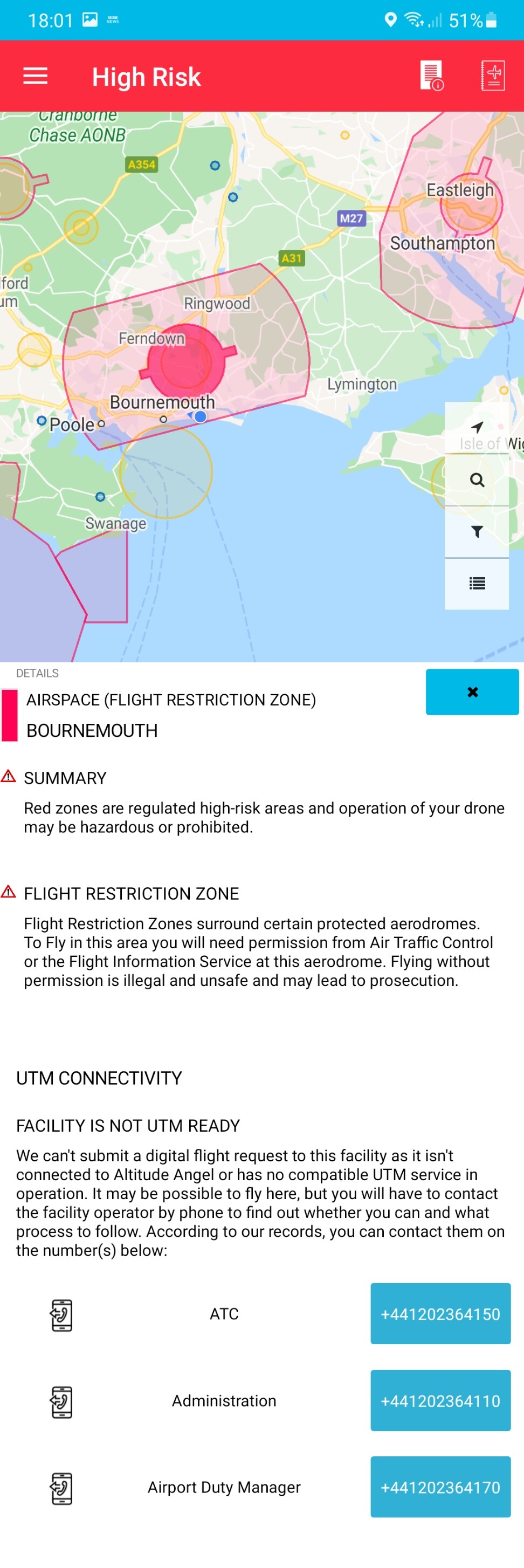
And I am not knocking DS its great for what it does but the info on the Airspace restrictions in Guardian or Drone Assist is more informative. DS simly says its a Class D CTR airspace but no details of it whereas DA will show you the full restriction …
but not in how its shown… click on it in DA it shows the full description of the airspace , thats not what it shows in DS it simply shows its as just a category D airspace …
use DS for where I might want to fly but I use Guardian/DA for the airspace and ground restrictions … its just IMHO better.
Can DS log your flight ? I cant see where if you can …