• Council Byelaws, Public Space Protection Orders (PSPOs) and Policies
Back in 2024, Grey Arrows Drone Club submitted a Freedom of Information request to every local authority in the UK, asking if they had any byelaws or policies relating to the recreational use of drones.
Not only have we done it again for 2026, but this time we’ve asked additional questions and we’ve mapped the results of every single council directly in to Drone Scene
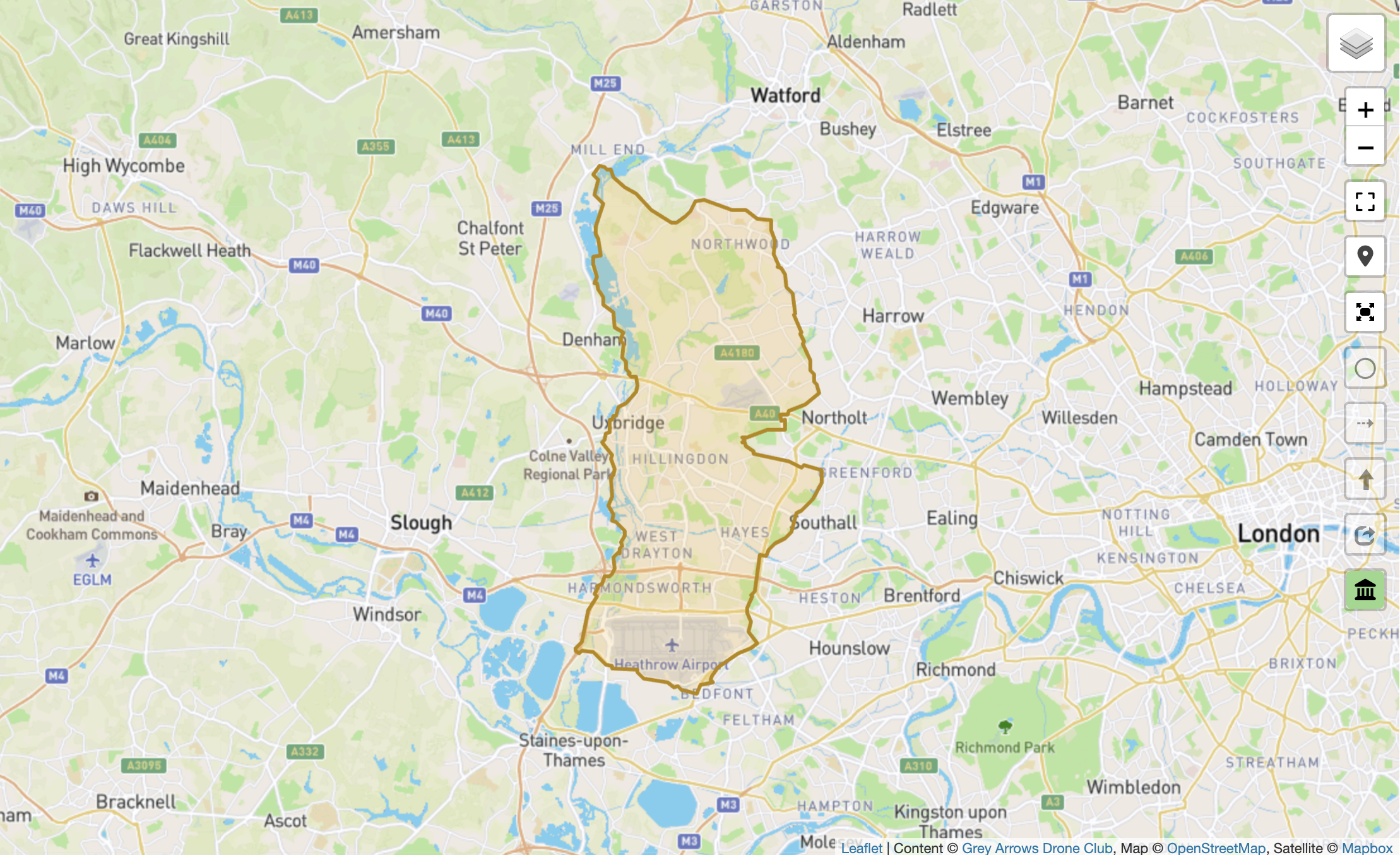
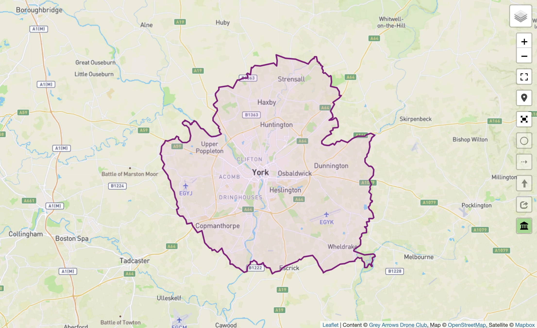
Over four million data points make up and define the exact boundaries of each local authority.
Our 2026 round of FOI requests asked three very specific questions of each council:
Do you have any byelaws that are used to regulate, restrict, or prohibit the recreational use of drones from land under your jurisdiction? If yes, please provide:
a) The dates of each byelaw.
b) A digital copy of the byelaws or a direct link to the specific document or webpage where the information can be accessed.
Do you have any Public Space Protection Orders (PSPOs) that are used to regulate, restrict, or prohibit the recreational use of drones from land under your jurisdiction? If yes, please provide:
a) The dates of each PSPO.
b) The locations and areas these PSPOs cover.
c) A digital copy of the PSPOs or a direct link to the specific document or webpage where the information can be accessed.
Do you have any policies that are used to regulate, restrict, or prohibit the recreational use of drones from land under your jurisdiction? If yes, please provide:
a) The dates of each policy.
b) A digital copy of the policies or a direct link to the specific document or webpage where the information can be accessed.
As you’ll see, we’ve ask for the details of anything a council can use to regulate, restrict, or prohibit the recreational use of drones from their land – including any PSPOs.
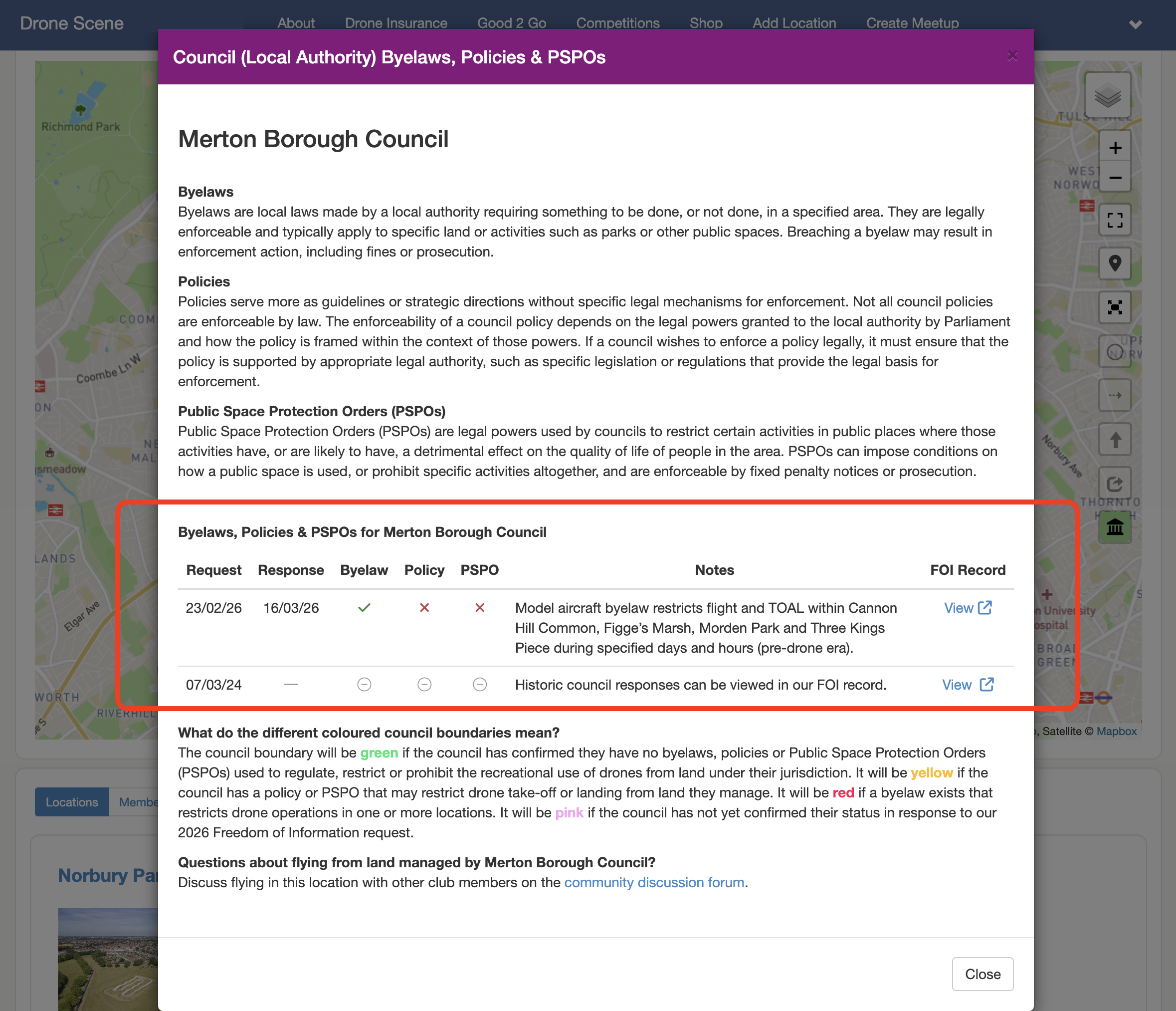
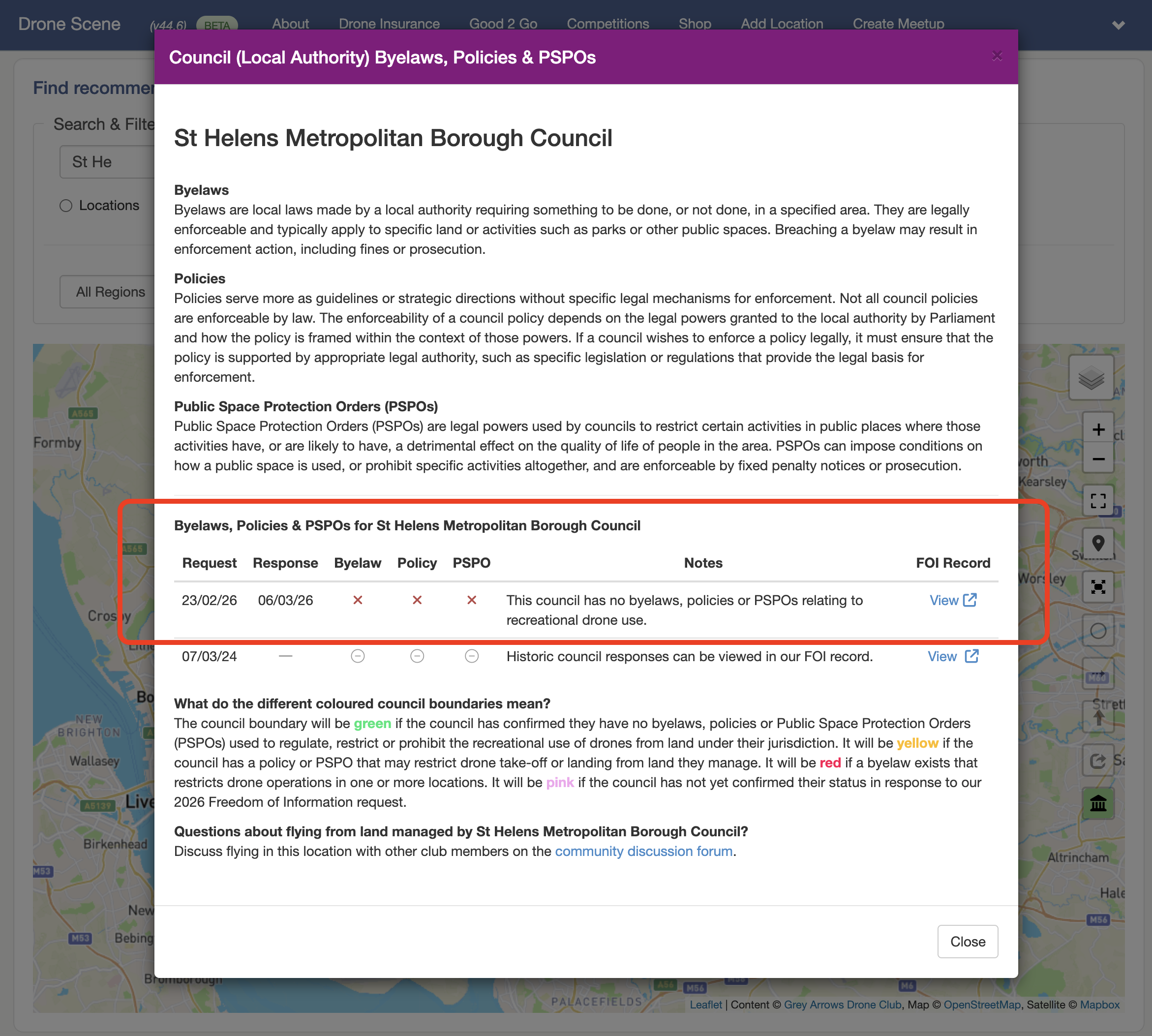
A Public Space Protection Order (PSPO) is a legal power which can be used by councils to restrict certain activities in public places where those activities have, or are likely to have, a detrimental effect on the quality of life of people in the area. They’re similar to an Antisocial Behaviour Order. These PSPOs can impose conditions on how a public space is used, or prohibit specific activities altogether, and are enforceable by fixed penalty notices or prosecution – they’re important.
The results of our 2024 round of FOI requests were linked in to Drone Scene, which meant when you wanted to find out about a particular council you had to spend some time reading though our full request, and all the various replies we received from each council. Quite a time consuming task, but the answers were available to you nonetheless.
However, in our 2026 round, we have brought all the responses directly in to Drone Scene, so now Drone Scene knows the response
This means you no longer need to wade through countless FOI requests and responses, you no longer need to wade through some often very outdated byelaw documents trying to decipher them, we’ve done it all for you
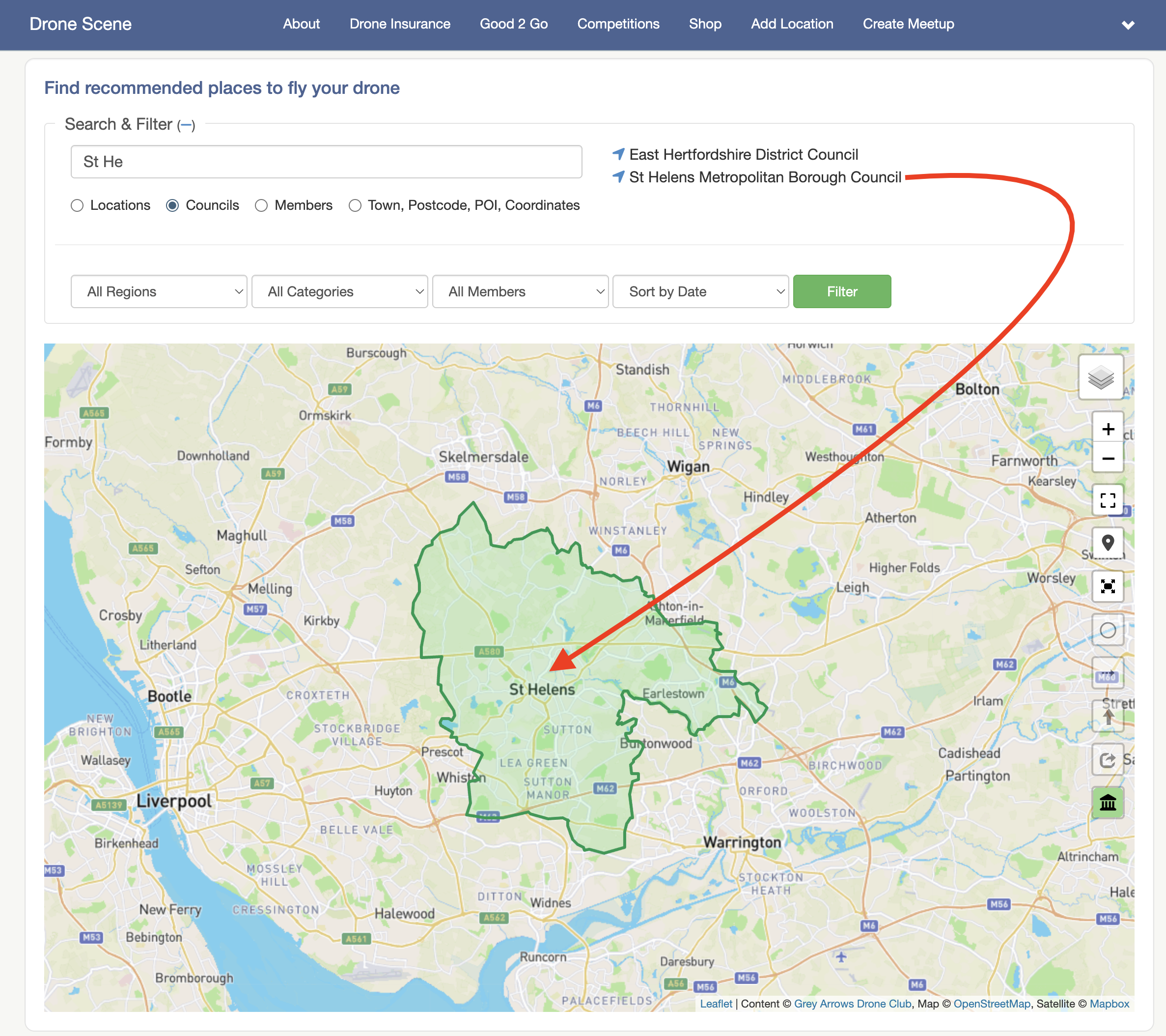
You can now instantly see if a local authority has a byelaw, a PSPO or a policy that they can use to restrict you flying from their land.
Each council boundary is now displayed in a different colour to quickly visualise any blockers that might be in place.
The council boundary will be green if the council has confirmed they have no byelaws, PSPOs or policies used to regulate, restrict or prohibit the recreational use of drones from land under their jurisdiction.
Furthermore, clicking on the council boundary will open a popup modal which contains a very simple checklist of the status of each council. Green ticks or red crosses give you a very quick indication of the status, along with a short summary of any specific or important details.
This table will build a historic picture in future successive years.
Also within each detailed popup is a link to view the entire FOI public record which contains every email we sent, every response, every legal document – providing you with full and complete transparency.
Access to this feature is included with Silver and Gold Membership.
If you’re currently a Bronze member, you can upgrade to unlock full Drone Scene access, including council data, competitions, and additional member benefits:
When reviewing FOI responses, it’s not uncommon to encounter vague or ambiguous replies, where councils present documents in a way that suggests they carry more regulatory weight than they actually do. We’ve worked through these responses carefully to ensure the outcome presented in Drone Scene is clear and accurate.
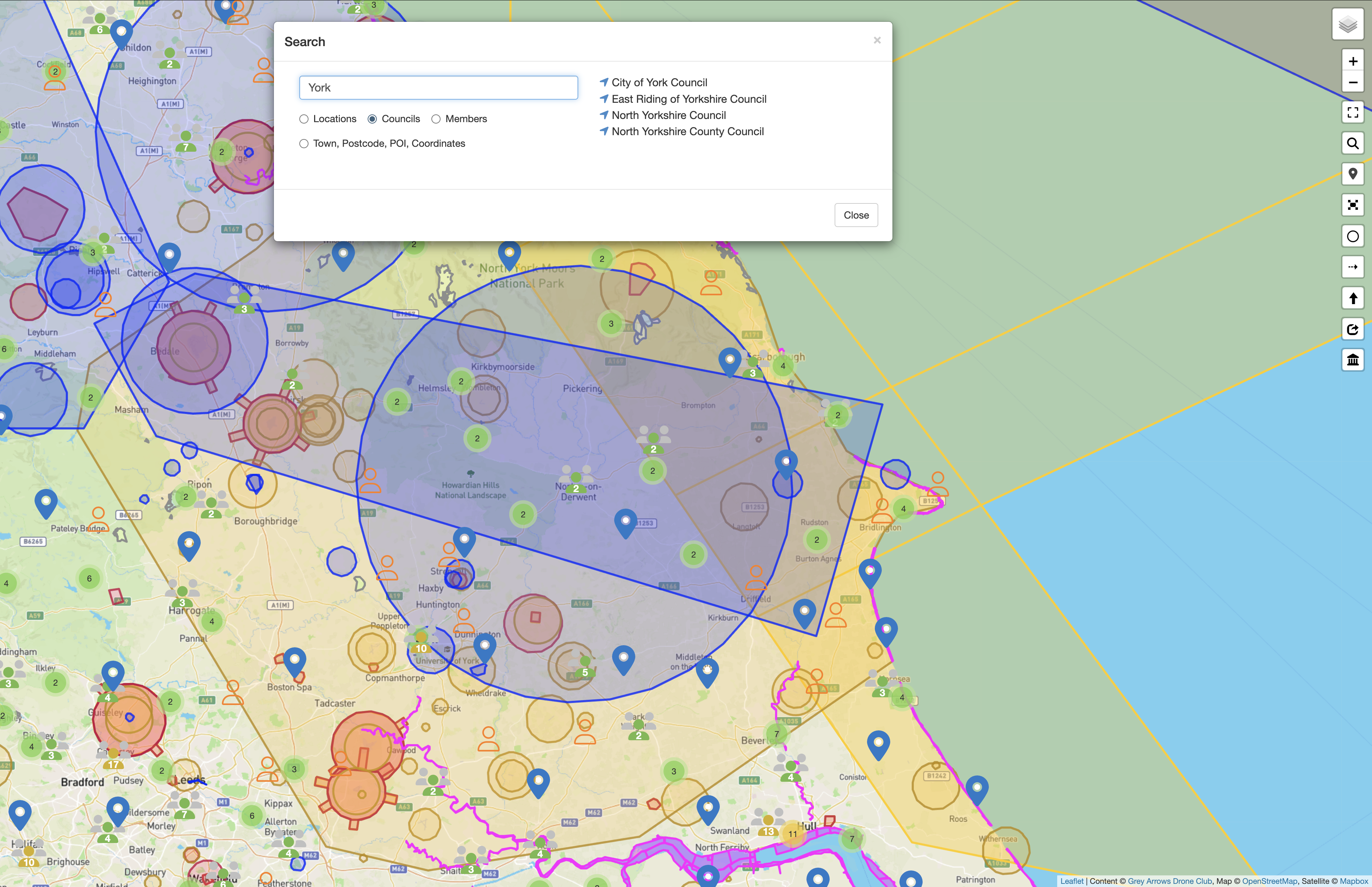
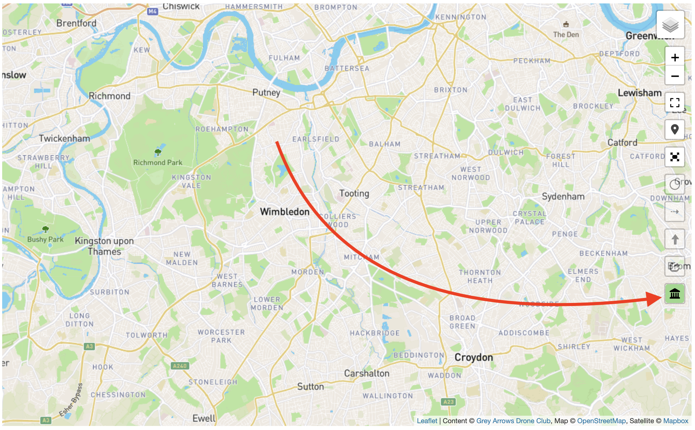
In the past, whenever you use the map on Drone Scene in full screen mode, you lost visibility of the search features.
This meant that when you wanted to search for something you needed to exit full screen map mode, perform your search, then switch back to full screen map mode.
We’ve now added a search icon to the full screen map.
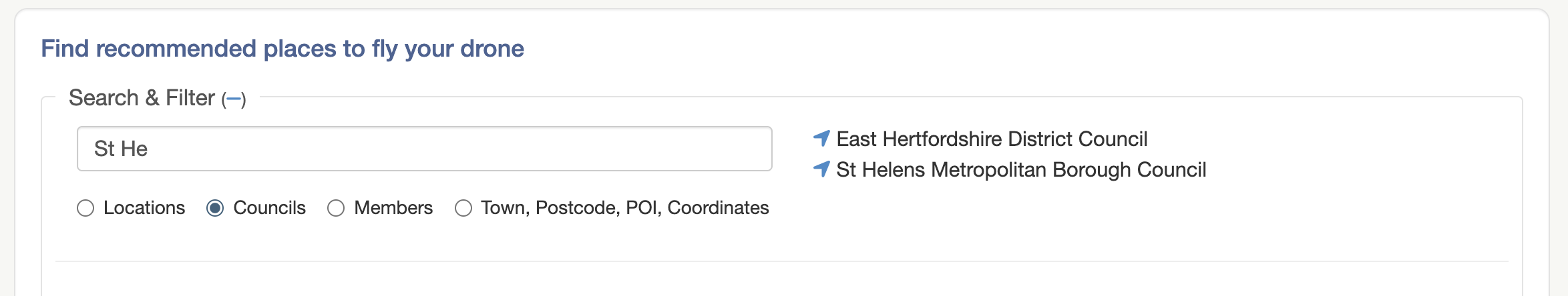
This allows you to search for locations, council byelaws, local club members, towns, postcodes and more – all without leaving the full screen map mode.
You can then click in the boundary to see if that local authority has any Byelaws, Public Space Protection Orders (PSPOs) or Policies used to regulate, restrict or prohibit the recreational use of drones from land under their jurisdiction.
When you change the search type to anything else, such as Councils, Drone Scene will now remember your preference and will default to it on your next visit.
Similarly, if you perform a search for Town, Postcode, POl, Coordinates then that last used search type will be remembered too.
• Changing the search type now places the cursor in the search box for you
If searching for a Location and then changing the search type to Town, Drone Scene will now automatically place the cursor back in to the search box for you.
Not specifically requested by @NDangel but it ties in with his requests for less search clicks
If there are no useful markers on a location (such as parking, toal, etc) and you add the location to your list then Drone Scene would add an extra line of text on to your forum reply, asking if anyone else could add some useful markers.
As @CutThroatJake rightly pointed out, that wasn’t his original intention.
We’ve changed this now so that if you share your intention to fly at a location, that’s all the forum post will say, just that you want to fly there and you’ve added it to your list – nothing more
What do you get out of joining the Beta Tester Programme?
Early access to every single new feature on Drone Scene the moment it’s been developed
– Often weeks or months ahead of the feature being rolled out to the public / production version of Drone Scene
The opportunity to help steer the direction of new features
Access to the Drone Scene (BETA) forum category
– Shushhhhh, this part is a secret
A very exclusive badge to adorn your profile
– And who doesn’t love a badge?
What do we need in return?
We need the new features testing
– Before we release them out in the wild
We need you to use the BETA version all the time
– Instead of the current public / production version
– And why wouldn’t you? It’s packed with all the shiny new stuff that nobody else has access to yet
If this is something you might be interested in helping us with please get in touch and let us know why you think you’d be a great addition to the group
Of the nearly 400 local authorities we submitted FOI requests to, around 50 have either not yet fully responded or have provided only a partial response.
They are now outside their legal 20-working-day deadline, so if you’re not seeing any 2026 results for your local council, please try again in a few days. We’ll be chasing the remaining responses this week
If you don’t want to search and just want to click around on the map to have a looksee, don’t forget you can turn the council option on and off with this icon on the bottom right hand side: