I’ve had 12 hours flying my DJI Mini 2 then disaster struck… bird strike! I think it’s stuck on the side of a building and the building owners can’t see it from their windows. I could do with anyone in Portsmouth with a drone getting in touch…
Have you seen our members map? (Click the burger-menu in the top right) You may find some pilots living near you. Feel free to add yourself to the members map too
We’re a well established club with many knowledgeable members so it’s very likely that any issues you come across will have been discussed here before. Our discussion forum has very powerful search features which should help you find what you need but if you get stuck you can post a new question in the #questions-and-answers category.
Looking for recommendations of places to fly? Check out our interactive map on Drone Scene - be sure to log in to gain access to the full suite of features and map layers:
And please feel free to add locations of your own too.
Please also take a moment to look at the Membership Levels section on our FAQ as we’re quite different to other clubs and you’ll be eligible for some rather exclusive club discounts as your membership level increases
Welcome once again!
I’m not so far away … but, with current legislation, is sounds like it’s not somewhere I can legally fly my MP1.
Amended topic title - possibly someone that can fly in the location will assist.
You don’t have to message them directly, you just mention users prefixed with an ‘@’ sign. They are then notified someone has mentioned them in a thread.
Chris (@clinkadink ) has kindly stirred me into action.
I was over Fort Cumberland earlier today but launched from Hayling, which is where I live. I have an ?Air 2 which is a bit more restricted as to where I can fly - unless we can get permission from the building owners.
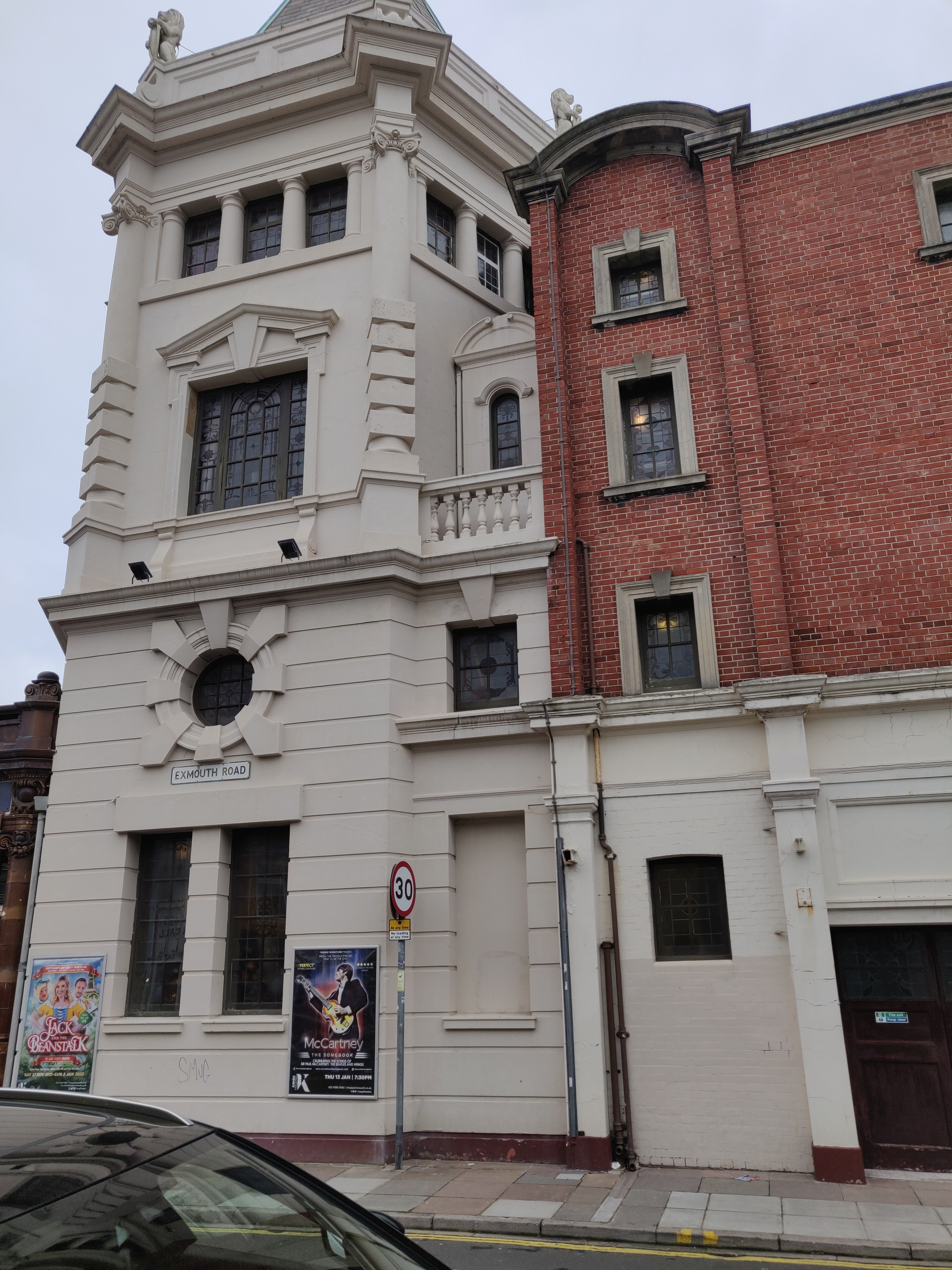
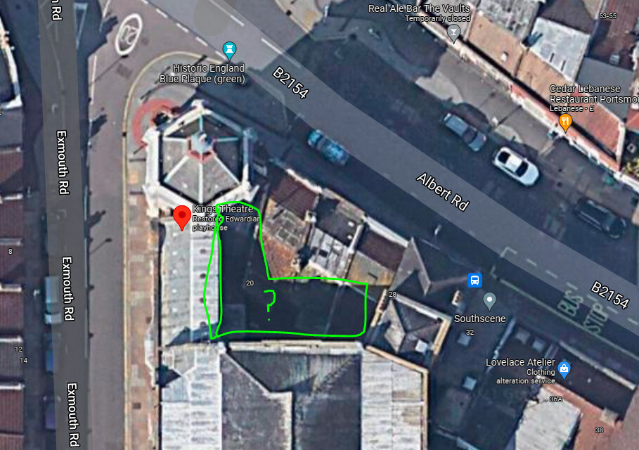
It collided with King’s Theatre on Albert Road. I did talk to the staff but they could not see it out of any windows. I do have a contact number though to ask for permission.
Thanks for taking an interest in my little lost drone problem. I have the last image on screen before collision, then the battery popped out. The altitude seems to indicate 14 metres.
Apparently that window over the balcony only opens to a limited extent. Perhaps if I create a “mirror on a stick” contraption, I might have more luck.
That area you highlighted @Steviegeek is an architectual quirk since those three shops predate the theatre, the shops were eventually acquired by the theatre and converted to office space (I believe). So there is a huge gap to fall into. I did see the drone hit the side of the build so I don’t think it’s in there.
Ah I had not used Airdata before - pretty cool. @RemoteIDsaveslives On the large map, you can see a bunch of errors before the crash, and the angle of impact.


 I have the last image on screen before collision, then the battery popped out. The altitude seems to indicate 14 metres.