Thanks for that it had me a bit worried lol![]()
Ringway Manchester, reports on a recent NFZ in the area with a NOTAM referencing GPS and RF jamming, likely to secure airspace from drones during the King’s visit.
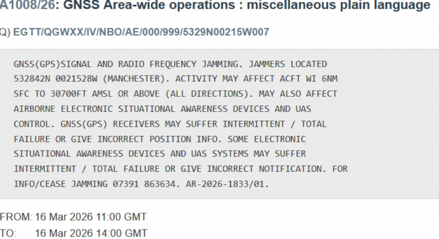

Despite the title of the video, I fail to believe an entire city was GPS ‘jammed’ …
1 Like
Ye, I think the effected range is in the NOTAM
ACFT WI 6NM SFC TO 30700FT AMSL OR ABOVE (ALL DIRECTIONS)
6 nautical miles from those co ordinates “(532842N 0021528W)”
Which in practical terms would be a fraction of the 45 square miles, I think the city spans.
He is relatively sensible but willing to play that click bate game, which I would assume is no small contributor to him being one of the more favourably broadcast channels in what is a somewhat small niche.
Also thank you to the mod that merged, please excuse the mistake as I didn’t see the topic.
As above …
.. and, even if it had an effect on drones .. it was only active between 11am and 2pm today.
1 Like
Yea I do question the effectiveness. I’m sure the aim more often is a chilling effect.
Afternoon fellow drone enthusiasts
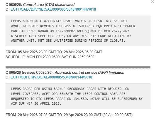
Not 100 % sure on notams and i don’t want locking up by the drone police, Can i fly here with this in place??
Regards,
A confused drone pilot.
2 Likes
It’s essentially telling you that the old Leeds Bradford CTA is being reverted back to Class G airspace.
Class G airspace is uncontrolled airspace and it’s basically wherever any controlled or regulated airspace doesn’t exist.
More here: Uncontrolled airspace - Wikipedia
Safe to ignore this one @GIbbo23 ![]()
3 Likes
And unless you intend to fly between 2300 and 0600 its doubley of no consequence
2 Likes
Thanks guys ![]()
1 Like
Always ask if you’re unsure of anything @GIbbo23
There’s helluva lot to get your head around ![]()
1 Like
Hi Guys,
New here but have been flying drones for around 2 years and commercially for over 12 months.
Had some confusion last week when in Cambridgeshire and an active NOTAM warning popped up on the Drone Scene app. I called the airfield asking whether I could fly to which they “couldn’t advise” one way or the other. Both confusing and annoying!
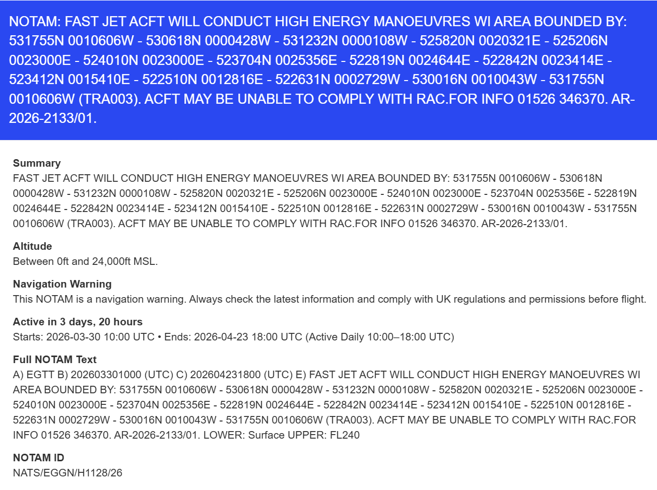
I’ve got a commercial job next Wednesday in Peterborough and the following NOTAM warning has appeared for the area:
Question is:
- can I legally fly within this NOTAM? and
- Is it advisable to given the high speed nature of the aircraft?
Thanks in advance…
Yes, it’s a navigation warning, not a restriction.
Highly unlikely you’ll have aircraft buzzing you at a minimum of 400 feet.
Depends on the aircraft. Military tends to do whatever it wants. Years back, when i was taking aerial photos - must be mid to late 1970’s - we used to flu at 500 feet and often give ourselves a discount if the target was small. One day my viewfinder blacked out momentarily as if I had taken a picture and the mirror had done its thing. It wasn’t the mirror blanking the view, it was a Vulcan
flying underneath us!
4 Likes
Thanks for the replies. Should have mentioned i’ll be flying botht the Mavic 4 Pro and the Mini 4 Pro but it’s open countryside so don’t think the classification matters in this instance - rather whether it’s sensible.
I can’t imagine they’ll fly lower than 250ft through the area given the infrastructure, housing etc?
It will probably be miles away from you, most of those zones that cover stupid sized areas are never fully used for exercises.
1 Like
Hi
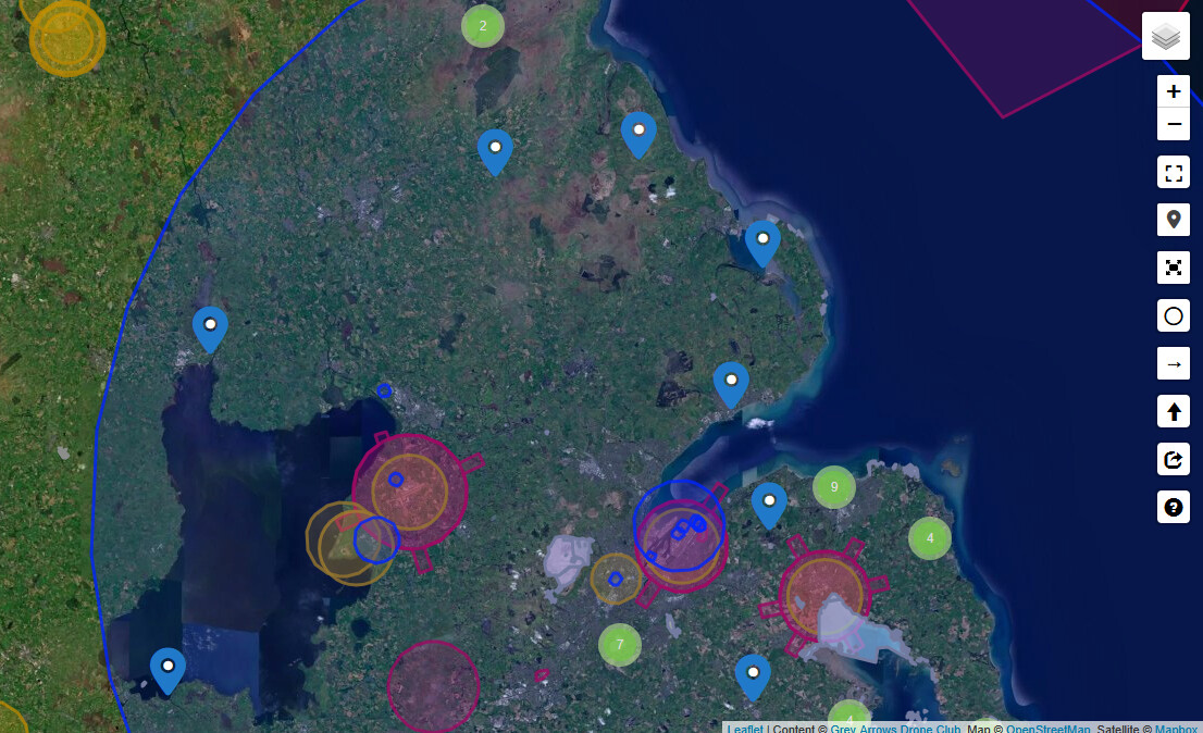
A new message has appeared in Dronescene, and it is a bit technical, and hard to understand. I’m wondering if someone could be so kind as to put it into layman’s terms for me, and how it might affect flying a drone in this spectacularly large blue area. TIA
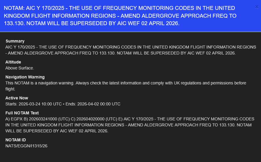
Never seen one of these before but it looks like its just a notice to pilots about the radio frequency change or change of system - so no impact on a drone flight at all.
3 Likes
Thanks.
Yep the clue is in the wording… Aldergrove approach frequency. It’s related to Belfast International Airport.
1 Like