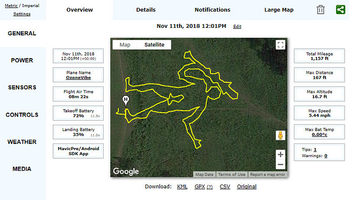
This one. ![]()
Just looking into this now, Going to have to work out an angle to shot this from the ground there for the tips of the wings are going to have to be the highest point and lowering the altitude the lower down the bird? sound right?
I’ve printed it on paper and holding that above my head I’m trying to visualise it in the air.
I think even flat in the air at the right altitude would still give a nice silhouette. 
Love this idea. Filming it yes but a long expo photo, it would have to be a rapid flight of 8 seconds. ![]()
![]()
I had quite a few discussions with the Lumecube guy, above, about how he planned them.
Basically, he used 3D software, exported all the points, and wrote software to convert them to the points needed by Litchi. He’d create them at 0°N 0°W, then use Virtual Litchi Mission to relocate the mission to where he wanted to fl and adjust other factors in that.
The mission files on your phone can be opened in a text editor to see the format - and for something like that cube, above, not too(!!!) difficult to do manually - for a few points.
Curves, and shit … that’s another story, and his software needed.
Even getting ground shots of my “vertical” Cerne Giant were a problem.
The size I needed was almost a 10 minute flight … so many points it had to be slow to prevent it looking crap at the points. (Yes - something more simple would be quicker … but I wanted an “erect” Cerne Giant, didn’t I. ![]() )
)
THEN you need a setting and filters to get a 10 minute exposure - but still see the stationary object you are flying around.
THEN you need lights on the drone that are bright enough to be seen at all with that exposure.
By the time I was getting close - I’d done all my batteries, and the sky brightness was different each time and all the faff had to be repeated.
I gave up.
Air to air is a non starter, really.
It has all the same issues as getting trails of the ISS … other than you have no control over the brightness of the ISS.
LOL
Maybe try it flat as a starter see what it does. Not used litchi before or at least missions. I’m guessing it can be canceled if say It was heading towards a tree with the tap of a button.
Also if I took off from no where near my start point it would take off then go to number 1 by itself?
Maybe its better to try this in the day light when the OA are working and not in the dark ![]()
Flat was Eeeeeeeeeezy!!!
VLM is your friend for this kind of thing … tho power cables and the like aren’t seen.
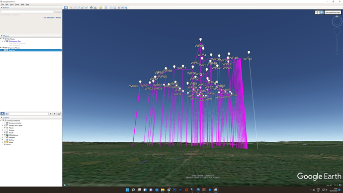
But the mission can be exported in 3D to Google Earth and rotated as far as 90° to see what it would look like as a horizontal shot, if not far enough to be looking up at it.
![]() Easy enough to do? I see it says export as 3D path…
Easy enough to do? I see it says export as 3D path… ![]()
From VLM it’s easy, yup.
(Add missing letter “y” to all posts where needed … new (impossible to find) keyboard needed for my laptop.)
From VLM …
… opens Google Earth …
That was my flat Cerne Giant. Gave up and deleted the attempt(s) at the vertical version(s).
Are you using VLM? … “Virtual Litchi Mission”.
Crap no, sorry that’s straight from litchi mission hub.
Using VLM, and selecting the CSV option, as above, it’s automatically fires up GE. No “export and load”.
VLM is so useful for 3D/terrain visualising … and the result in GE can generate a virtual fly through of the mission, too. Check out that thread … think most things are in there.
Trying to download VLM but it’s just adding it it as an extension to Chrome… is that normal?
When i try exporting KML
Hmmm, I see what you mean, This looks shocking from the ground  Going to take some serious work.


