FRZs are only for airfields, so … ![]()
That’s what I meant ![]()
Don’t be getting confused with the DJI made up bollocks that is an NFZ
King Charles visit to York to distribute Maundy money at the Minster: York roads to shut ahead of royal visit - BBC News
1 Like
Ahh yes. Charlie handing out money. Look at the thousands of drone operators who cannot fly today, because he can’t be arsed to get the train . ![]()
![]()
![]()
![]()
![]()
Handed out to the “genteel poor” who are presentable,int the Minster. Rather than, say, the actual homeless and needy - who can be found anywhere in York outside the Minster.
HMS POW stuck at rosyth for the foreseeable due to manu defect on propeller shaft bearings all involved arguing whose going to pay for repairs as it doesn’t have a warranty

Yep…You’ll see the 'SAM ’ callsign appear on ADS-B
Hello,
I stumbled across this strangely straight blue zone/line navigation warning on Altitude Angel. I’m just curious if anyone knows what this is? It’s a straight line showing a flight plan that goes straight as an arrow from the UK to Africa? It’s made me really curious… any one out there able to shine a light on this?
*if my screen shot didn’t upload, you can find it on Altitude Angel Map right next to Lyme Regis.
Many Thanks!

Software glitch… Nothing shows up when you click on that line…

Ohh blimey, what could that be!? ![]()
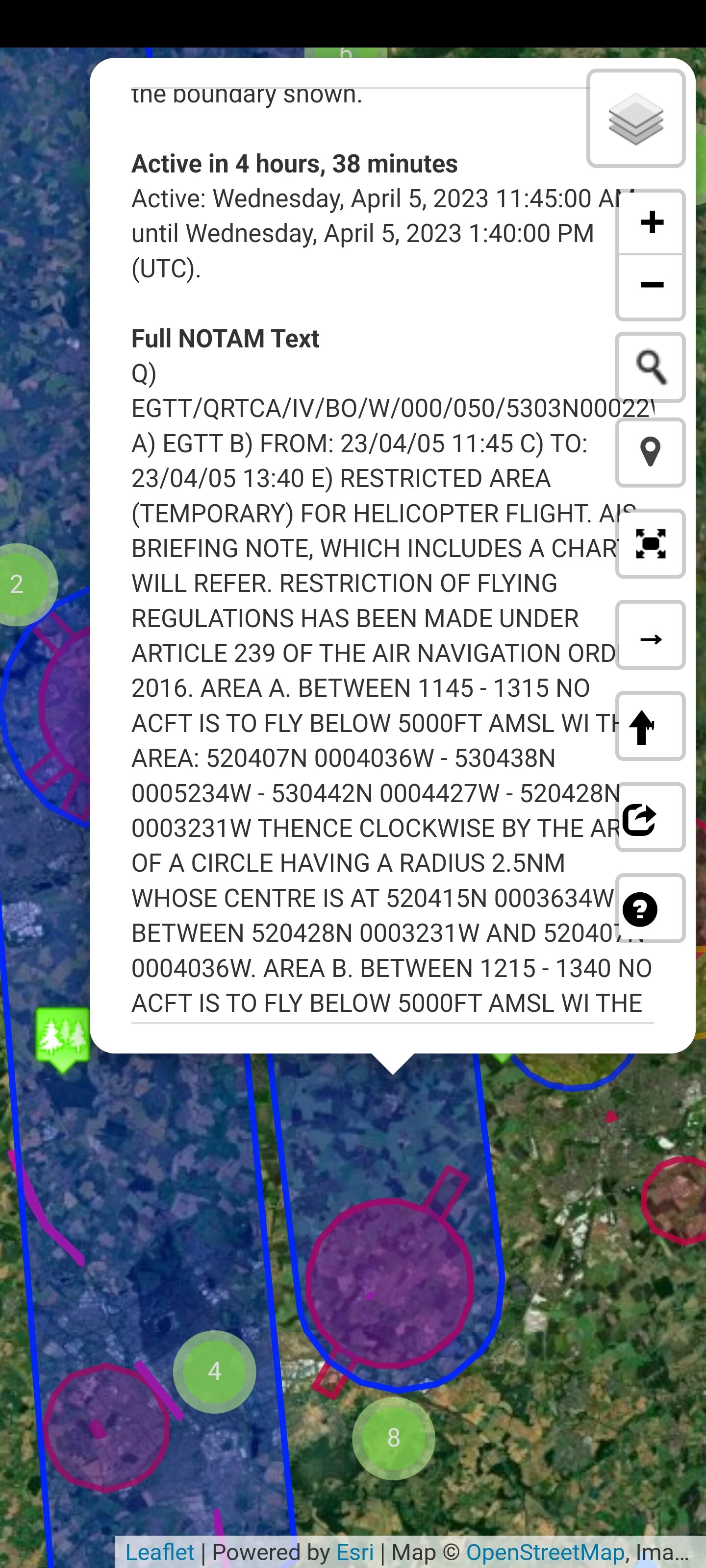
A very long, and very thin, NOTAM? ![]()
Most interesting is that it’s not going above 394ftAGL?
Probably a Cruise Missile.
![]()
Finding the northern end doesn’t help …

1 Like
UK to Africa?
8 in the morning till four in the afternoon?
Probably @clinkadink on another of his so-called speed records … ![]()
Is he doing a return trip then?
Funny it’s due south, i would def say a glitch, used to get these in mission planner for the pixhawk quiet regularly on virtually the same path finnishing in the Gulf of Guinea.