Yesterday I went for a bit of a road trip around the Hope Vally.
I did take my Mavic Mini with me but I didn’t fly.
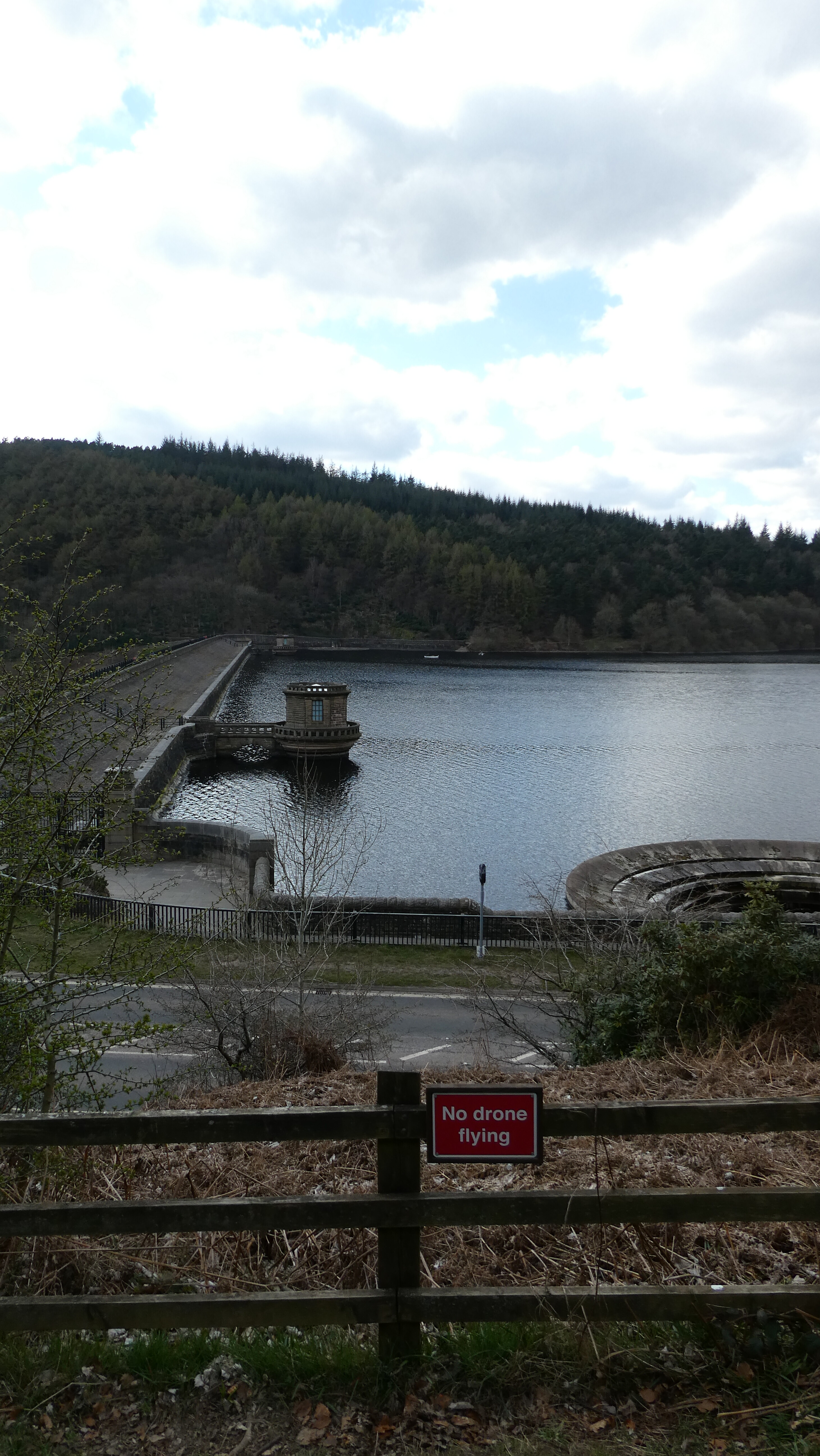
I stopped off at Ladybower Reservoir thinking about flying. On the walk from the carpark down to where the plug holes / wall is I saw this sign by a bench across the road.
I can only think this sign is to stop people from TOAL from this location and its not a full on no fly zone !
The post was just to point out that there is a sign that says no drone incase someone tried to be smart about it. The sign is in my view for that location where the bench is. So as not to fly across the road.
Probably just put there by some local who doesn’t like drones. An ‘official’ sign would more likely have the council’s logos etc on it and possibly quote whatever law they were using to prevent you from flying. You could have the drone in the air, videos/photos taken and be off before anyone appeared.
Who put it there? Is it a polite request, a legal notice, or an idle threat (like the notorious and meaningless “trespassers will be prosecuted”)? How would the request / notice / threat be enforced?
Unless the sign maker has put some effort into dealing with these likely questions, I think it’s almost a public duty to ignore it!
If I remember correctly, aren’t there some picnic tables/seat by that sign? So I’d assumed it meant no flying from there (and it’s close to the road).
If you leave the car park further up (closer to the car park entrance) and cross the road, walk along the side of the reservoir and cross the dam, you don’t see any signs at all
@Crackerjack Already use it in this way, was just curious TBH.
While bookmarking to the Home Screen is good and looks like an app, a native app will always operate better and allows for certain additional features like retaining user specific parameters.
Yes my dear "milkman "
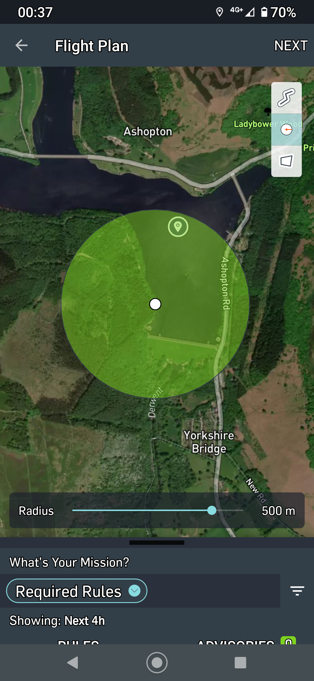
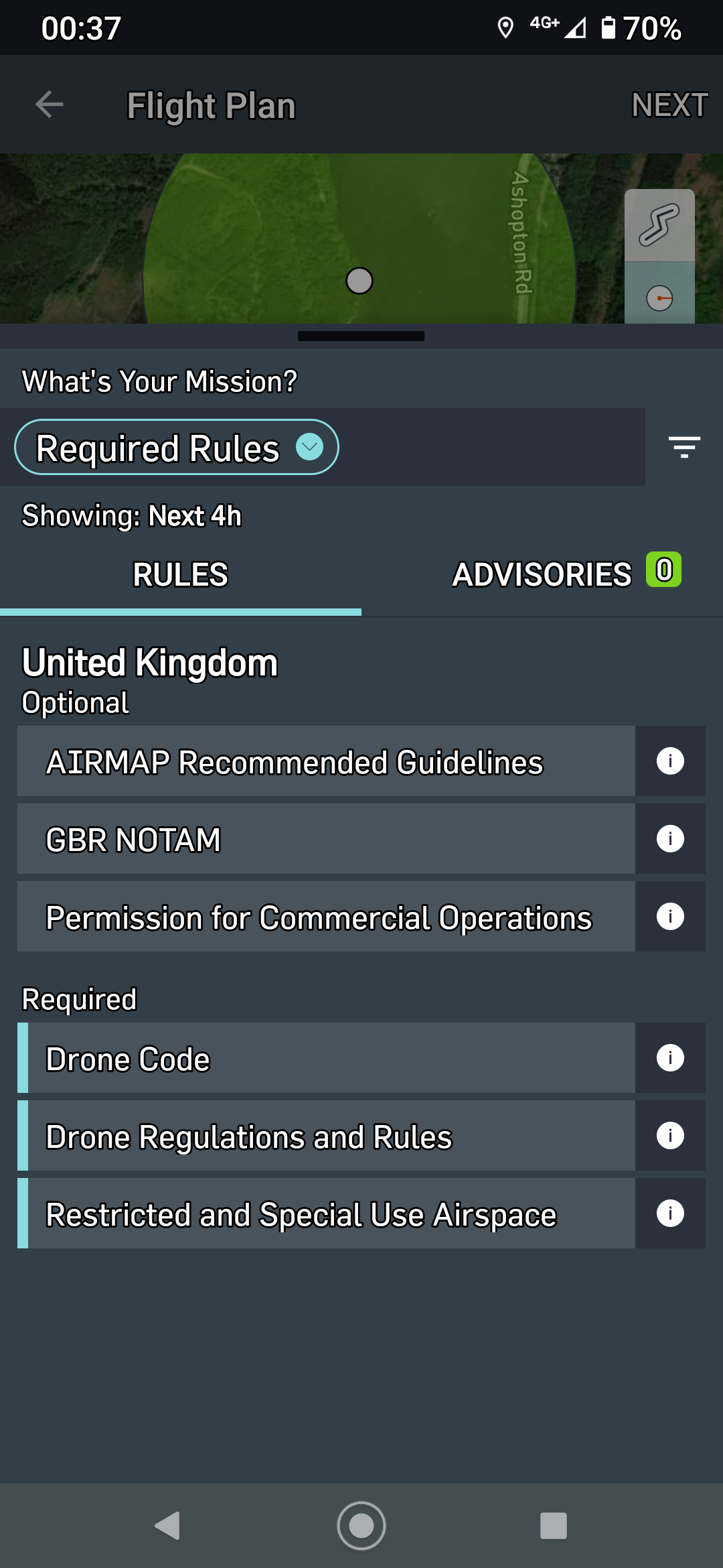
It does the job and I’m pleased to use it if I have a flight plan to do .
Now I learned that greyarrows has this map and guide . I’ll try to use both of them in the future . Got to study the new one . Thx for intel .


 Thx for intel .