The development of Drone Scene continues!

@PingSpike

Hi Rich, hope you are well. I spotted a small issue on Drone Scene.

If you follow this link, you’ll see that there are no markers/pins.

If you look at the post created by me last year…

And follow the link, the marker/pin for Newlands Corner is shown. Here’s the link to the map if you need it

Cheers

Ned

1 Like

Or rather there wasn’t! I can see it now - maybe cached after following the link in my original post when I added the pin/marker?

Ned

1 Like

I can see it no problem Ned

2 Likes

I swear it wasn’t there 5 mins ago!

2 Likes

Did you have the “Locations” layer switched off? … and now it’s on?

2 Likes

Nope - I could see the other pin I added - no problems.

Weird - but working now.

2 Likes

Exactly. Responsive UI with Bootstrap, ‘mobile first’ design. Eliminates the need for multiple versions of the same product.

2 Likes

DroneScene having a funny 5mins? Lol

1 Like

Never! … famous last words.

1 Like

Never say never :rofl:

I didn’t say never. I typed it. :wink:

1 Like

This is true, walked into that one :man_facepalming: :grin:

:+1:t2:

I was ( during a very dull video call ) scrolling around the map and sussing out potential flights.

I saw a military building marked with the normal brown highlight just south of Farnham. This particular one in Waverly Abbey isnt an active military site, its a pill box style concrete lump which formed part of a WW2 Stop Line.
( https://fsgfort.com/fortfinder/poi/ghq-lines-waverley-abbey-type-28-and-redoubt/ ).

Does this need updating / changing ? Asking as its interesting to see it marked, but not as a flight restriction.

Moved your post over to the relevant thread.

The data that the map is based on isn’t our data - it is obtained dynamically from official sources. So any possible discrepancy isn’t within our control to be edited.

Obviously the government have reasons for that area to be marked as it is.

1 Like

Wow you must be bored! Well spotted - it must be the smallest restricted area on the whole Dronescene map.

For those still searching - here it is:

2 Likes

Thank you for moving the thread and commenting. I understand.

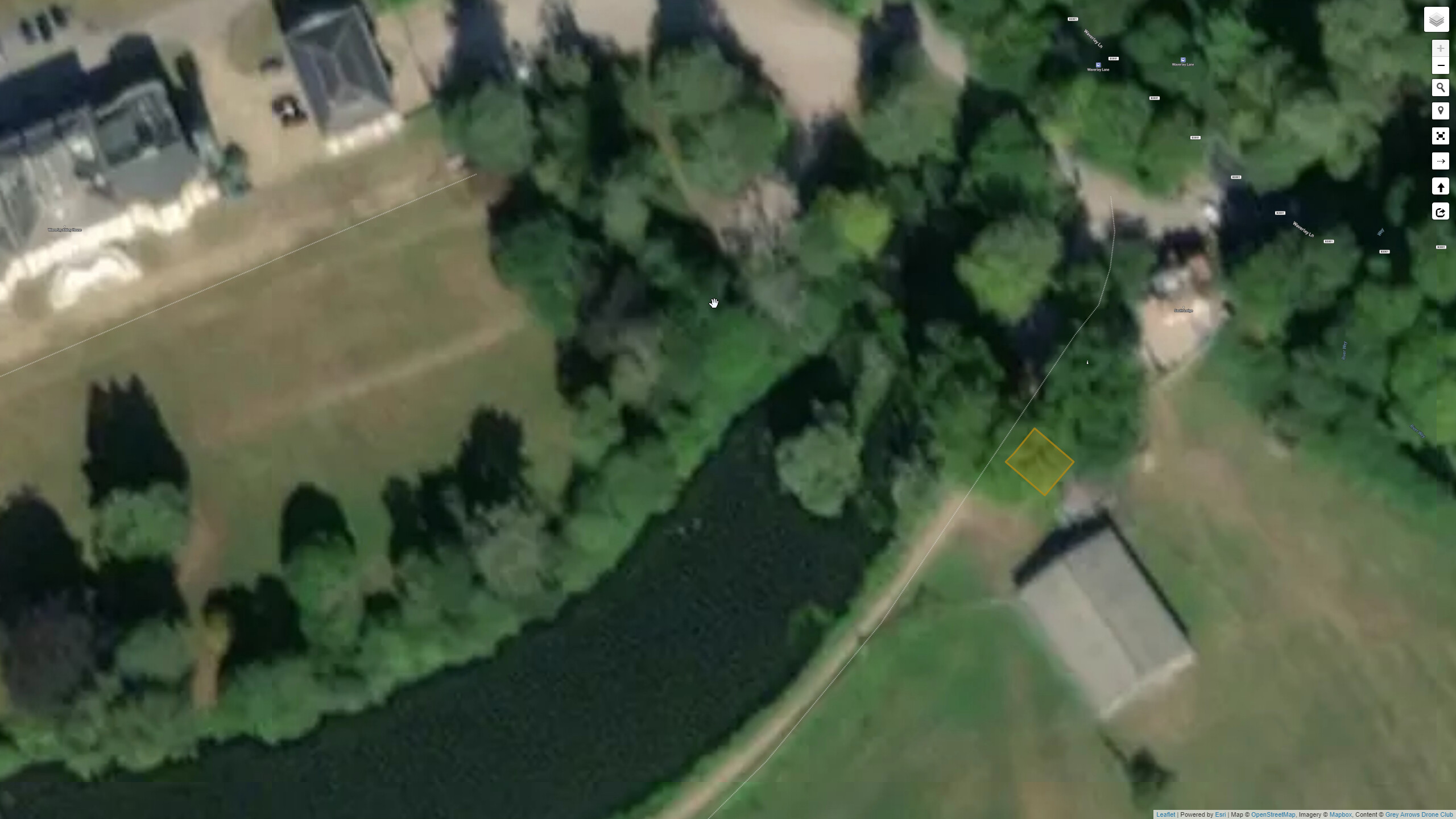
I wonder if its a size thing for them to have marked it, pill boxes are pretty small, a few square meters, so they don’t get shown or aren’t on maps or are below a preset size or area, but this one thats I guess 4x4 meters, is slightly larger and therefore on their system above a threshold.

Thats the one, a short video I have found shows the inside:

1 Like

This, the Hayling Island Heavy Anti-Aircraft Gun Site, is not marked on Dronescene for any reason (apart from my recommendation) although it is a site where soldiers lost their lives.

It now appears to be under the care of the local council. I wondered whether the military had an residual interest in your pillbox.

As part of the stop line it may have been associated with a nearby operational base for the Home Guard Auxilliaries - the secret volunteers who would go to ground as the country was overrun and emerge to carry out acts of sabotage and terrorism on the occupying forces.

32 posts were merged into an existing topic: Problem Users